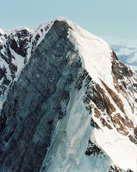
A Dangerous Rogue
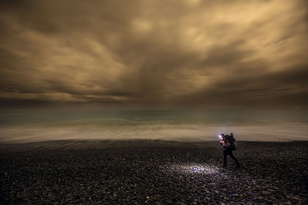
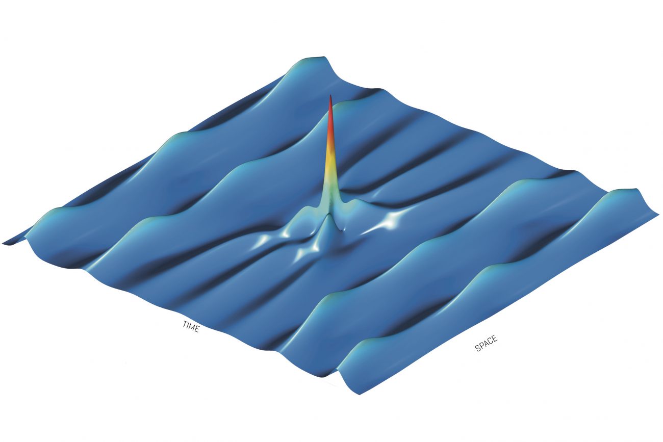
Rouge waves are being re-created using lasers.

Rouge waves are being re-created using lasers.
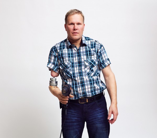
Robotic prostheses are a reality.
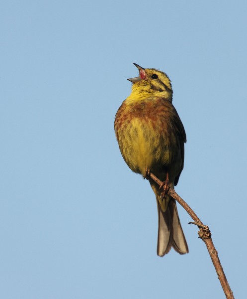
New Zealand’s yellowhammers may be from the British Isles, but they sing with European accents.
Marine geologist Cornel de Ronde is filling in the blanks on the map of New Zealand’s submerged territory—and investigating the wealth it may contain.
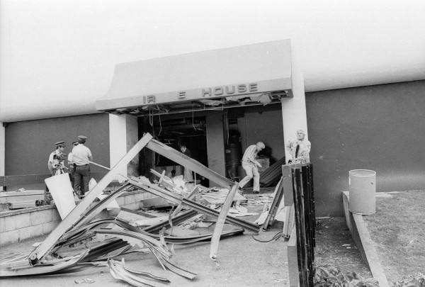
Why the government’s $7 million plan is unlikely to bring the remains of the Pike River 29 back to the light.
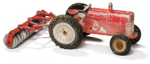
“Toys are the products of the society that makes them,” writes David Veart. “The traditional toys of my childhood—trains, trucks, cars and soldiers, dolls, dolls’ houses and play kitchens reflected a time when gender roles were more rigid and facilitated the acting out of the grown-up worlds of motherhood, work and warfare. Today... the worlds of play are infinite.” Hello Girls and Boys traces the greatest hits of New Zealand playthings, from early Māori kites, stilts, knucklebones and bullroarers through to toys made in local factories or imported in bulk. Running alongside this tour of childhoods past is the question of what each of these objects revealed about the people who made and played with them.
When James Cook rounded Cape Horn and entered the Pacific aboard Endeavour in January 1769, his first job was a scientific one—to observe the transit of Venus. But Cook was also under Admiralty instructions to search for a long-suspected southern continent—Terra Australis Incognita. In 1770, having spent six months charting the coast of New Zealand, Cook sailed west, convinced that it was not part of the continent he was looking for. Geologists Nick Mortimer and Hamish Campbell think he was mistaken, and they have written Zealandia: Our Continent Revealed to prove it. The great explorer failed, they say, because Terra Australis Incognita lay under Endeavour’s hull. “Imagine a typical continent with seemingly endless land in all directions. There are broad valleys and uplands, wide-open vistas across undulating plains and upstanding mountain ranges far in the distance... And there may be canyons, valleys, gorges, large depressions and basins. Now imagine this same continent under the sea, and largely drowned.” That, say Mortimer and Campbell, is Zealandia. The landmass of New Zealand straddles its centre and, away to the north, New Caledonia marks its visible tropical extreme. But, unlike Earth’s other six continents, most of Zealandia—95 per cent to be precise—lies beneath the water. A great deal of investigative work, using an array of scientific tools and centuries of accumulated knowledge, has been required to understand and map it. The most fundamental prerequisite, say the authors, is to understand—in terms of geology as opposed to geography—what makes a continent a continent. This hinges on its thickness, the rocks involved and, where it is below sea level, the depth at which it lies. Oceanic crust is largely composed of basalt, produced by undersea volcanoes. The thicker continental crust, by contrast, is more varied and includes granite, rhyolite, schist and greywacke. These rocks are less dense than basalt, and float higher on the soft part of the Earth’s mantle (the asthenosphere) than oceanic crust does. Marine geology and geophysics have been key in outlining the extent of Zealandia. Scientists have retrieved continental rocks far out at sea, measured the crust’s thickness and used bathymetry to trace where the edge of the continental slope meets the abyssal plain. A great advantage of this geological approach to mapping Zealandia is that its size and shape are not affected by changing sea level. The extent of Zealandia—and for that matter, of Africa, Australia and the rest—remains constant, come ice age or high water. Nevertheless, Mortimer and Campbell vividly picture how the newly discovered continent would have looked to Kupe and Cook if the waters of the Pacific had obligingly dropped to expose its full extent. It measures 4000 kilometres in length and is 17 times the area of present-day New Zealand. When mapped, it resembles a tilted and much enlarged Britain, with New Zealand as a mountain chain running through its waist and New Caledonia—serendipitously, given its name overlaying Scotland. A river system drains southeast beneath what the authors label the Chatham Peninsula, and another river, longer than the Colorado, runs north. Surprisingly, Charles Hursthouse, an early colonist, foreshadowed all this in his 1857 book New Zealand or Zealandia, the Britain of the South. Hursthouse was no scientist. He wrote before systematic geological surveys had begun, and largely to advance the cause of settlement. Yet he penned these astonishing words: “The geology of New Zealand adopts the theory that New Zealand is but a part of a great continent which has been submerged...”. A century and a half later, a United Nations commission accepted New Zealand’s claim to an extended 5.857-million-squarekilometre continental shelf. By then, the name Zealandia was increasingly being used—after the example of American geoscientist Bruce Luyendyk in 1995—to describe the continental crust on which New Zealand sits. All well and good, but why does any of this matter? Because, say Mortimer and Campbell, the shift from “islands” to “continent” has massive implications in terms of both natural resources and national identity. “Whether we care to admit it or not, what makes or breaks nations and allows them to celebrate, preserve and promote their culture and environment instead of simply surviving off them is largely to do with access to resources... Zealandia is of continental proportions and hence its potential energy and mineral resources are of continental proportions.” Perhaps, then, it is time for us to get better acquainted not just with the Chatham Rise, but with the vast expanses of the Campbell Plateau, the Lord Howe Rise and the Challenger Plateau. All we lack to profit from them are environmentally acceptable techniques and extraction technologies we can afford.
One man takes on the state.
Contributors face a well-armed assailant.
150 years ago, they came seeking gold and found a fresh start in an uncompromising land. For many of the West Coast’s pioneers it was a regrettably short stay, while others would endure for generations
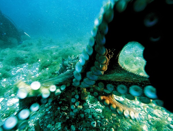
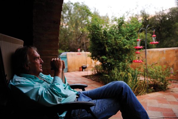
A former editor recalls how he was smitten by deceptively simple creatures.
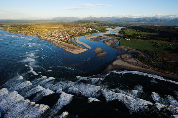
Around New Zealand’s coastline by foot, raft, etc...
Most of New Zealand’s lowland areas are now devoted to food production. How we produce food for consumption, sale and export continues to shape our landscape and lives, but the 90 per cent of New Zealanders who live in cities have little contact with those processes and the social and environmental considerations they create. Can farmers improve yields and use resources more efficiently? Can consumers reconnect with the land and farm practices to make more informed choices and reduce waste? What is the future of our food?
“Havent heard of that track before?”And well you might ask, as the Deception-Mingha forms the mountain run component of the celebrated Coast-to-Coast race. Top athletes complete it in around three hours. This route is a good step up for walkers wanting a “wilderness” experience. Though be warned, like any alpine route in New Zealand, it requires respect, preparation and awareness of local conditions. On the Deception side the track is rough and not regularly marked. However, in good conditions it is a reasonable route which most trampers take two days to complete. Enter the track by crossing the Otira River on the Morrison footbridge then follow the Deception River up the true right side across river flats. Cross to the true left and follow rock cairns through the lower gorge, re-crossing the river where necessary. The route involves many river crossings—up to ten significant crossings in the lower Deception alone—so is vulnerable to bad weather. Don’t attempt it in heavy rain or when heavy rain is forecast. Come prepared to wait out flood conditions. Continue to pick your way upwards, mostly in the riverbed though there are some small tracked portions under bush cover. There is a final steep climb over rough terrain to get up to the Goat Pass Hut (20 bunks), located a short distance below the pass itself. This is a good spot to overnight. From the hut the track improves significantly but still has many river crossings. The track crosses Goat Pass on boardwalk sections then descends towards the bushline into the Mingha Valley. The track departs the river course towards Dudley’s Knob to avoid a difficult gorge and continues down to the Lower Mingha flats. Look for a safe crossing of the Bealey River near its confluence with the Mingha River and continue down towards Greyney Shelter Campsite on SH 73. The track line rises to the road along the way. The area is also home to rare and protected blue duck/whio. DOC asks for sightings to be reported to staff at the Visitor Centre in Arthur’s Pass.
Traditional forecasting techniques to predict a storm, and storm a pa.
Like many children of the 1970s, I grew up on five-layer casseroles and meatloaf. But over the course of my childhood, my mum discovered a world of cuisine. I remember her first pasta, her experiments on ‘vegetarian’ visitors, and the time that the pet mince got mixed up in the freezer and became a lasagne of radical flavour and questionable nutrition. I remember the shocking green flesh of my first avocado, the oozing centre of my first Brie, new experiences with sun-dried tomatoes and olive oil on salads. It was a time of profound change in Kiwi kitchens, a time when the British traditions gave way to flirtations with Mediterranean fare. Food became something more than sustenance, and New Zealand cuisine began to acquire an identity of its own—as our new deputy editor, Rebekah White, discovered in her profile of Tui Flower for this issue. Our geography was changing too. The rolling pastures that used to bake brown in summer and sprout thick and verdant in autumn took on an evergreen quality thanks to superphosphate and an irrigation regime that’s doubled in area every 12 years since 1970. (More irrigation, particularly in dry areas, can triple the output of a farm.) My memories of fields of sheep—at the time outnumbering New Zealanders 25 to one—slowly faded as sheep numbers halved, replaced in part by the massive expansion of dairying. These changes have been driven by the economics of the free market, rather than rural planning, and the economy has responded positively to the high-input model. It was the primary industries that gave New Zealand buoyancy to emerge from the global recession before most other developed nations, and the government’s Economic Growth Agenda calls for agricultural exports to earn 40 per cent of GDP by 2025, hingeing on something approaching a trebling of current production value. But market-led change in the global context also results in some bizarre distortions. We import lettuces from Fiji, and export lettuces to Fiji. New Zealanders, on an isolated temperate archipelago, are the world’s largest consumers of bananas, a tropical fruit. Farmers in Canterbury are converting fields of cereals—crops suited to the dry, thin soils of the plains—to pastures for a dairy herd that can’t be productive there without untold volumes of water from pivot irrigators. High-intensity agriculture comes at a high price: pollution, eutrophication, fertiliser run-off, pesticides that contribute to colony collapse in honeybees. Our distance from international markets creates cost and concern and doesn’t insulate us as much as we would like from pest species and pathogens. We need only to consider the outbreaks of PSA, varroa, fruit flies and great white butterflies that have resulted in national emergencies and the collapse of entire market sectors to appreciate the vulnerability of monocultural cropping to a biosecurity breach. There are alternatives—organic, biodynamic, permaculture, hydroponic, intensive farm systems but detractors suggest they can’t achieve the volume or the efficiency to feed our nation and its economy, let alone sustain three-fold growth in international receipts. In the clamour of industry, shrill cries to eat less meat or buy organic produce are easily drowned out. The only truly effective means of altering the behaviour of a market is educating consumers and highlighting their responsibility for the shape and nature of the supply chain. But, like farmers, consumers feel bombarded by the issues. There’s a lot to consider when you shop: food miles, nutrition, animal welfare, traceability, industrial sustainability, international worker rights, product safety... A conscientious consumer can’t hold a fork without quivering with anxiety. Greg Bruce’s special feature in this edition is the fifth in New Zealand Geographic’s 25th-anniversary series on the issues that will shape our nation over the next quarter-century. Since humans first set foot here, food production has shaped the land and will likely have a greater impact on the structure, prosperity and natural values of the country than any other factor. Is there an alternative? How much will it cost? Can we afford to change? Can we afford not to?
On the value of wilderness adventures, photography, and social memory.
It is a truth universally acknowledged that there are too many books and too little time. This is why you can stumble across a new and brilliant writer and wonder, “Where have you been all my life?” I had that thought a few weeks ago when I read an essay by Charles Bowden on nature photography.
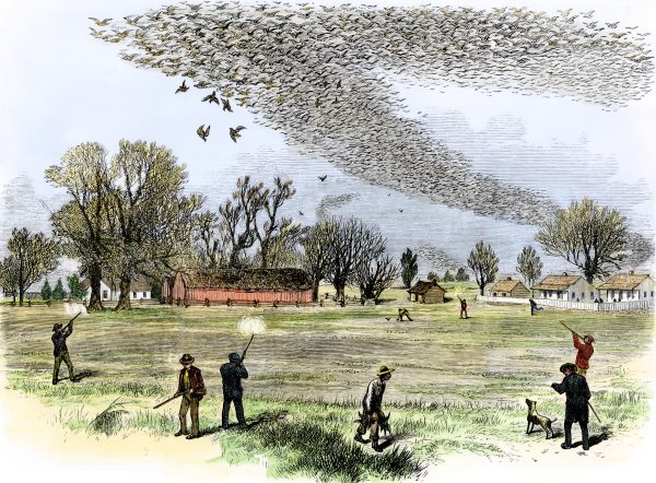
Today is the 100th anniversary of the death of Martha, the last passenger pigeon. From billions to zero in 50 years—a cautionary tale about a phenomenal bird.
All is not great ’twixt the pond and the plate.
Loading..

3
$1 trial for two weeks, thereafter $8.50 every two months, cancel any time
Already a subscriber? Sign in
Signed in as . Sign out

Ask your librarian to subscribe to this service next year. Alternatively, use a home network and buy a digital subscription—just $1/week...

Subscribe to our free newsletter for news and prizes