Keep reading for just $1
$1 trial for two weeks, thereafter $8.50 every two months, cancel any time
Already a subscriber? Sign in
Signed in as . Sign out


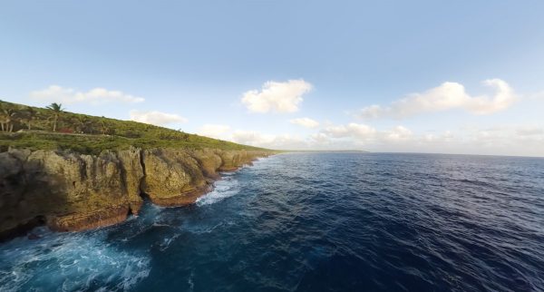
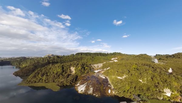
Goat Island and the Poor Knights were among the first marine reserves in the world, and exemplars of the benefits that come from protecting our natural world.

Tīkapa Moana, Te Moananui-ā-Toi was once one of the world's most productive marine areas. After a century of unrelenting extraction, it faces new challenges.
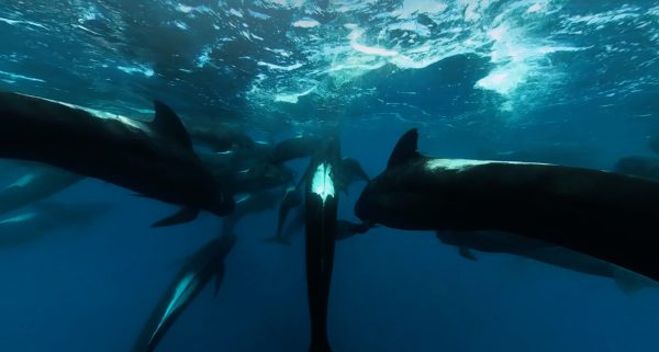
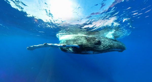
The Auckland Islands are anchored in the furious fifties, a latitude all the more hostile when the massive southern right whales visit in winter.

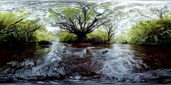
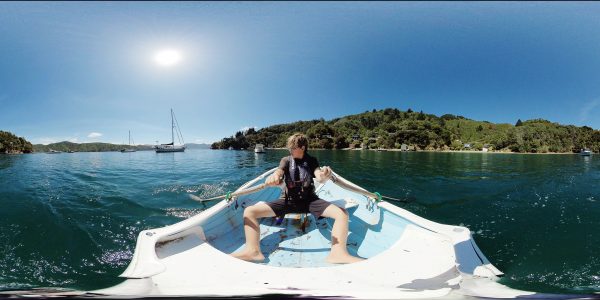
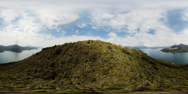
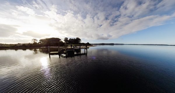
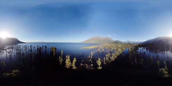
A jigsaw of islands protect the sheltered waters of the Marlborough Sounds—spectacular, rich and fragile.
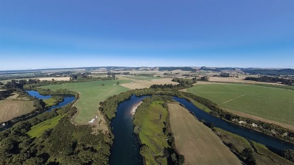
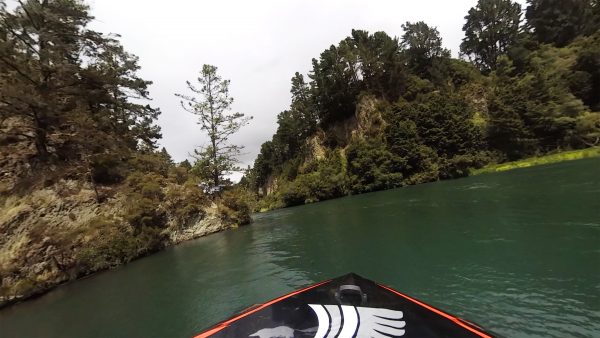
The mighty Waikato is New Zealand's longest river, also a highway, a power generator and the lifeblood of its communities.

For Māori, Te Manawatawhi is the final resting place of the spirits. It's also a haven for wildlife.

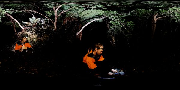
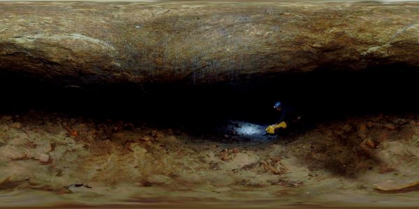
Starting with a 176-metre abseil, the Harwood's Hole is one of the most magnificent caving experiences in New Zealand.

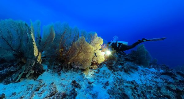
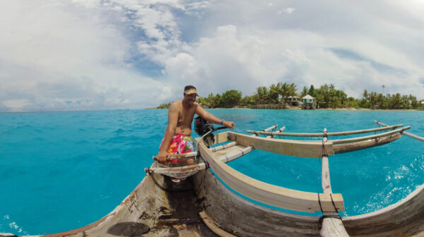
'The Rock' of Niue has some of the clearest water in the world, a haven for visiting humpback whales, but also sea snakes and gargantuan sea fans.

Aoraki/Mt Cook is the top turret of our spine of Southern Alps. Glaciers flow from the flanks into braided rivers and the mighty Mackenzie Basin.
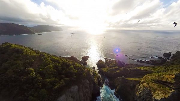
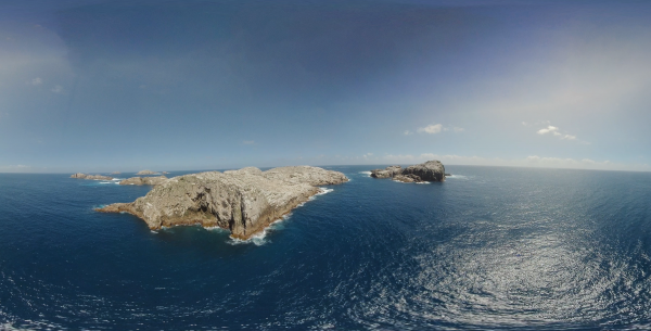
A thousand kilometres north of the mainland, the Kermadecs bridge both tropical and temperate waters.
Bounty and Antipodes Islands, deep in New Zealand's subantarctic, are heaving with albatrosses, penguins, seals—an orchestra of life.

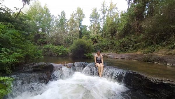
New Zealand's West Coast is wet, wild and steeped in pioneering history. It's also a magnetic for adventurers, hikers and paddlers.
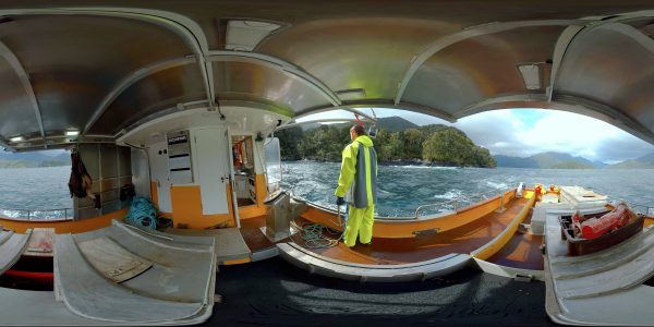
Carved by the adze of Tu-te-raki-whanoa, the giddy turrets and profound fiords of Fiordland are a shadowland of secrets.

Taranaki mounga is one of the totemic landmarks of the North Island, and the lifeblood of the farming province around it.
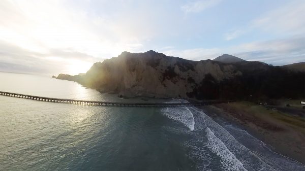
The Bay of Plenty and East Cape are out land of the rising sun—the first to see the light of the new day.

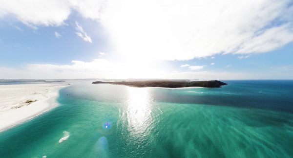
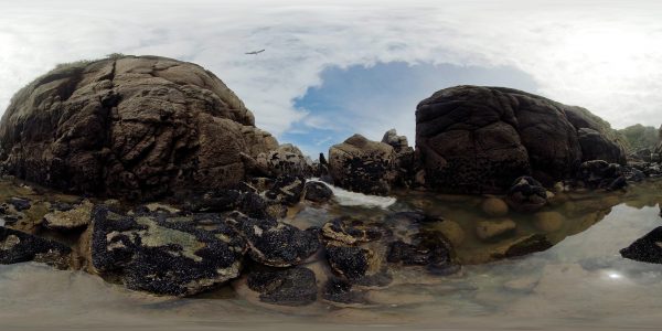
The shallow Far North harbour of Parengarenga is among the most healthy in the country—protected by its isolation and local community.
Beyond the territorial limit of New Zealand, life exists in a big, blue realm—transient, precious and magnificent.
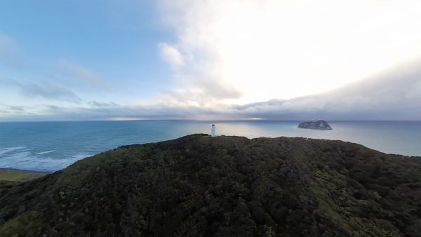
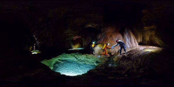
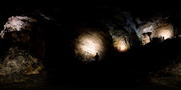
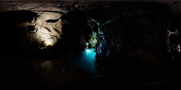
 Harwood's Hole
Harwood's Hole connects to Starlight Cave after a series of tortuous squeezes and rocky descents. Suddenly the caver is surrounded by stars—a galaxy of tiny flecks of glass-like mica embedded in the rock that reflect the torchlight. The last stretch is a scramble around the river, a long wade out to the mouth of the cave, and the relief of warm air and daylight.
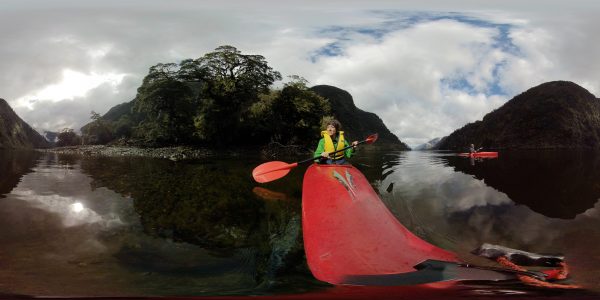
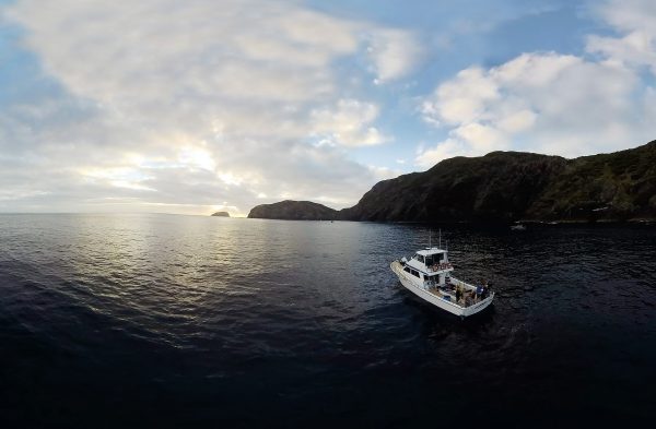
 Marlborough Sounds
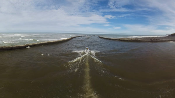
The roll-on roll-off Interislander ferries that ply Cook Strait take passengers, cars and even trains across the 100-kilometre body of water, in almost any conditions. They carry a million passengers and nearly a quarter of the million vehicles every year. Here in Queen Charlotte Sound, Aratere and Arahura ferries pass between Allports Island and The Snout.
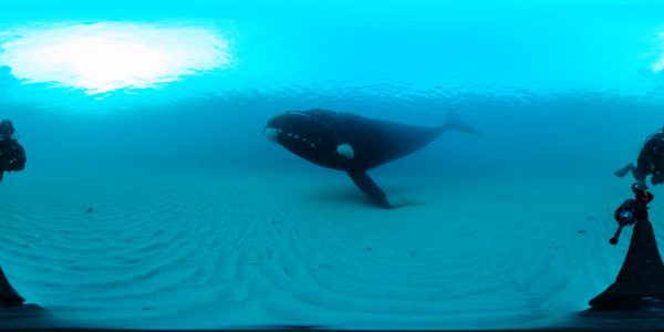
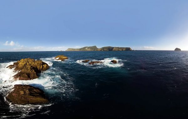
 Auckland Islands
Sealion pups play in the creek on Enderby Island. More than 300 pups are born on the island each year, one of the largest colonies at the Auckland Islands, which also represents some 80 per cent of sealions breeding in New Zealand.
Auckland Islands
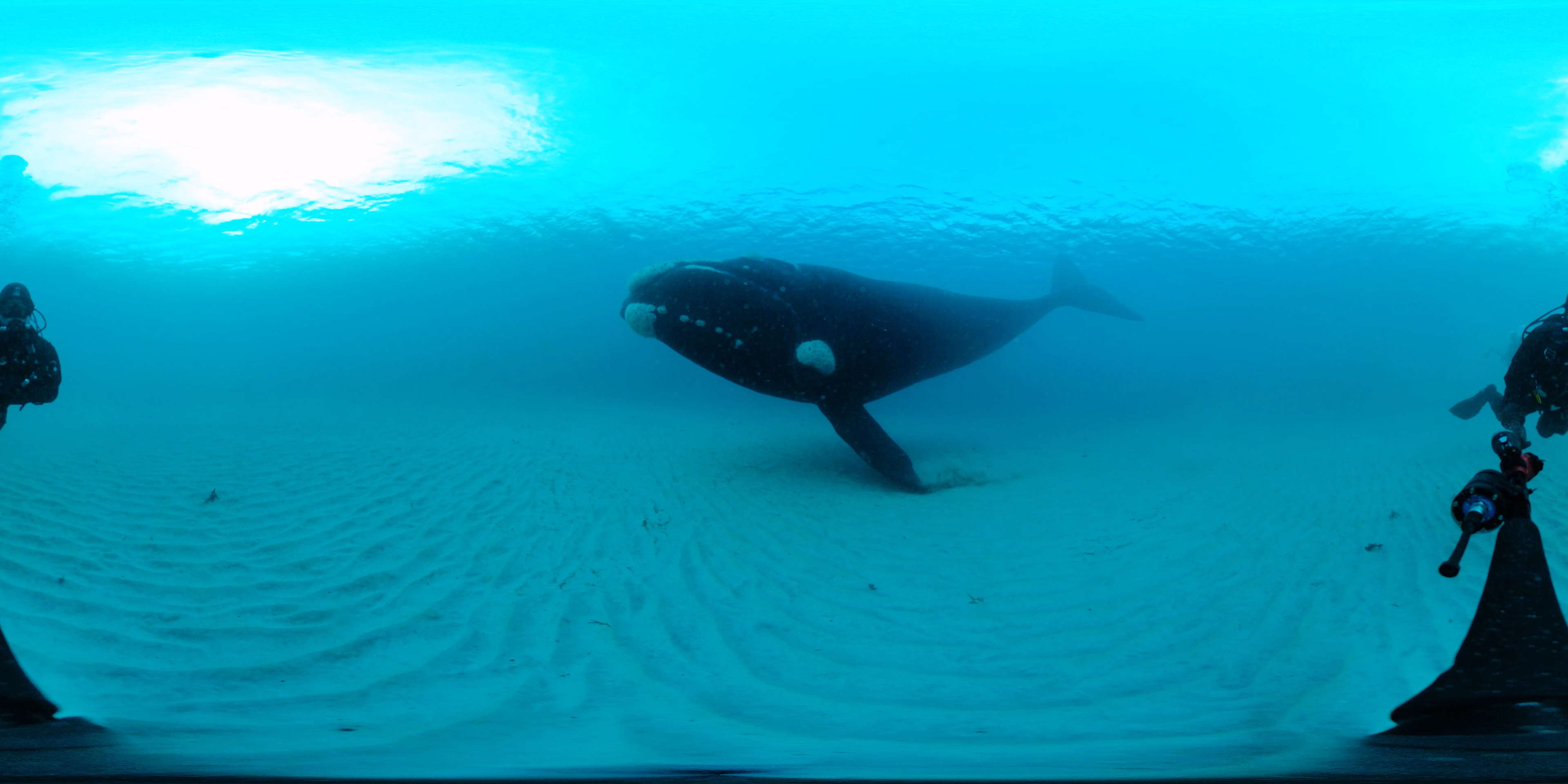
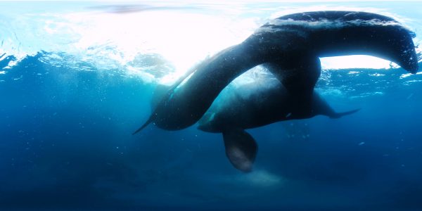
Whales gather in Sandy Bay, Port Ross in the Auckland Islands every winter to mate, calve and nurse newborn whales. This sub-adult male is still growing, as evidenced by its not-yet-fully-formed callosities, the clusters of whale lice that mark the face of every right whale. Notice how it touches the sand with its pectoral fin.
Bounty & Antipodes Islands
High on Proclamation Island in the Bounty Island Group, overlooking the vast Southern Ocean, Salvin’s albatrosses negotiate a fragile peace in their colony. Here 68,000 albatrosses vie for space among some 30,000 erect-crested penguins, which prefer to nest directly on the ground.
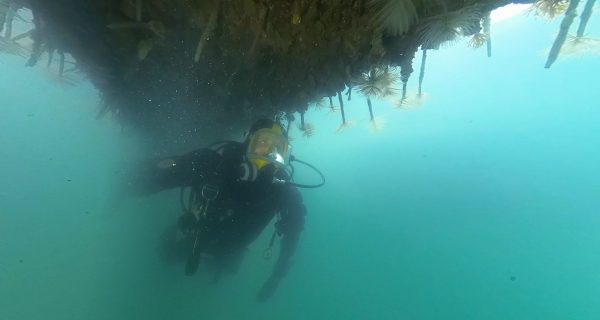
 Fiordland
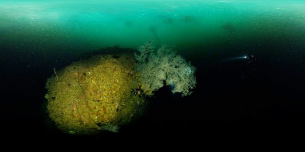
Twenty-five metres beneath the surface, in water barely 12ºC, golden zooanthids thrive amongst red coral in The Gut, a narrow channel inside Bauza Island, and the smallest marine reserve in Fiordland. Sea pens flutter on the seafloor.
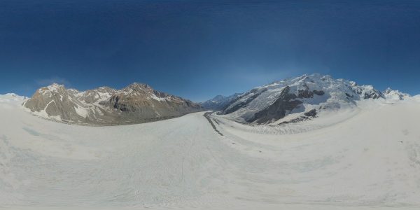
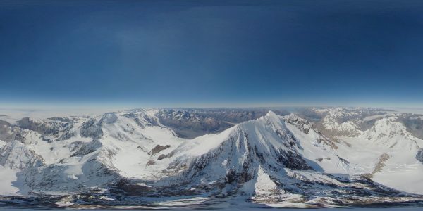 Aoraki / Mt Cook
At 3,724 metres above sea level, Aoraki is the highest point in New Zealand and the massif of the Southern Alps that divides east and west. Originally thought to mean ‘cloud piercer’, Ngāi Tahu tradition links the mountain’s name to that of the South Island Te Waka o Aoraki, Aoraki’s canoe.
 Aoraki / Mt Cook
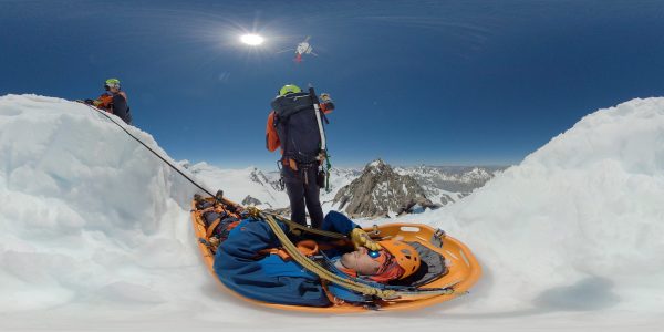
A LandSAR crew hitches a ‘banana boat’ under a rescue helicopter in a drill up on the Tasman Glacier. This LandSAR team receives about 50 call-outs a year, responding to climbers and tourists in distress, mainly during the summer season between November and April.
Harwood's Hole
Harwood's Hole connects to Starlight Cave after a series of tortuous squeezes and rocky descents. Suddenly the caver is surrounded by stars—a galaxy of tiny flecks of glass-like mica embedded in the rock that reflect the torchlight. The last stretch is a scramble around the river, a long wade out to the mouth of the cave, and the relief of warm air and daylight.
 Auckland Islands
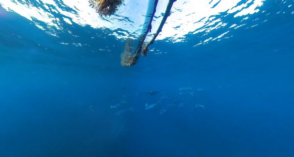
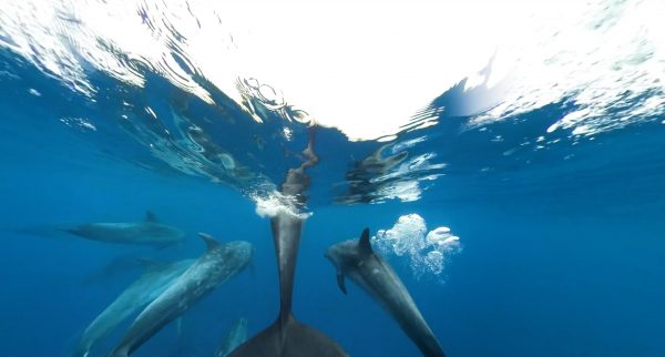
See whales up close and (very, very) personal—This may be the first footage ever recorded of southern right whales mating, shot with a remote 360/3D camera hanging off a float in the waters of Port Ross. Packing a four-metre-long penis and testes together weighing a tonne, southern rights have the biggest package in the animal kingdom. It suggests that ‘sperm competition’ may be important in the mating process, as we can see here—there is more than one suitor in the shot.
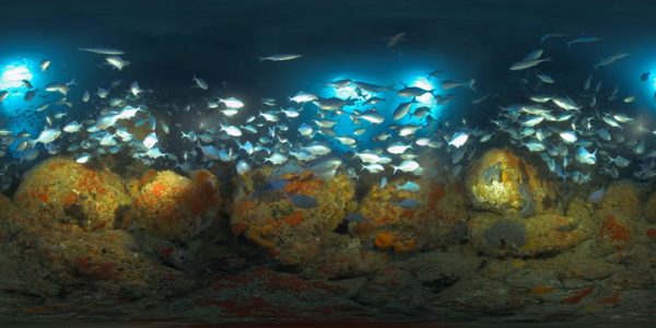
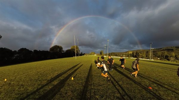
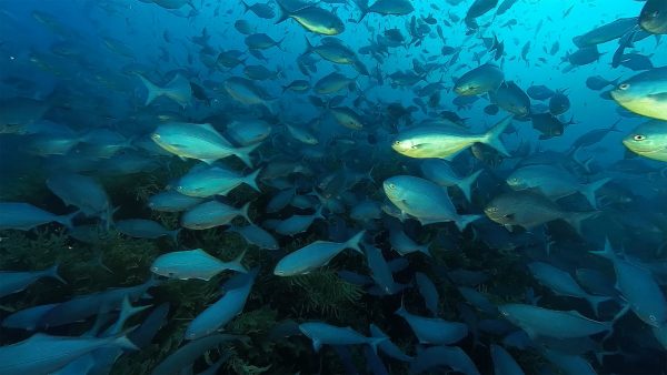
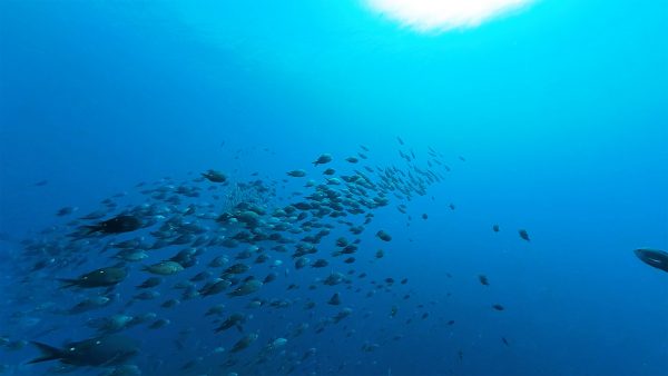
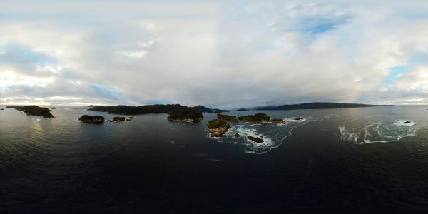
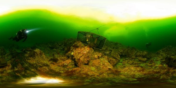
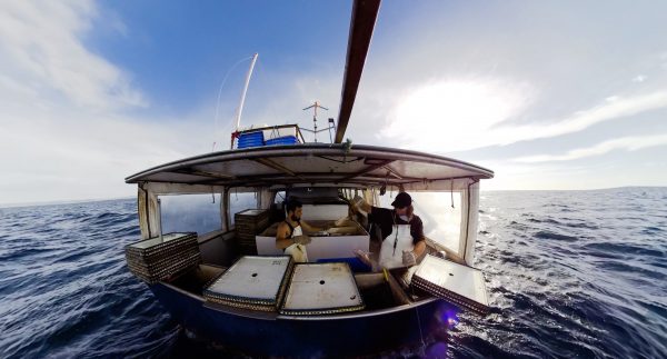
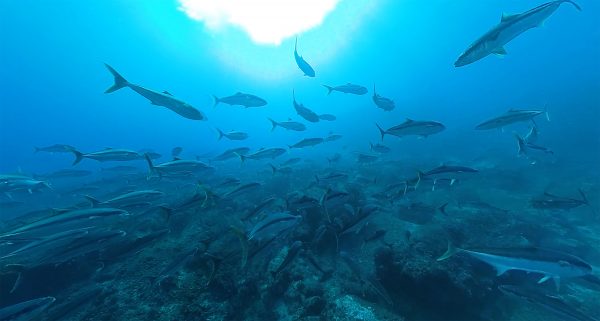
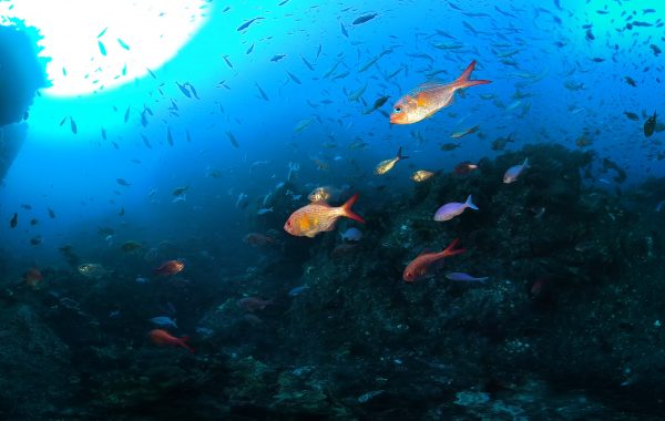
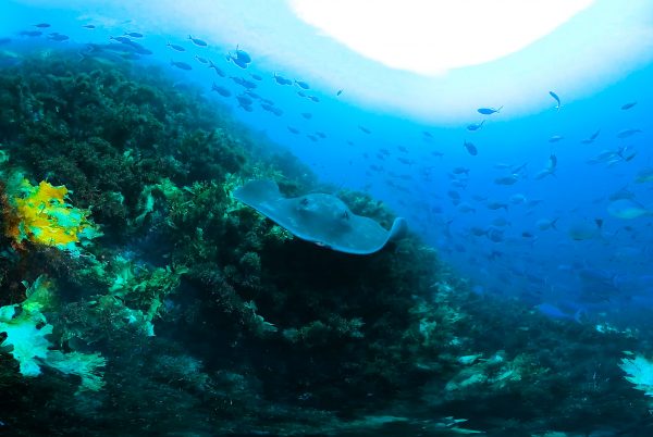
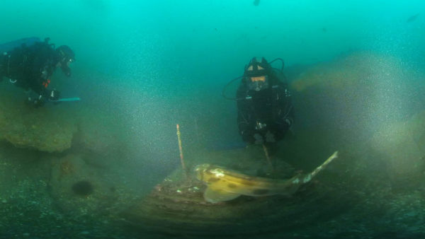
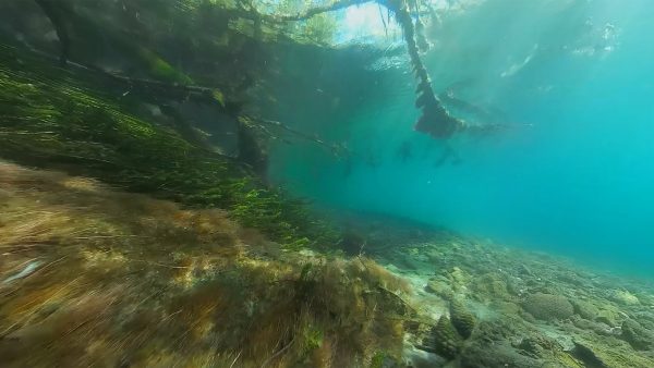
 Hauraki Gulf
The irony is that the camera can't see far enough to properly document the worst sites in the Hauraki Gulf—they're too turbid to see more than a foot.
 Hauraki Gulf
An ecosystem in balance is marked by diversity and abundance. An ecosystem out of balance is a desert of monotony.
 Te Manawatawhi / Three Kings
Fishing effort, day after day, century after century, has changed the shape of this place. It’s still heaving with reef fish, but the predators are gone.
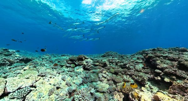
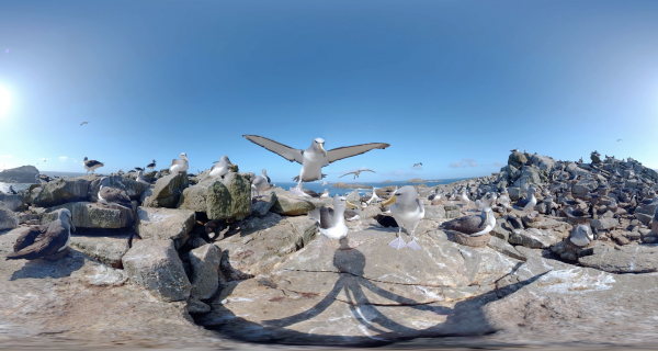
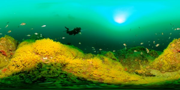
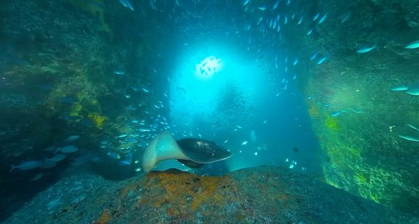
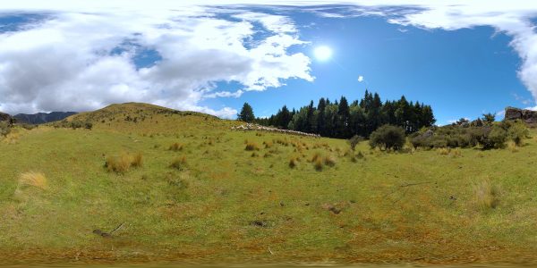
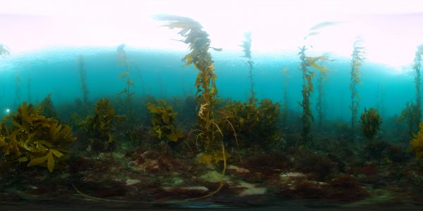
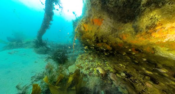
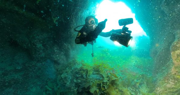
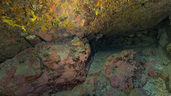
 Poor Knights & Goat Islands
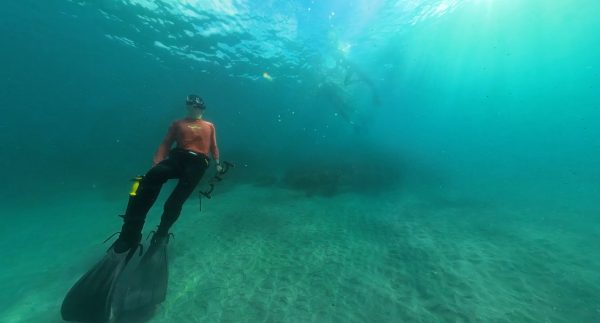
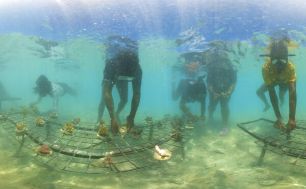
Experiencing Marine Reserves is a national programme of experiential learning that allows anyone to borrow a mask and wetsuit, take the hand of a guide, and wade into the most pristine sites in New Zealand.
 Poor Knights & Goat Islands
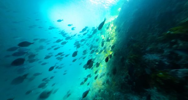
Snapper congregate in the shallows of Cape Rodney-Okakari Point Marine Reserve at an abundance and maturity that may closely reflect the original snapper populations of the Hauraki Gulf.
Poor Knights & Goat Islands
Snapper congregate in the shallows of Cape Rodney-Okakari Point Marine Reserve at an abundance and maturity that may closely reflect the original snapper populations of the Hauraki Gulf.
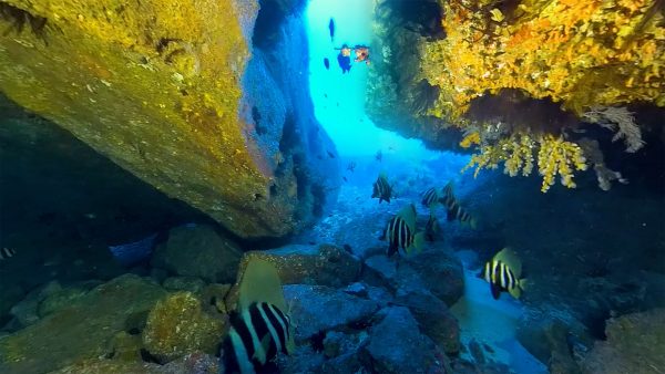
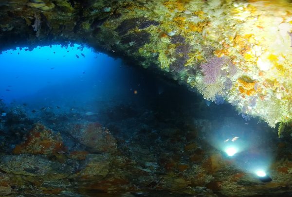
 Poor Knights & Goat Islands
At the northern extent of the Poor Knights Islands is a gash in the rock, cutting through a promontory to a depth of more than 40 metres. Pink maomao and rays parade through it, day in day out.
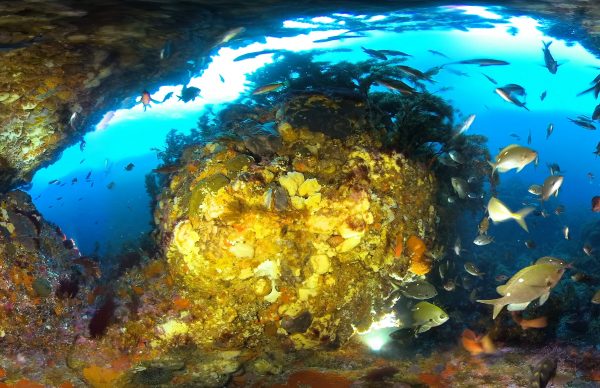
 Poor Knights & Goat Islands
At a group of tall rock stacks south of the Poor Knights is a huge cavern at a depth of 25 metres, choked with fish and rays, and wallpapered in colourful sponges.
 Aoraki / Mt Cook
In the rain shadow of the South Alps, and adjacent to a large body of water in Lake Tekapo, the Mount John observatory has one of the clearest night skies anywhere in New Zealand, and indeed the southern hemisphere. Watch the moon set and the Milky Way turn overhead.
 Aoraki / Mt Cook
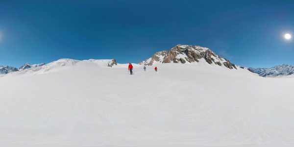
Mountain climbing legend Lydia Bradey picks her way up a couloir to reach the Summit Ridge of Aoraki/Mt Cook, the highest peak in New Zealand. It’s dawn, when the snow is firm and safe, with the sun rising over the North Canterbury hinterland in the background.
 Aoraki / Mt Cook
Cameron Gumbley and Henry Wilson feed meal into the pens at High Country Salmon on an arm of Lake Ruataniwha. The family-owned operation sells directly into the local market, rather than exporting.
 Aoraki / Mt Cook
Chinook (or king) salmon were introduced to New Zealand from the McLeod in California between 1901 and 1907 and established in rivers mainly on the east coast of the South Island. The salmon are hatched in Kaiapoi and trucked back to the fish farm when they get to about 30 grams. After a couple of years they will weigh 3–5 kilograms.
 Aoraki / Mt Cook
Legendary Kiwi mountain climber Lydia Bradey swaps notes with fellow climber Ruari MacFarlane in the iconic Plateau Hut, something of a ‘base camp’ for attempts on the summit of Aoraki/Mt Cook. There are dozens of routes up the peak to choose from, all of them challenging, but some more challenging than others.
 Aoraki / Mt Cook
Alan and Pam Gilmour have been researching near-Earth asteroids since 1973, monitoring 20 to 30 targets in any one night from University of Canterbury Mt John Observatory in Tekapo.
Aoraki / Mt Cook
At 3,724 metres above sea level, Aoraki is the highest point in New Zealand and the massif of the Southern Alps that divides east and west. Originally thought to mean ‘cloud piercer’, Ngāi Tahu tradition links the mountain’s name to that of the South Island Te Waka o Aoraki, Aoraki’s canoe.
 Aoraki / Mt Cook
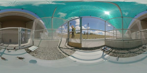
Head Aviculturist Liz Brown has been working with kakī/black stilts for 12 years. It’s been a bumper season for eggs—almost 200 with 40 hungry chicks already. These chicks are being fed on minced oxheart and wombaroo, and will be released into the wild at eight months of age.
 Aoraki / Mt Cook
A pair of kakī/black stilts—among the rarest birds on the planet—feed in a sheltered oxbow of the Tasman River under the watch of Aoraki/Mt Cook in the distance. Here, predators are intensively controlled, and there is a 50% survival rate for birds released from the captive breeding programme.
 Aoraki / Mt Cook
Climbers return through thick snow from shoulder of Aoraki/Mt Cook. They’re roped together, so if one falls through into a hidden crevasse in the glacier, the other has an opportunity to arrest the fall with their ice axe—the first skill that any mountain climber learns.
 Aoraki / Mt Cook
The Tasman Glacier is shot through with holes, crevices, caves and crevasses, the result of the slow-motion waterfall as ice tumbles down the valley. LandSAR crew led by Jono Gillan explore the ever-changing blue world beneath.
Aoraki / Mt Cook
A LandSAR crew hitches a ‘banana boat’ under a rescue helicopter in a drill up on the Tasman Glacier. This LandSAR team receives about 50 call-outs a year, responding to climbers and tourists in distress, mainly during the summer season between November and April.
 Aoraki / Mt Cook
Ross Ivey and his dogs round up the ewes on Glentanner Station. While the farm is still a going concern, the family have diversified business in tourism and are foundation partners of Te Manahuna Aoraki conservation project to reduce pests and weeds in the area.
 Aoraki / Mt Cook
Wag, Slade and Betty hitch a ride up the hill with Ross Ivey, to overlook Glentanner Station, 4000 hectares of country at the foot of Aoraki/Mt Cook. It was first farmed in 1858 and has been owned by the Ivey family since 1974. (When Ross’ father managed the property back in 1957, it was some 18,000 hectares, reduced by raising Lake Pukaki for hydro, and the land tenure review process.)
 Aoraki / Mt Cook
Despite shrinking since the 1990s, the Tasman Glacier remains the longest in New Zealand—23 kilometres of ice, slithering down the shoulder of our highest peak, Aoraki/Mt Cook. Today the glacier is retreating at more than 500 metres every year.
 Aoraki / Mt Cook
The mighty Tasman Glacier melts into Tasman Lake, then tumbles down the Tasman River in a cloak of braids to run into Lake Pukaki. The gravel braided river bed is itself the result of the glacier—thousands of years of struggle between ice and rock.
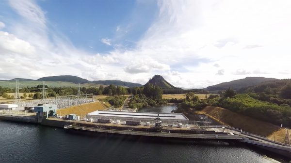
Aoraki / Mt Cook
The hydro canals of the Mackenzie Basin were constructed in the 1970s and 80s to connect Lake Tekapo, Pukaki and Ōhau to syphon off the electrical potential before the water hit Lake Benmore. The power stations make up a significant proportion of the renewable energy for New Zealand.
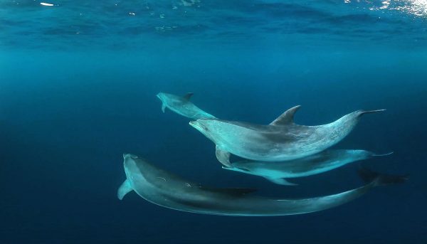
Auckland Islands
See whales up close and (very, very) personal—This may be the first footage ever recorded of southern right whales mating, shot with a remote 360/3D camera hanging off a float in the waters of Port Ross. Packing a four-metre-long penis and testes together weighing a tonne, southern rights have the biggest package in the animal kingdom. It suggests that ‘sperm competition’ may be important in the mating process, as we can see here—there is more than one suitor in the shot.
 Auckland Islands
After the Grafton wrecked on Auckland Island, three men built and sailed a vessel to Stewart Island. Two men left on the island were subsequently rescued, which rallied state governments in Australia to search for more shipwreck victims, deploying the HMCS Victoria. In Erebus Cove the trunk of a rātā tree was chiselled flat and an inscription was carved into the wood: ‘H.M.C.S. VICTORIA NORMAN IN SEARCH OF SHIPWRECKED PEOPLE OCT 13TH 1865’. The crew also released goats and rabbits on Enderby Island to provide food for castaways, but no further survivors were found.
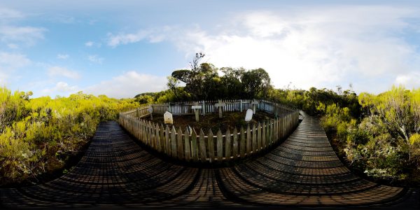 Auckland Islands
The cemetery at Enderby Island marks the location of the ill-fated settlement of Harwicke, started farm workers, shipwrights, a surgeon and others in 1849. But crops proved impossible to grow, livestock were hard to muster and whaling didn’t meet the outgoings to feed the settlors. It was abandoned after two years and nine months, during which there were five weddings, sixteen births and two infant deaths—including three-month-old Isabella Younger, whose headstone is made of a mill wheel brought by settlers to mill grain that never grew.
 Auckland Islands
The western coast of Enderby Island cops the full fury of the Southern Ocean—swells that circle Antarctica more or less unimpeded until they reach this shore. In front of you are megaherbs—massive, lush vegetation that bursts into flower every summer, which are actually members of the carrot family. Above you, albatross ride the updraft off the cliffs, slingshotting around the weather side of the island.
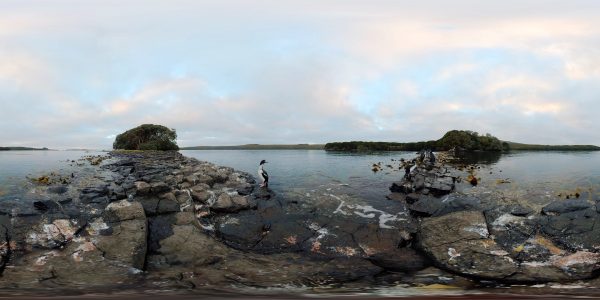 Auckland Islands
Auckland Islands shags roost quietly on a rocky promontory in Port Ross. With a yellow accent on the beak, a magenta pink halo around the eye, matching pink feet and an iridescent green quiff, they strike quite the look. They are only found at the subantarctic Auckland Islands.
Auckland Islands
Sealion pups play in the creek on Enderby Island. More than 300 pups are born on the island each year, one of the largest colonies at the Auckland Islands, which also represents some 80 per cent of sealions breeding in New Zealand.
 Auckland Islands
Bladder kelp, or rimurimu, sustains itself on sunlight, like plants on land. But it also provides habitat for other organisms, nurseries for small fish and sort of jungle gyms for spider crabs which forage for mussels and other crustaceans, sometimes climbing up the kelp itself.
 Auckland Islands
Yellow-eyed penguins, or hoiho, live around the Otago coast, Stewart Island, Campbell Island and also here at the Auckland Islands. (They also appear on the back of the $5 note.) They are one of the rarest penguins in the world, and the biggest in New Zealand. The population around New Zealand is in decline due to competition from commercial fishing, and fishing nets themselves, but here on remote Enderby Island they are relatively safe.
 Auckland Islands
Southern right whale calves are born right here at the Auckland Islands, during winter, and weigh in at a tonne on day one. The calf will remain with its mother for up to two years, at which time it will have doubled in length.
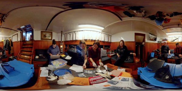 Auckland Islands
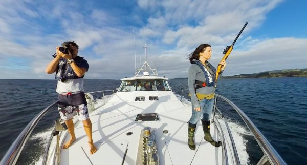
Scientists gather the day’s samples in the cosy saloon of the expedition ship Evohe. Every sample tells a story, but first you need to extract it from the dart. But the blubber can only tell you so much—the scientists also rely on data from drones to build three-dimensional models of the whales, satellite tags to trace their migration, and scoops of poo to understand what they’re eating.
 Auckland Islands
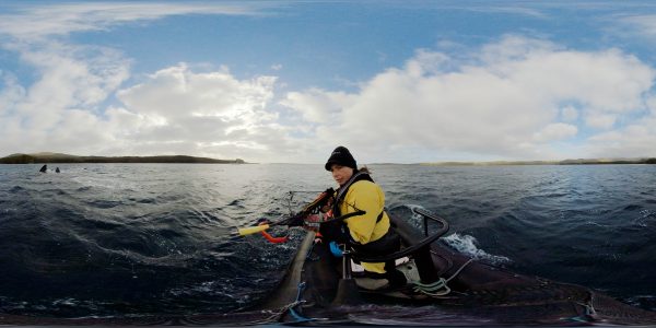
Scientist Emma Carrol is trying to understand the population dynamics of the southern right whales that over-winter at the Auckland Islands—how are they related to each other, how many there are, and where they travel over summer. Using a biopsy dart she can capture a plug of blubber about the size of a pea from an individual which reveals it’s DNA to unravel some of these mysteries.
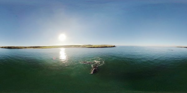 Auckland Islands
Sandy Bay is a popular spot for southern right whales. Though calving and mating occur in winter, whales can be found here year round, cavorting in groups. There were at least 30,000 southern right whales around New Zealand before they were hunted nearly to extinction prior to 1900. Barely 100 whales (including just 13 females) may have survived the slaughter. Today the population is thousands strong and growing at around 7 per cent per year.
Auckland Islands
Whales gather in Sandy Bay, Port Ross in the Auckland Islands every winter to mate, calve and nurse newborn whales. This sub-adult male is still growing, as evidenced by its not-yet-fully-formed callosities, the clusters of whale lice that mark the face of every right whale. Notice how it touches the sand with its pectoral fin.
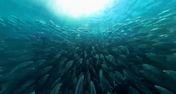
 Bay of Plenty
East Cape is one of the first places in the world to see the light of the new day.
 Bay of Plenty
Pat Nukunuku inspects frames and inserts new queens to maintain good production on his hives at Lottin Point.
 Bay of Plenty
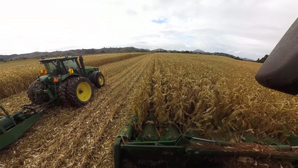
Though still damp with autumn rain Tony Ferkins decided it was "better to be cutting than doing nothing", so fired up the combine harvester in Tolaga Bay.
 Bay of Plenty
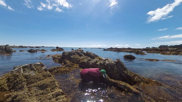
Elaine Kasper doesn't have far to go to collect a feed of kina—the rocks at Papatea Bay, outside the historic Ruakokore Church usually provide a shopping bag full in a few minutes.
 Bay of Plenty
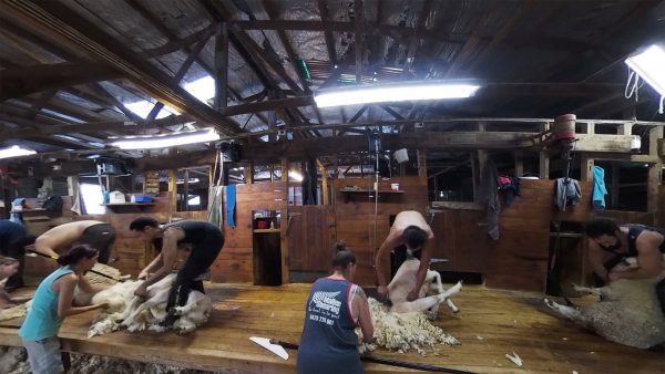
Though nearly 5pm, Harry's shearing gang digs deep to work through the last ewes on Waikura.
 Bay of Plenty
The utes arrive for evening footy practice at the Hikurangi Sports Club in Ruatoria.
 Bay of Plenty
Volkner Rocks—once used by the navy for target practice—are now a marine reserve. And it shows
 Bay of Plenty
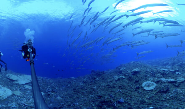
Like a flock of starlings, two-spot demoiselles and flashy koheru form dazzling murmurations at a sharp pinnacle called Laisons Reef off the coast of White Island.
 Bay of Plenty
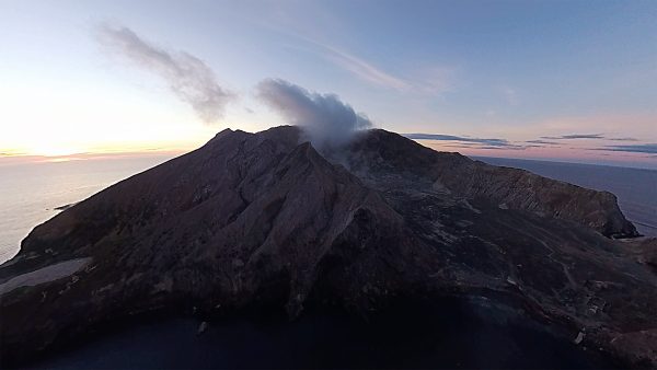
White Island hosts 3000 pairs of gannets, which gather in a colony at the southern side of the island across summer.
 Bay of Plenty
A tour party gathered at the edge of the crater lake marvels at the 55ºC pistachio-green pond of acid, boiling and erupting in sulphuric plumes before them.
Bay of Plenty
Whakaari is New Zealand's most active volcano, being in a state of continuous volcanic activity for some 150,000 years.
Bounty & Antipodes Islands
High on Proclamation Island in the Bounty Island Group, overlooking the vast Southern Ocean, Salvin’s albatrosses negotiate a fragile peace in their colony. Here 68,000 albatrosses vie for space among some 30,000 erect-crested penguins, which prefer to nest directly on the ground.
 Bounty & Antipodes Islands
The Bounty Islands were first sighted by William Bligh in 1788, who named them for his ship, mutinied just seven months later. He described them as covered in “patches of snow’, which is in fact guano—the output of tens of thousands of seabirds which nest here.
 Bounty & Antipodes Islands
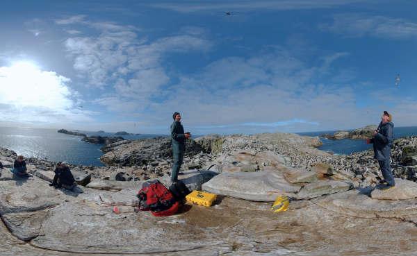
Standing at the summit of Proclamation Island, scientist Thomas Mattern guides his drone up ‘the albatross layer’, taking guidance from DOC’s Dave Houston. He has a formidable mission—to count every albatross, penguin and shag on the 25 islands, and do it all from his plastic pigeon. In all, he and his daughter Hannah took 8145 photos on 44 white-knuckled flights to map and model the entire island group.
 Bounty & Antipodes Islands
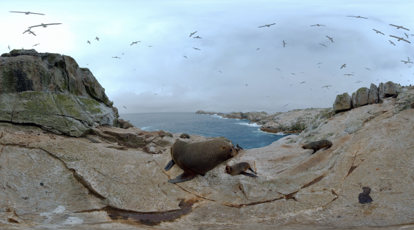
These islands were once home to more than 50,000 fur seals, but they were slaughtered—largely to make coverings for top hats for English gentry—in just two years from 1807. Numbers have since recovered to around 20,000, which nonetheless contest every inch of territory on the islands
 Bounty & Antipodes Islands
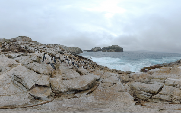
Keep your eyes on the breaking waves where scores of penguins are ready to make landfall after long periods hunting at sea. They leap from the water on the back of a swell, using it like and escalator to shore. And then they begin their slow parade back to their nests higher on the island. With claws like crampons and a beak like an ice axe, they can clamber up rock stacks some 40 metres high.
 Bounty & Antipodes Islands
Scientist Jeff White is weighing, erect-crested penguins, sampling their blood and feathers in order to understand what the birds have been eating, where they have been eating, and when. This paints a picture of their health immediately before the important egg-laying and chick-rearing period where they are effectively land-bound and starving. It also gives a picture of whether the population is stable, or declining.
 Bounty & Antipodes Islands
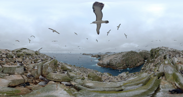
Salvin’s albatrosses whirl above Proclamation Island in the subantarctic. The jagged promontory of Depot Island stretches towards the crouching sliver of granite called Lion Island. In all there are 25 rocky outcrops in the Bounty Island Group, and a handful of plants have been found on only two of them.
 Bounty & Antipodes Islands
Above Hut Cove on Antipodes Island, giant petrels tend the nests of fluffy chicks—looking like they’ve been covered in underfloor insulation. The birds are large, efficient, aggressive predators and scavengers, rivalling some albatrosses in size.
 Bounty & Antipodes Islands
Anchorage Bay on Antipodes Island is a veritable zoo on calm days like this. Elephant seals the size of station wagons take up residency on the rocky shore, while erect-crested and the smaller rockhopper penguins preen themselves in the colony—a colony that has diminished to about half the size in the past decade.
 Bounty & Antipodes Islands
Standing a metre tall, an Antipodean albatross chick at barely eight months old is one big baby. Every hour or so, this hatchling stretches and beats its wings, feeling the wind and building the flight muscles that will one day hold it aloft for months on end.
Fiordland
Twenty-five metres beneath the surface, in water barely 12ºC, golden zooanthids thrive amongst red coral in The Gut, a narrow channel inside Bauza Island, and the smallest marine reserve in Fiordland. Sea pens flutter on the seafloor.
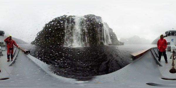 Fiordland
Brace yourself on the bow of MV Flightless and plunge under the spell of a waterfall in Doubtful Sound. With up to seven metres of rainfall a year in Fiordland, waterfalls cascade from the hillsides with every shower of rain, filling the fiords with freshwater that sits atop the saltwater metres deep.
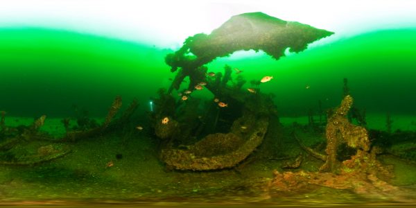 Fiordland
The steamer Waikare was wrecked on January 4, 1910, in Dusky Sound when on her annual excursion to the West Coast Sounds. There was no loss of life amongst the 141 passengers and 85 crew, nor did anybody get wet. She has rested there ever since, the province of butterfly perch with the distinctive spot that local fishos suggest is a “map of Australia”.
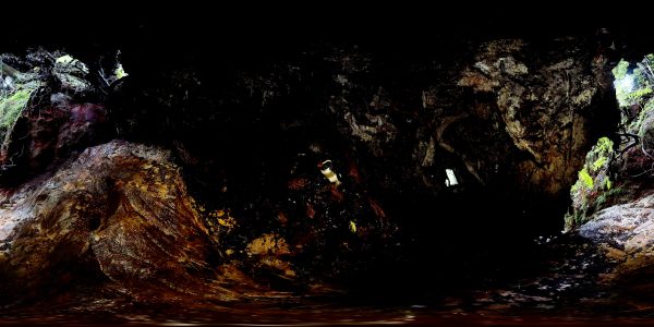 Fiordland
The Fiordland crested penguin, or Tawaki, is unusual among penguins—it lives in a rainforest, sometimes deep in caves beneath trees, this one in Shelter Islands is called The Bat Cave by researchers. Scientist Thomas Mattern is on a mission with his Tawaki Project to discover how many penguins there are, what their life cycle is, and where they feed. Turns out, the population is healthy and stable, thriving and feeding as much within the fiords as at sea.
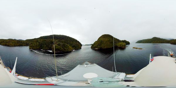 Fiordland
The radar tower affords a dramatic view as MV Flightless leaves the narrow entrance Pickersgill Harbour and makes for the Outer Islands of Dusky Sound. It was here board Cook’s second voyage in 1773 that Resolution stopped for repairs and recuperation, made the first beer out of rimu and manuka and fixed the exact position of New Zealand at Astronomer’s Point.
 Fiordland
The mountainous remains of the Southern Alps tower a thousand metres over Vancouver Arm in Breaksea Sound. It’s hundreds of metres deep, but shelves up rapidly to the mouth of the river which runs tea-brown with tannins from the forest above it.
 Fiordland
Māori describe how the demi-god Tu-te-raki-whanoa shaped Fiordland with an adze, carving out the steep-sided mountains and profound fiords with blows from his adze. If you imagine that the adze was made of ice, then geologists largely agree—glaciers cut a path toward the sea over millions of years during the last ice age, cutting deep valleys as they went, with the shattered remains rendered as islands at the mouth of the fiord.
 Fiordland
Bottlenose dolphins are attracted to passing vessels, hitching a ride here on MV Flightless as she steams up the inlet. The freshwater layer of Preservation Inlet is tea-brown, stained by tannins from the forest.
 Fiordland
These crayfish in holding pots at Sunday Cove, Breaksea Sound, awaiting the arrival of a helicopter that will whip them up, up and away, over the Southern Alps to land in Manapouri, where they’ll be offloaded into a DC-9 plane and flown to Auckland, then as airfreight to international markets—mainly China. It’s a lucrative industry, and recently, a sustainable fishery too.
 Fiordland
Peter Young has been crayfishing the Fiordland coast for decades, throwing those that are undersize or ‘in berry’ back, retaining the rest for export. But after a number of years of decline, he joined other fishers in pausing the harvest for a few seasons to allow the population to rebuild. Today Young and his son fish his quota in just 60 days; the example of what a sustainable, responsible fishery looks like.
Fiordland
Twenty metres beneath the freshwater layer of Breaksea Sound it’s almost pitch black. Here, black coral can be found clinging to rock walls some thousand years old—the fronds as fine and delicate as lace. Divers must take care not to damage the corals, which could take hundreds of years to re-grow.
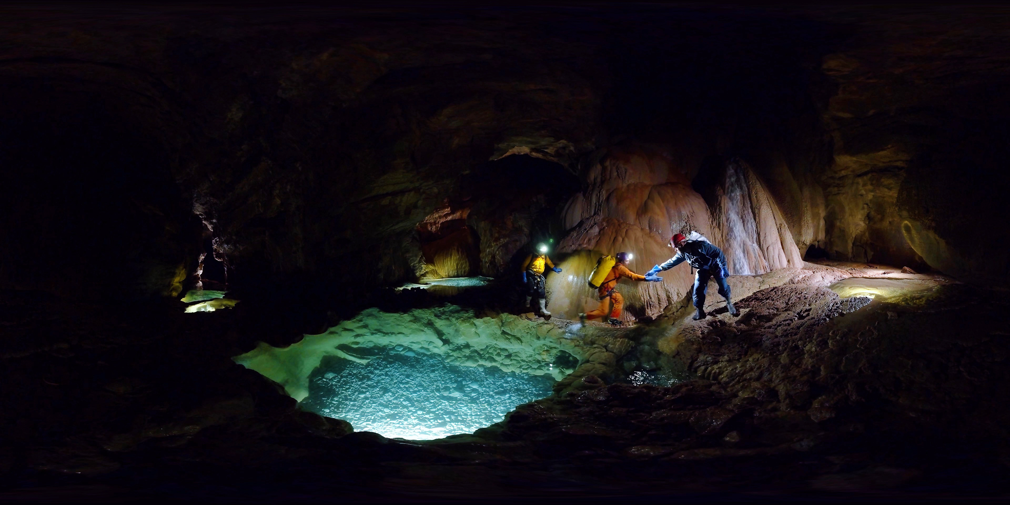
 Harwood's Hole
Gather your wits, caver, and brace yourself for a squeeze. No other moment epitomises the caving experience than writhing headlong through a space too small for your body—this one just 35cm at its widest. In the uncompromising embrace of limestone, the caver must control their mind as much as their body, and push through.
 Harwood's Hole
The landscape underground rivals that above in every way. At Twin Waterfalls, two cascades tumble through a cavern and then join the main flow of the river. The water is clear, but the limestone opalescent under lights.
Harwood's Hole
Harwood's Hole connects to Starlight Cave after a series of tortuous squeezes and rocky descents. Suddenly the caver is surrounded by stars—a galaxy of tiny flecks of glass-like mica embedded in the rock that reflect the torchlight. The last stretch is a scramble around the river, a long wade out to the mouth of the cave, and the relief of warm air and daylight.
 Harwood's Hole
Shorty's Terror is enough to frighten the hardiest soul. The massive cave narrows to a tube and the cave floor descend into unfathomably deep water, leaving the caver no option but to cling to the roof, walk on the walls, brace above the thrashing river. Meanwhile the pressure difference from one side of the mountain to the other creates a gale-force wind the howls through the passage, which then narrows to a 'squeeze'. It's sensory overload, and not in a good way.
 Harwood's Hole
After climbing out of the Starlight Cave, there are two options for cavers—huck your gear up the rockfall and walk for kilometres, or take a tin pigeon. We opt for the second option, which requires the pilot to expertly balance the machine with one skid on a rock while gear and cavers are loaded... keeping a weather eye out for tumbling boulders coming down the rock fall.
 Harwood's Hole
Cavers light up the interior of a massive chamber, some 60 metres across and just as high. The ground is covered in boulders the size of small cars, all of which have tumbled down the slope or fallen from the roof of the cave above, vaulted like a gothic cathedral.
 Harwood's Hole
Some 260 metres below the surface, cavers make camp in a dry crook of the cave system known as The Boudoir. In one corner is a memorial cairn to Peter Lambert, who lost his life exploring the cave. His helmet is still there, punched through by the rock that tragically killed him—a sobering reminder of the hazards for anyone who ventures here.
 Harwood's Hole
Caver use a rigging technique called a Tyrolean traverse to swing gear—or themselves—between two fixed points across a river or ravine. This can be improvised to sling gear between two people over water in a cave, but it takes some teamwork.
 Harwood's Hole
A through-caver takes what they need for one, hard day of caving, passing though the system without stopping. But to overnight, and film along the way, the team needs camera equipment, lighting gear, tents, provisions and cooking equipment—some 25 kilos of gear for each caver to hitch to themselves for the descent.
 Harwood's Hole
As the caver gets close to the bottom of the 176-metre abseil, the relative weight of the remaining rope gets lighter and lighter. To avoid speeding up and plunging to the cave floor, the abseiler must compensate by wrapping their leg around the rope to create more friction, or rely on a partner beneath them to apply tension to the rope and belay them down.
Harwood's Hole
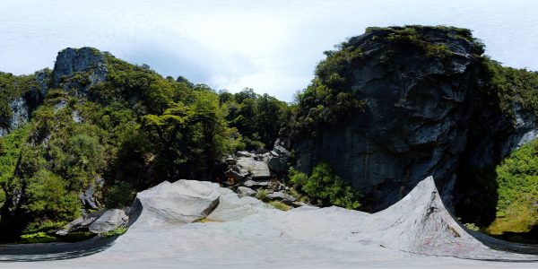
Named for the original landowner, Harwood's is a 176-metre-deep chasm, that falls like a well into the marble heart of Takaka. The caver must ease themselves into the steep entrance, then transfer from one rope to another—while suspended over the hole—before beginning the long, slow descent.
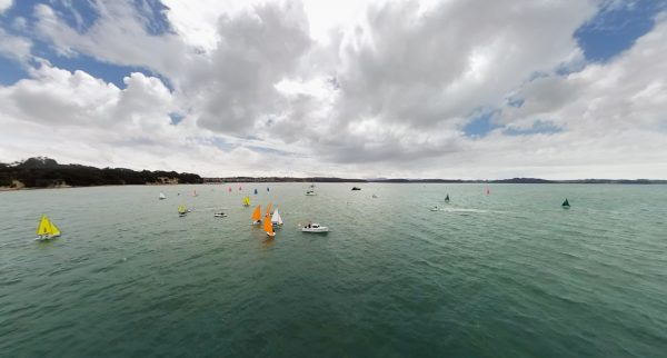 Hauraki Gulf
Secondary school sailing teams manoeuvre before the start of a team race at Snells Beach north of Auckland.
 Hauraki Gulf
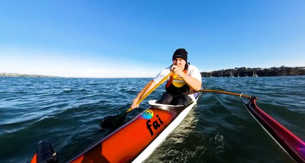
Richard Manuka leans on his hoe and drives his waka-ama towards the city from Birkenhead Point.
 Hauraki Gulf
Godwits and wrybills roost on chenier shell banks at Miranda, and the western shore of the Firth of Thames.
 Hauraki Gulf
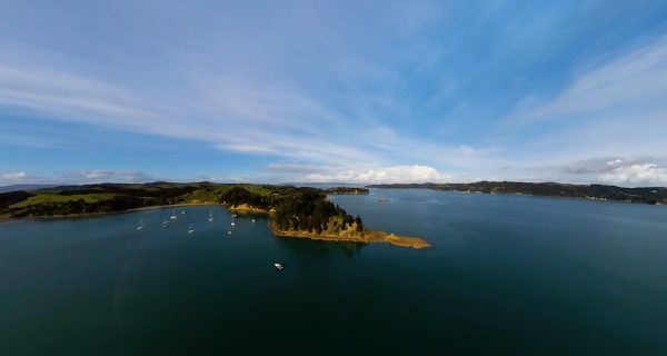
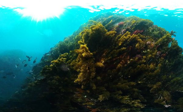
There are some 70 islands in the Hauraki Gulf, cast across the great embayment in a disorderly fashion.
 Hauraki Gulf
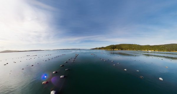
Shellfish aquaculture appears to be relatively low impact, and presents the opportunity of high-value, high-quality protein, sustainably cultivated in a healthy marine environment.
Hauraki Gulf
The irony is that the camera can't see far enough to properly document the worst sites in the Hauraki Gulf—they're too turbid to see more than a foot.
 Hauraki Gulf
At Pōnui Island, under the shade of picturesque pōhutukawa, effluent from a farm drains into the Waiheke Channel adjacent to the Te Matuku Marine Reserve.
 Hauraki Gulf
In many of Auckland's older suburbs, stormwater and sewerage is combined. As the population has increased, infrastructure has failed to adapt adequately, and changes in climate make rainfall events more intense.
 Hauraki Gulf
Fishermen cast a line from Orakei Wharf. For some, fishing here is recreational. For many others, it's about sustenance.
 Hauraki Gulf
Commercial fishers take around 1000 tonnes of snapper per year from the gulf, and recreational fishers double that amount.
Hauraki Gulf
An ecosystem in balance is marked by diversity and abundance. An ecosystem out of balance is a desert of monotony.
 Hauraki Gulf
A Leigh Fisheries longliner reels in a catch with practiced efficiency.
 Hauraki Gulf
Off the northern coast of Waiheke, vivacious common dolphins travel in search of the next work-up.
 Hauraki Gulf
Schools of feeding trevally once covered acres of the Hauraki Gulf, so plentiful was the krill and so abundant the fish.
 Hauraki Gulf
Beneath the granite-clad apartments and superyachts, NIWA divers survey the pontoons of the Viaduct Basin.
Hauraki Gulf
We are citizens of the sea. Māori arrived in New Zealand by sea, as did Pakeha, and our commercial centre of Auckland lies on the shores of two harbours and at the headwaters of the immense Hauraki Gulf, Tikapa Moana.
 Marlborough Sounds
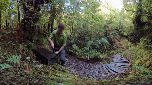
Visit a kiwi creche—Young kiwis stay in a 12-hectare Atarau Sanctuary creche until they are about a year old—large enough to defend themselves from stoats. Rangers Kristy Owens and Glen Newton check the weight, beak length, body condition and vision. Stoats and rats are controlled in the Paparoa National Park, where some 40 kiwis have been released with high survival rates.
 Marlborough Sounds
Shacklton ‘Shack’ Scollay is the 13-year-old son of Kina Scollay, fisherman, shark diver and filmmaker. He's a man of the sea too, here rowing around Waikawa Bay.
 Marlborough Sounds
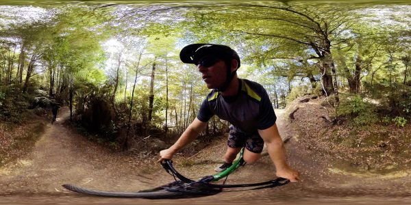
The Queen Charlotte Track is one of New Zealand's Great Rides with 72 kilometres of continuous single track, undulating up and down the coast between Ship Cove and Anakiwa, through bush and past secluded bays. It’s also part of the 3000-kiometre-long Te Araroa walking trail.
 Marlborough Sounds
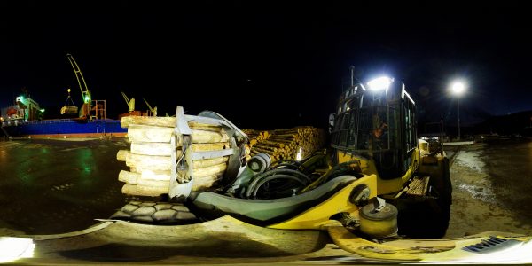
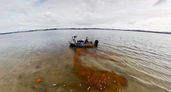
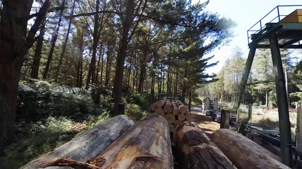
New Zealand timber bound for markets in Australia and China are loaded at Port Marlborough on to bulk carriers by log loaders that can carry 18 tonnes of logs at once. The vessel will also stop to load more timber in Napier and Whangarei.
 Marlborough Sounds
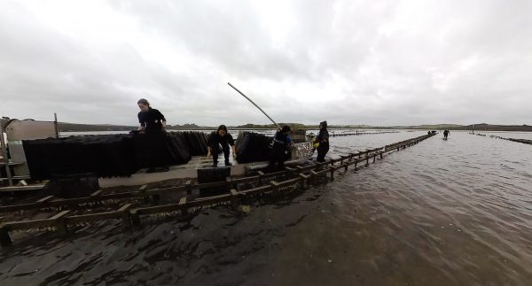
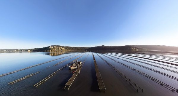
Workers harvest mussels from the lines hung beneath the floats while shags pirouette about hoping to catch a free feed. Waimana Marine, a small family-owned aquaculture company, has been growing mussel farms in the area for more than 30 years—much of it going into health products such as mussel powder to support joint health. The mussel spat comes all the way from Ninety Mile Beach in the Far North.
 Marlborough Sounds
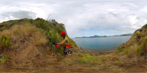
Rangers Natalie Johnson, Micaela Courtney and Chance Ngatai do some weed whacking along the steep cliffs at the northern end of the Maud Island. Here, strangely enough, pohutukawa is a weed, as seed blows across from Taranaki and takes hold anywhere there is open space. Once established it creates a monoculture canopy that prevents other species from growing.
 Marlborough Sounds
High on the top of Maud Island/Te Hoiere, DOC ranger Emmanuel Oysten checks tracking tunnels to maintain the predator free status of the island. A predator entering the baited tunnel will walk across an ink pad, leaving footprints on a white card that allows rangers to identify the intruder and know how to respond.
 Marlborough Sounds
The Maud Island frog is one of the rarest frogs on the planet, and also the longest lived—a monitoring programme set up by Ben Bell in the mid-1970s has tracked the same individuals up for 50 years, some of them staying within a 20–30 square metre area for their entire life. Here, rangers catch, identify and measure frogs at night (they’re nocturnal) as part of that continuing half-century of research.
 Marlborough Sounds
The long spur of Harter Point on Maud Island/Te Hoiere, direct the view across Pelorus Sound. Kakapō were introduced to the predator-free island in 1974 but struggled to breed without forests. Takahe have done better, but Te Hoiere is best known as habitat for weta, flax weevil, Cook Strait click beetles and Maud Island frog.
 Marlborough Sounds
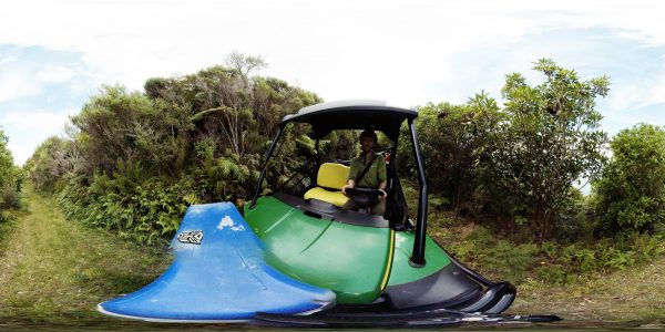
There are few roads around the rugged coast of the Marlborough Sounds, making the Pelorus Express Mail Boat a critical connection for isolated families for more than 100 years—such as Rangers Emmanuel Oysten, Anna Star and kids Fergus (7) and Quin (4). Mail, groceries and farming supplies are all transported on the boat, as well tourists.
Marlborough Sounds
The roll-on roll-off Interislander ferries that ply Cook Strait take passengers, cars and even trains across the 100-kilometre body of water, in almost any conditions. They carry a million passengers and nearly a quarter of the million vehicles every year. Here in Queen Charlotte Sound, Aratere and Arahura ferries pass between Allports Island and The Snout.
Marlborough Sounds
The narrow channel that separates D’Urville Island from the South Island mainland has the fastest tidal current in the country, reaching eight knots (15 km/h, or 4 m/s). It can be treacherous for vessels, which can only navigate the pass at slack water.
 Niue
Niue
Between August and October each year, humpback whales stop to shelter and sing under the lee of Niue.
 Niue
Niue
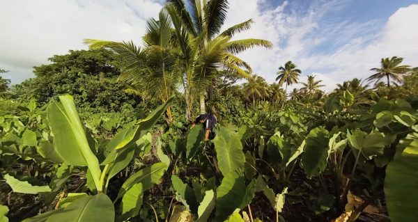
Dan Makaia tends his family taro patch. For many years, taro was the chief export of the island, and Niue's taro was prized across the Pacific.
 Niue
Niue
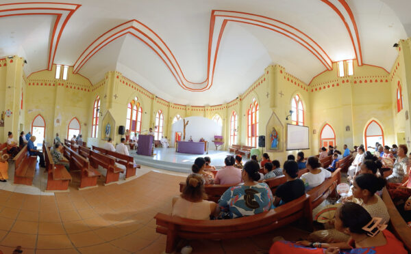
Hakupu locals gather on the first Sunday of the month—White Sunday. The church is an important focal point for the close-knit communities on the island and an influential public voice.
 Niue
Niue
Coral crevices along Niue's shore harbour dens of writhing sea snakes, no more so than at Snake Gully. Here, snakes swim regularly to the surface to take a breath, then return to their lairs.
Niue
Spinner dolphins—slender torpedoes of the tropics—tumble like gymnasts on the displacement wave of a charter fishing boat.
 Niue
Niue
Gorgonian fans the size of golf umbrellas filter the cool water upwelling on the reef edge.
 Niue
Niue
In Avatele, Hine Makaia and Bretrick Vakanofiti ply their vaka out through the passage in the reef to fish.
 Niue
Niue
The Huvalu Forest Conservation Area stretches across a verdant swathe of the island's south-east. Much of it is primary growth, but it is suffering from a multitude of threats.
 Niue
Niue
Researchers Jake Levenson, Olive Andrews and Rosie Dodd attempt to attach a LIMPET satellite tracking tag to a whale.
 Niue
Niue
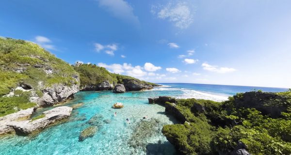
On the west coast, in the lee of the prevailing trade winds, the Pacific has penetrated broken coral cliffs to create a series of pools and channels that delight tourists as much as the locals.
 Niue
Niue
Each month a freighter pulls up to Alofi, Niue’s capital and port, to offload food, fuel, building materials and Japanese cars.
 Niue
Niue
Niue is one of the world's smallest states, and one of world's largest coral islands.
 Outer Gulf
A pair of juvenile triggerfish hang beneath a hunk of driftwood encrusted with goose barnacles, some 25 kilometres out to sea.
 Outer Gulf
Point the bow at the razor horizon and leave the coast behind. As the seafloor drops away to 400 metres deep—marking the edge of the continental shelf—you leave New Zealand and enter the wide, wild realm of Tangaroa.
 Outer Gulf
Oceanic bottlenose dolphins play on the bow, leaping, cavorting and blowing bubbles.
 Outer Gulf
Just beyond the territorial boundary of New Zealand, marine scientist Jochen Zaeschmar takes aim at a pod of pilot whales.
Outer Gulf
In calm water far out to sea, a group of pilot whales—including some juveniles—rests on the surface between hunts. Some doze upright in the water column, while others appear to drift off in front of the camera as they swim.
 Parengarenga Harbour
As the sun goes down on Te Hapua, a local casts a line into the still waters of Parenga Channel, a source of sustenance for generations.
 Parengarenga Harbour
Like strange fruit, ascidians cling to a wharf pile in Te Hapua. A native of Australia, they first appeared in Houhora Harbour in 2005 and were later found on oyster racks here in Parengarenga, likely brought in on the hull of an oyster barge.
 Parengarenga Harbour
Commercial fishers from Te Kao clear mullet from their net in the shallows of Kokota Spit where they fish their quota.
 Parengarenga Harbour
Aquaculture is an important industry for local communities, as employment opportunities are thin on the ground.
 Parengarenga Harbour
Workers repair an oyster farm damaged by a storm in the shallow upper reaches of Porotu Arm.
 Parengarenga Harbour
At the harbour entrance, tiny juvenile fish, like these bigeyes, hide in the shelter of a rock.
 Parengarenga Harbour
The vast Parengarenga Harbour spills into the sea through a narrow channel of dark water running over a shallow bar.
 Parengarenga Harbour
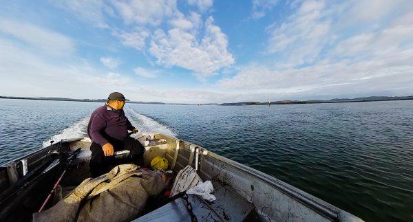
The harbour is a larder for the 500 residents of Te Kao and Te Hapua, like Nick Marsh, who have fished these waters for generations.
 Parengarenga Harbour
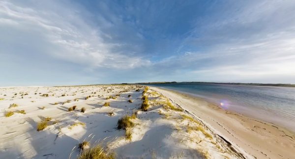
Parengarenga Harbour is sheltered from the sea by a 10-kilometre-long promontory of pure silica sand, called Kokota Spit.
 Parengarenga Harbour
Deep channels lead inland from the harbour entrance. The edges are laced with mangroves and the shallows green with meadows of seagrass.
Parengarenga Harbour
Eagle rays bask in the warm, clear shallows of Parengarenga, one of the best preserved harbour systems in New Zealand.
Poor Knights & Goat Islands
Experiencing Marine Reserves is a national programme of experiential learning that allows anyone to borrow a mask and wetsuit, take the hand of a guide, and wade into the most pristine sites in New Zealand.
Poor Knights & Goat Islands
Snapper congregate in the shallows of Cape Rodney-Okakari Point Marine Reserve at an abundance and maturity that may closely reflect the original snapper populations of the Hauraki Gulf.
 Poor Knights & Goat Islands
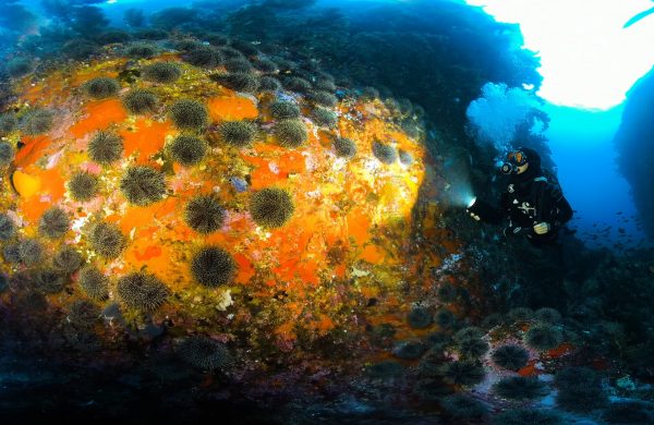
Cape Rodney-Okakari Point Marine Reserve (Goat Island) marked the beginning of an environmental awakening. Established in 1977, it was the country's first no-take marine reserve, and among first in the world too.
Poor Knights & Goat Islands
South of the Poor Knights stand a crop of rocky spires called The Pinnacles. Under the largest is a cathedral-like cavern called Tie Dye Arch, named for the kaleidoscope of colours that clad every surface like graffiti.
 Poor Knights & Goat Islands
Marine scientist Lucy van Oosterom wrote her Masters thesis on fish communication. Yes, fish talk, using a range of sounds that include pops, crackles and whistles, depending on the species.
 Poor Knights & Goat Islands
Why swim when you can scoot? Marine biologist Lucy van Oosterom, our VR Producer, hitches a ride through clouds of blue maomao and past swathes of kelp.
 Poor Knights & Goat Islands
Twenty kilometres off the Tutukaka Coast, the Poor Knights Islands are the remnants of an ancient volcano, shattered and penetrated by the sea.
Poor Knights & Goat Islands
Snapper congregate in the shallows of Cape Rodney-Okakari Point Marine Reserve at an abundance and maturity that may closely reflect the original snapper populations of the Hauraki Gulf.
Poor Knights & Goat Islands
At the northern extent of the Poor Knights Islands is a gash in the rock, cutting through a promontory to a depth of more than 40 metres. Pink maomao and rays parade through it, day in day out.
Poor Knights & Goat Islands
At a group of tall rock stacks south of the Poor Knights is a huge cavern at a depth of 25 metres, choked with fish and rays, and wallpapered in colourful sponges.
 Poor Knights & Goat Islands
In the underwater labyrinth of the Poor Knights islands are fish that have learned to talk. Dive in with scientist Lucy Van Oosterom, who is trying to figure out what they're saying.
 Poor Knights & Goat Islands
Why swim when you can scoot? Marine biologist Lucy van Oosterom, our VR Producer, hitches a ride through clouds of blue maomao and past swathes of kelp.
Poor Knights & Goat Islands
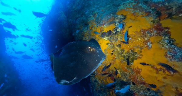
Deep under Archway Island is a cavern swarming with blue maomao—a common schooling fish in New Zealand's north. They seek shelter and protection in these caves, which are wallpapered with vibrant sponges and algae.
 Rangitāhua / The Kermadecs
Below the waterline, the Kermadec Islands are close to pristine, and brimming with sharks—the ultimate indicator of a healthy ecosystem.
 Rangitāhua / The Kermadecs
Two lionfish, trailing their elaborate manes with 18 venomous spines, linger in a cave with slender roughy and yellow-banded perch.
 Rangitāhua / The Kermadecs
A small school of boarfish linger in a crack at Parsons Rock off the heaving surfline of Denham Bay.
 Rangitāhua / The Kermadecs
After the 2002 predator eradication, Public Enemy #1 on Raoul is no long rats, but weeds—Mysore thorn, black passionfruit, buttercup plant and two species of guava.
 Rangitāhua / The Kermadecs
Hold on to your hat, you're riding a mule—four-wheel-drive all-terrain vehicles that can navigate the narrow, bush-cloaked goat tracks that are Raoul's autobahns.
 Rangitāhua / The Kermadecs
Director of photography Richie Robinson expertly pilots a dive scooter alongside a school of kingfish, thronging in the shallows at Meyer Islets.
 Rangitāhua / The Kermadecs
The Kermadecs are the only place in New Zealand with water warm enough to support coral.
 Rangitāhua / The Kermadecs
Raoul Island is massive volcanic cone, with a caldera at its centre and two volcanic lakes. Ironically, at present, Blue Lake appears green and Green Lake is blue.
Rangitāhua / The Kermadecs
While birdlife on Raoul Island was ravaged by rats and cats from the 1920s, neighbourly Meyer Islets remained free of pests.
 Rangitāhua / The Kermadecs
A good northerly on the quarter makes for easy running home. Point the bow south-west, and follow the Kermadec Ridge for a thousand miles towards the blue horizon.
 Te Manawatawhi / Three Kings
On a still, clear day, you can see the pyramid-shaped form of Te Manawatawhi from Cape Reinga, rising like a tombstone from the horizon.
 Te Manawatawhi / Three Kings
Deep beneath a rock stack on the south coast of the Princes Islands is a dark cavern, invisible from the surface.
Te Manawatawhi / Three Kings
Fishing effort, day after day, century after century, has changed the shape of this place. It’s still heaving with reef fish, but the predators are gone.
 Te Manawatawhi / Three Kings
In North-West Bay, between the lollipop-coloured floats marking cray pots, fishing charter boats find anchor.
 Te Manawatawhi / Three Kings
Colourful sponges festoon a cave in Irishman's Garden which shelters a plethora of reef fish.
 Te Manawatawhi / Three Kings
Oceanic bottlenose dolphins shelter and feed in the lee of the Princes Islands. They are larger and more scarred than their cousins along the coasts of mainland New Zealand.
 Te Manawatawhi / Three Kings
On the north coast of Princes Islands, a huge rocky spire called Arch Pinnacle rises steeply from the seafloor.
 Te Manawatawhi / Three Kings
Landsbergia Rock is cloaked in a diverse forest of weeds, one of which is only found on this single rock. Swarms of maomao circle above and a short-tailed stingray gets spooked by the camera!
 Te Manawatawhi / Three Kings
The Three Kings is unusual. It has one of the highest rates of endemism in New Zealand, which is to say the things that live here are found nowhere else.
Te Manawatawhi / Three Kings
The cliffs of Te Manawatawhi are plumb and wrinkled with age. At the waterline they wear a piupiu of bull kelp that reaches out towards the sea on an incoming swell, and hangs supple and bronze as the wave departs.
 Te Mounga
Project Reef juts out from the seafloor like a shipwreck. Seaweed and sponges cling to the rock, becoming habitat for crustaceans and invertebrate communities, and in turn, small reef fish and hoards of blue cod.
 Te Mounga
Eleven kilometres off the coast of Patea, a citizen science enterprise called Project Reef Life is working to document a coastal reef habitat.
 Te Mounga
Mark "Frosty" Frost lines up the mouth of the Patea River and prepares to 'take the bar'.
 Te Mounga
Jenny Kerrisk has been volunteering at Rotokare Sanctuary three days a week for 10 years. Among other tasks, she keeps the sugar-water topped up in the feeding stations—supplementary food for hihi, or stitchbirds.
 Te Mounga
Ash Muralidhar and volunteer Jenny Kerrisk hand-feed meal worms to North Island robins (toutouwai) at Rotokare Sanctuary, 35 kilometres south-east of the mounga.
 Te Mounga
The Waiwhakaiho runs to sea at New Plymouth—the end of a short 25-kilometre flow across Taranaki's ring plain from the top of the mounga.
 Te Mounga
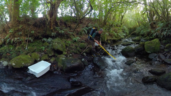
On an unnamed tributary, Fish & Game field officer Allen Stancliff and ecologist Bart Jansma survey Waiwhakaiho tributary with an electrofishing rig.
 Te Mounga
There are no less than 1400 traps forming a lethal net around the mounga—traps that must be checked and re-baited every month.
 Te Mounga
Tongues of dense bush reach out from the disc of forest that cloaks the perimeter of the national park—the country's second, established in 1890.
 Te Mounga
Whio were functionally extinct in Taranaki until an extensive network of stoat traps enabled the introduction of ten blue ducks in 2003.
 Te Mounga
Moss-encrusted kamahi trees dominate the Kamahi Loop Track on the lush eastern flanks of Taranaki, where rainfall totals more than two metres a year.
 Tokelau
The Taupulega, or council, of each atoll holds the decision making power in Tokelau. It's made up of the heads of each family on the island and decides everything from spend of public finances to how to deal with waste. Here on Atafu, they begin proceedings with a song.
 Tokelau
After school the students of Fenua Fala hit the lagoon for some relief from the scorching tropical heat. The lagoon is a balmy 25º degrees or more most days.
 Tokelau
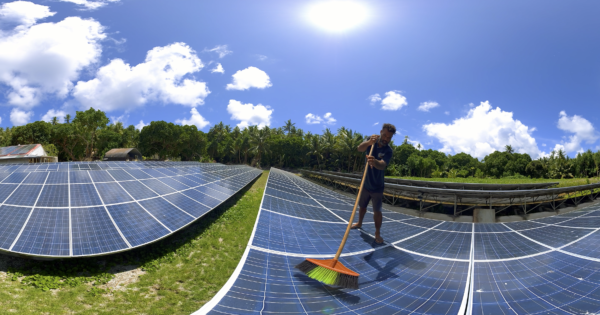
Tala Tyrell cleans the solar panels on Fenua Fala, to keep the array operating at top efficiency. The solar farm—which meets 100% of Fakaofo's power demands—was installed in 2012 and is due for a major upgrade to lithium batteries.
 Tokelau
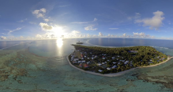
Fakaofo is the smallest and most southerly of Tokelau's three atolls. Two islands are inhabited, the tiny islet of Fale, and featured in this video, the larger island of Fenua Fala. Can you see the school and solar farm?
 Tokelau
Nukunonu's lagoon is nearly 100 square kilometres in area. Some areas are deep, but here near Tokelau Island in the east, locals can find clams growing in coral structures in the shallows—easy pickings for a Sunday picnic.
 Tokelau
Only one islet of the Atafu atoll is inhabited, and like the other atolls in Tokelau, it's 100% powered by solar. As a result, locals get around in electric carts, like in a fancy golf resort. Take a tour of the coral roads.
 Tokelau
Everything in and out of Tokelau arrives on this ferry, the Mataliki, which makes the 10-day round-trip linking Fakaofo, Nukunonu and Atafu atolls, then back to Samoa, and then repeat. The cargo is loaded on to a barge to get through the shallow channel to the wharf, then offloaded to shore.
 Tokelau
Volleyball is ever-popular on Atafu atoll, especially in late afternoon when it's cooler. On the adjacent field, a younger crew enjoys touch rugby.
 Tokelau
In the Pisonia forest on Tokelau Island, Nukunonu, Troy William, Isaac Perez and Dominic Manuele check holes under trees for monstrous coconut crabs. Each the size of a dinner plate, they make a tasty meal—think muddy crayfish flavour.
 Tokelau
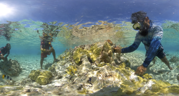
Tokelauans rely on their ocean estate for sustenance and survival. Students from Matauala School on Atafu atoll plant corals on netting within the lagoon. After they grow the corals can be located to deeper, cooler reefs with a greater chance of survival in a warming world.
 Tokelau
Every year the sea surface temperatures rise in Atafu, leaving behind towering coral structures that couldn't stand the heat.
 Tokelau
Southeasterly trades blow through the louvred windows, lifting the smoke of Mass. The hymns are full-throated. While congregations wither in the West, every household turns out for the service on Nukunonu. The joy and structure of Catholicism seem to match the conservative family values and collective responsibility that is baked into Tokelauan culture.
 Tokelau
On the eastern islets of Nununonu's 98-square-kilometre lagoon, petrels have set up camp in greater numbers than ever before. As the local community receives more goods from the outside world, and exercises greater efforts in conservation, hunting these seabirds for food has become increasingly rare. Terrestrial ecologist Moeumu Uili visits the colony to update the count.
 Tokelau
A school of barracuda circle the outer reef at Fenua Loa, Fakaofo, a sign that fish life is in good health, even while corals are recovering from recent heatwaves.
 Tokelau
As aluminium boats have replaced traditional dug-out canoes—called paopao in Tokelau—for fishing. But on Nukunonu, Suega Isaia and four-year-old Alowhenua keep the tradition alive.
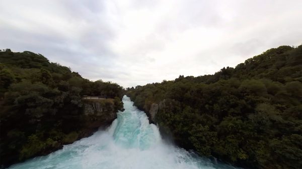
 Waikato River
Tourists take a load off at Kerosene Creek, a natural hotspring on the Wai-o-Tapu tributary that ultimately runs into the Waikato.
 Waikato River
Hinemoa's Needle marks the end of a massive escarpment of Te Horohoroinga o nga ringa o Kahumatamomoe—where Tutanekai washed his hands after burying bones.
 Waikato River
Allan Bryant guides his log truck up Waipa State Mill Road to the Whakarewarewa weighbridge to check through a load of pine from a farm wood lot near the river.
 Waikato River
The water draining from Lake Taupō is crystal clear at Reids Park Farm, the out-point for daring drift divers following the current downstream. Miss this out-point and the next stop is Huka Falls.
 Waikato River
At Orakei-Korako, the immense Taupō Volcanic Zone brushes the surface, superheating water to form the largest geyser field in New Zealand. Kurapai Geyser is erupting on the hill behind the terraces.
 Waikato River
The upper reaches of the Waikato writhe like a serpent through the fertile farmland of Broadlands Forest.
 Waikato River
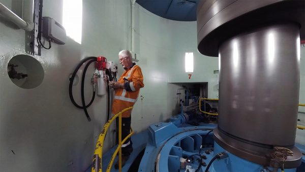
It's Craig Caldwell's last day in 'the office' before his retirement as production technician of Maraetai Power Station.
 Waikato River
Atiamuri Power Station was the third of eight hydroelectric power stations to take advantage of the massive vertical potential of the Waikato River.
 Waikato River
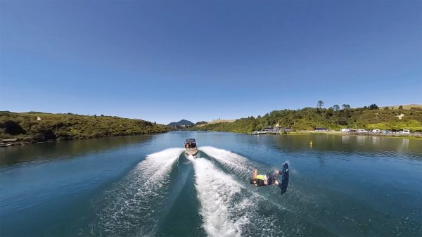
Searing up the green highway at 90 kilometres per hour, punters on the New Zealand River Jet get a whistle-stop tour of the upper Waikato.
 Waikato River
Ohakuri local Nik Gibson has won the national wakeboarding champs four times, and travelled to the Worlds in Korea, Doha, Italy and Australia, first time at age 14.
 Waikato River
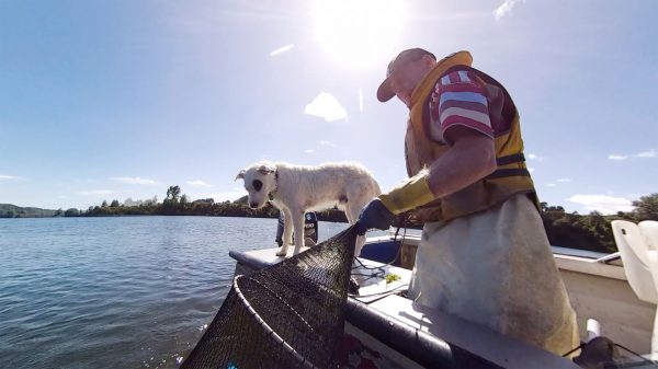
Mike Holmes pulls shortfin eels from a fyke net, under the watchful eye of his hound Jack. A decent day returns 150 kilograms—six bags—to make up his 20-tonne quota for the year.
 Waikato River
Endemic species coexist with invasives in the highly modified ecology of Lake Ohakuri on the Waikato River. Shortfin eels writhe around the camera, while introduced rudd—the 'possums of the waterways'—circle at a safe distance.
 Waikato River
Students from Reporoa College recreate history, paddling a double-hulled waka hourua—a cultural programme run by Aotearoa Waka Experiences—through the infamous Tutukau Gorge, a section of the Waikato River two kilometres south of Orakei-Korako.
Waikato River
New Zealand's longest river narrows to a 15-metre cataract of whitewater at Te Waiheke o Huka, where some 220,000 litres of water per second tumbles over six-metre drop.
 West Coast
Local Tim O'Donnell turns the power of the infamous Westport Bar in his favour on a foiling surfboard. Born at Lake Rotoiti at the top of the Southern Alps, the Buller River runs west to the coast, spilling into the Tasman at Westport (originally called Buller). Māori lived here in the 14th century, trading pounamu, with sealers, gold miners then coal miners arriving from the 17th century—the river and port serving them all.
 West Coast
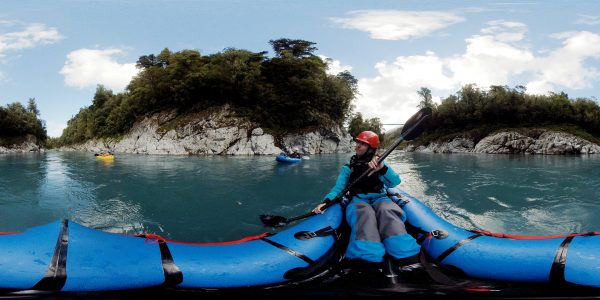
Kayakers take on the rapids on the Hokitika River, expertly guiding their inflatable pack-rafts downstream between the rocks. The art to prepare yourself before the rapid, the paddle hard at the ‘V’ formation of water which signifies the main channel, and the best chance you have of a smooth run through.
 West Coast
The Okarito Lagoon is the largest unmodified coastal wetland in New Zealand. It stretches over some 3240 hectares along the coast south of Hokitika, the consequence of flooding rivers, Tasman swells, landslides in the foothills, earthquakes and upheavals—a natural tapestry of change.
 West Coast
Suzanne Hills and Chris Cromey live in a ‘tiny house’, on wheels and off grid south of Punkaiki. In the past five years she has planted 5000 native trees, set solar and wind power generation and even uses ‘solar cooking’. A large vege patch, two ewes and a small hoard of rabbits provide sustenance, pleasure and fertiliser in equal measure.
 West Coast
Paul works on a front end loader to clear off the overburden and get to the gold-bearing quartz and greywacke which is deposited into the floating gold screen. Gold is heavy, so settles to the bottom while the remaining deposits are spread onto the land. Last year 700 kilograms of gold was mined across the West Coast, worth nearly $75 million.
 West Coast
Lake Brunner/Kōtukuwhakaoka is the largest lake in the West Coast region, but also one of the hardest to get to. It’s miles from the state highway that runs along the coast and most of it can only be reached by boat. It’s so deep, shelves so steeply from shore, and looks so black in colour (from tannins in the water ) that locals believed it was bottomless, though the deepest point is just over 100 metres. Kahikatea can tolerate wet roots, so they dominate the lake edge as if permanently in flood.
 West Coast
Waitangiroto Nature Reserve is the only nesting area for kotuku in New Zealand. Some 140 birds breed in New Zealand, always within the same stretch of stream, laying three eggs per nest—all eggs hatch but only one or two survive. The birds were discovered by surveyor Gerhard Mueller in 1865, but had diminished to just six nests by 1877 due to demand for feathers for fashion.
 West Coast
The Hokitika Gorge is one of the highlights of any visit to The Coast. Glacier ‘flour’—the fine powder that is the result of ice grinding rocks to a pulp—suspended in the water paints it a luminous turquoise. The river is also favourite run pack-rafters, a fast-growing sport of enthusiasts who walk in to remote rivers, inflate their craft and paddle out.
 West Coast
Glow worms love damp, dark conditions with little wind, like here the Ananui/Metro cave system, perhaps the largest colony of glowworms in the South Island. The light is the result of a chemical reaction between luciferin (a waste product), the enzyme lucifarse, ATP and oxygen. It attracts prey which get caught in the sticky silk threads. The worms live for only nine months, after which they pupate into a fungus gnat.
 West Coast
New Zealand fur seals splash through tidal pools at Cape Foulwind, near Westport. Female fur seals live in the same colony all their lives, mating in December, giving birth the following November, with lots of fishing trips to sea. There are now about 75,000 fur seals in New Zealand, which have recovered from hunting in the late 1800s and early 1900s, to meet a demand for furry top hats among European gentry.
 West Coast
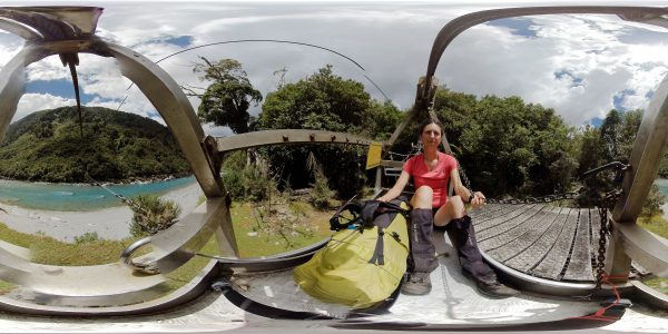
Lauren Kelley braces herself for a crossing of the Hokitika River on a flying fox—a versatile if invigorating mode of transport on the West Coast. With variable river levels, the flying foxes are an efficient and safe means to get people and gear across the otherwise daunting rivers in the region.
 West Coast
Franz Josef Glacier / Kā Roimata o Hine Hukatere is a 12-kilometre long jigsaw of ice and rock, tumbling some from a névé 2500 metres above sea level—where the ice is 300 metres thick—to 300 metres above sea level, in the middle of the rainforest. It once extended all the way to the sea (19 kilometres away). Today it is three kilometres shorter than it was a century ago.
West Coast
Dave Johanssen and his daughter Olivia milk 320 cows a day on their West Coast farm at Ahaura, each of them producing some 27 litres of milk a day. Johanssen has been milking cows for four decades, and the kids are on a similar path, taking turns with the milking to earn pocket money.

3
$1 trial for two weeks, thereafter $8.50 every two months, cancel any time
Already a subscriber? Sign in
Signed in as . Sign out

Ask your librarian to subscribe to this service next year. Alternatively, use a home network and buy a digital subscription—just $1/week...

Subscribe to our free newsletter for news and prizes