
Towards a new resilience
Lying on the Pacific Ring of Fire, New Zealand is vulnerable to a host of volcanic and tectonic threats. And being an island nation, also the possibility of inundation by tsunami, and the prospect of sea-level rise and more intense weather events. When natural events are difficult to predict or mitigate, how do we build more durable infrastructure, and a more resilient society?
Landfall
What force of nature kills more New Zealanders than volcanoes, tsunamis and earthquakes combined? Landslides. With climate change making landslides more frequent, and the South Island overdue for a big quake, scientists are racing to understand the risk. But the tricky part is translating that existential maths into action.
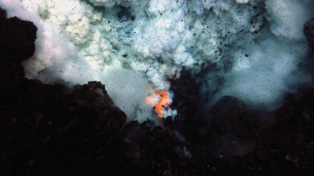
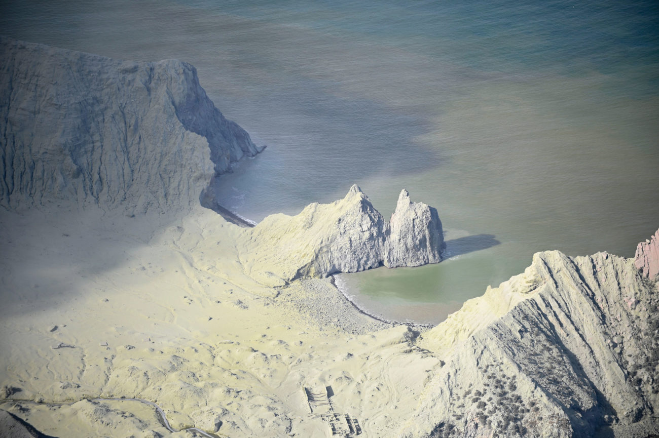
Underwater volcanos of the Pacific
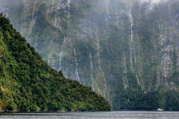
Extending some 1400 kilometres northeast from the Bay of Plenty, the Kermadec Arc is the longest underwater volcanic ridge on the planet. It is also highly active, creating great calderas on the sea floor and spewing rafts of pumice that drift on the surface for thousands of kilometres. Scientists are only beginning to understand the diversity of life that takes advantage of this unstable environment.
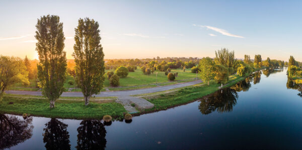
New Zealand's tsunami threat
Off the east coast of the North Island, one tectonic plate slipping could lead to the same kind of quake that caused devastating tsunami in Japan in 2011 and Southeast Asia in 2004. Thanks to a suite of seafloor instruments and new underwater observatories, scientists are discovering more about this plate boundary and how it behaves.
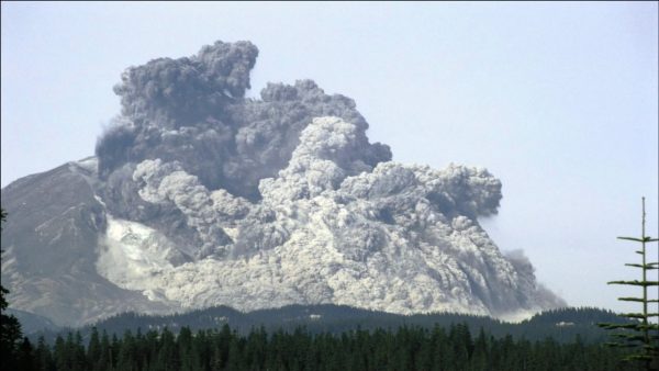
What happened on Whakaari?
Three years ago, our most active volcano warned us of its impulsive and devastating power. We didn’t listen.
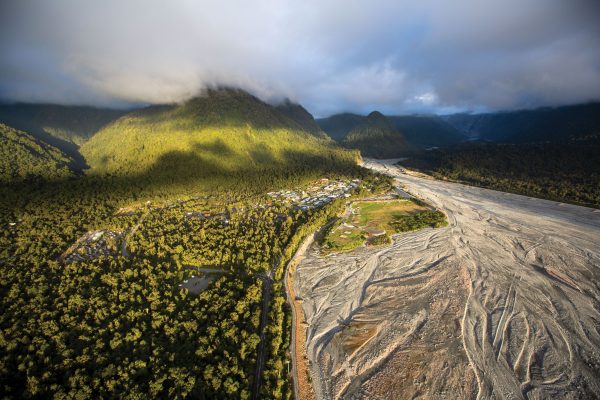
New Zealand's most endangered town
Franz Josef is a town in jeopardy—it straddles the Alpine Fault and the Waiho River, and its tourism income has cratered. Who’s responsible for moving it out of danger? And where should it go?
Ready or not
Preparing for a natural disaster has long been considered a matter of personal responsibility—but what happens to those without the finances to stockpile supplies or the physical ability to run up the nearest hill? Lessons learned during New Zealand’s most recent crises have shifted how towns and cities are building resilience. Researchers with the Resilience National Science Challenge and other agencies now believe that strong community connections will best help everyone ride out a worst-case scenario—but can we form those bonds in time for the next big one?
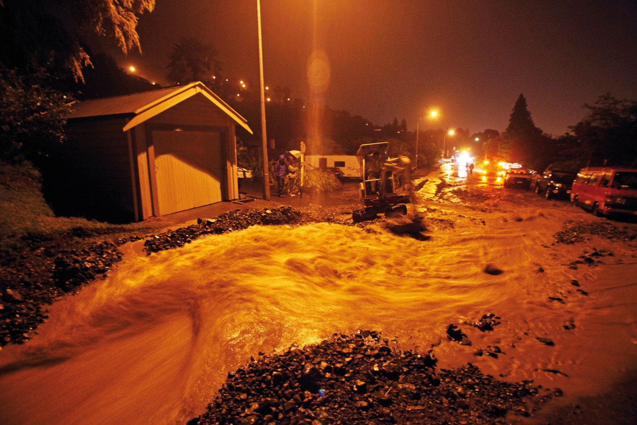
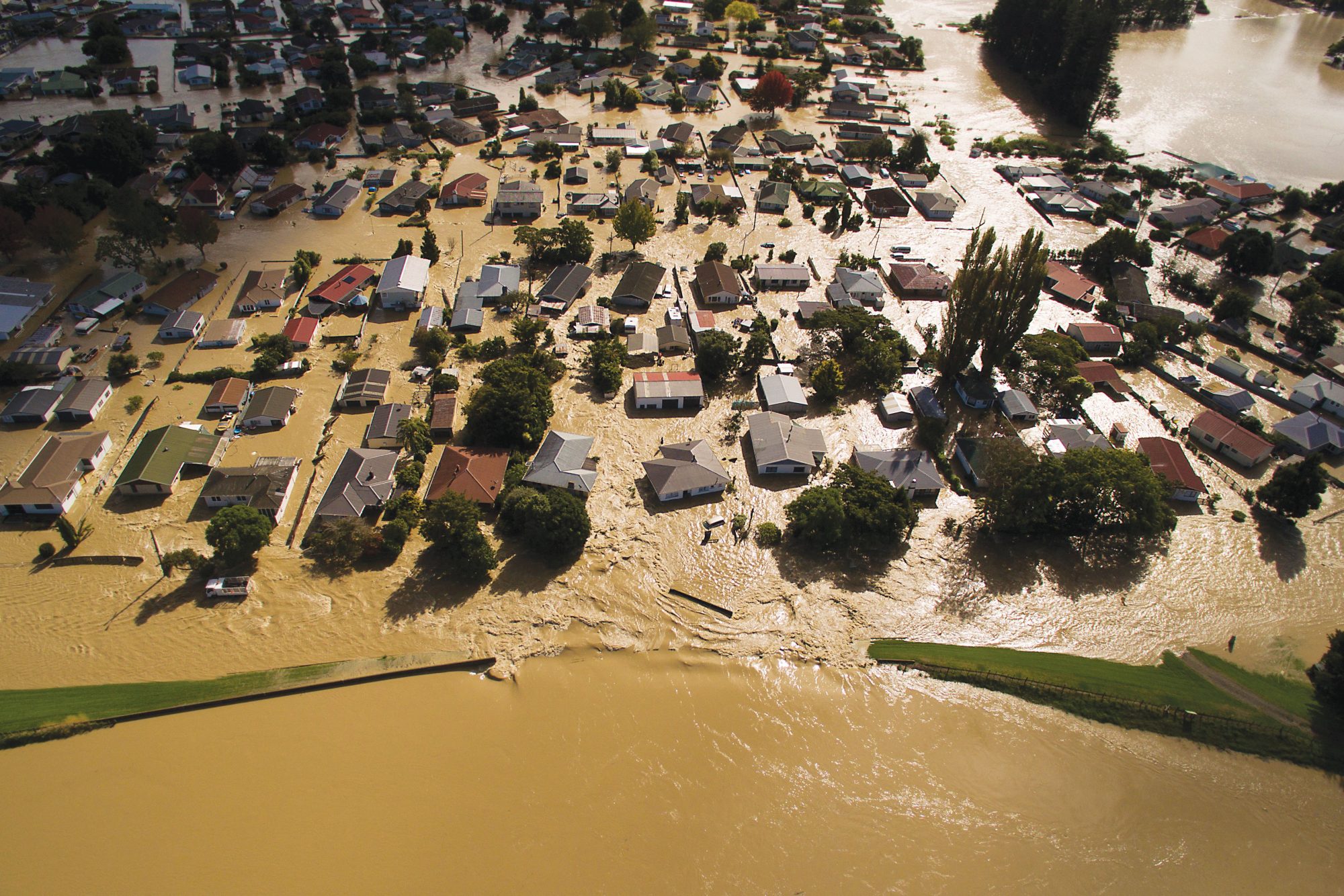
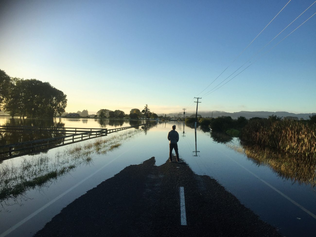
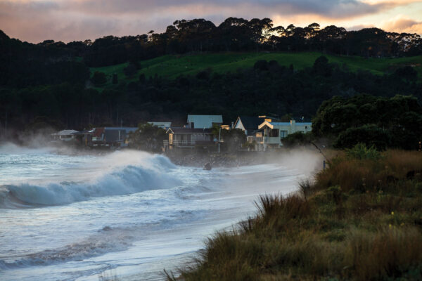
After the flood
Nile Street looked much like its Egyptian namesake as rain thundered down on Nelson in December. Culverts choked with rocks and silt, and despite extensive use of sandbags, houses and gardens were inundated. But worse was to come. Hillsides collapsed, rivers burst their banks and torrents of water drove tonnes of silt and sand through valleys and farmland throughout the district. After two days of deluge, those who weren’t driven from their homes by the rising flood looked in disbelief upon the damage wrought by water in one of New Zealand’s sunniest regions.
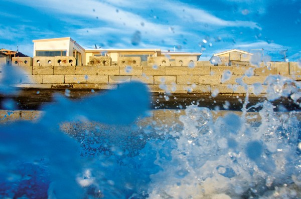
What storms may come
Much of New Zealand’s coastal property has an expiry date, with its value set to be wiped off the ledger in as little as nine years’ time, well before sea levels rise and coastlines are redrawn. What will happen to marae and communities by the beach? And why are we still buying—and building—properties right in the danger zone?

Tsunami
An investigation into the anatomy of a tsunami: from the science behind recent events, ramping to a mega tsunami that’s yet to happen – the Mega Disaster.
In the wake of the quake
The Kaikōura Earthquake was better documented and measured than any natural event in our history. As the data streams in, scientists are scrambling to decode its hidden meanings and answer some burning questions of Antipodean geology: How does seismic energy jump from one fault to another? Why were so many involved in this earthquake? And what can it teach us so we are better prepared for the next one?
What Kaikōura taught us
The 2016 earthquake is now believed to be one of the most complex ever recorded.
Volcano
An investigation into the anatomy of a volcanic eruption: from the science behind recent events, ramping to a mega eruption that’s yet to happen—the Mega Disaster.

Earthquake
An investigation into the anatomy of an earthquake: from the science behind recent events, ramping to a mega earthquake that’s yet to happen – the Mega Disaster.
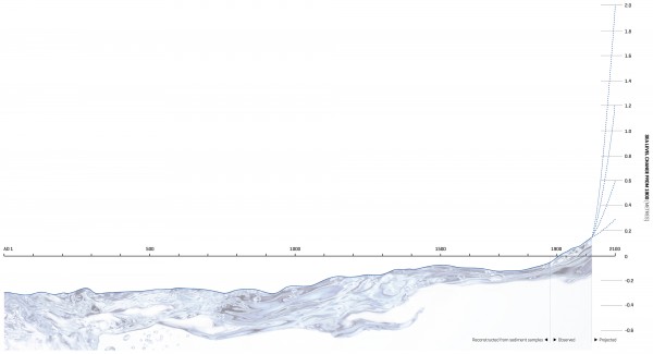
Three feet high and rising
With predicted increases in sea level of a metre or more by the end of this century, present-day problems of coastal erosion, flooding and salt-water intrusion into groundwater are going to get much worse. As world leaders gather in Paris to seek a political solution to climate change, it’s timely to ask how we in New Zealand are responding to the challenge of rising seas.

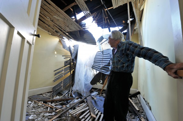
Red zone
Entire suburbs were ‘red-zoned’ after the 2011 earthquake in Christchurch. Even now, the fate of these properties and the few residents still wrangling with authorities remains uncertain. Welcome to purgatory.
Canterbury quake
Fear and loathing in Canterbury
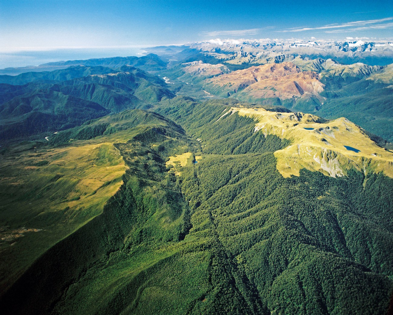
The big one
The Alpine Fault ruptures—on average—every 330 years with a magnitude 8 earthquake. Geologists and authorities are racing to quantify what might happen, and how they might respond in the event of the next one, likely to occur some time in the next 50 years.

Renaissance of the land
Kim Hill and a panel of East Coast people discuss the vicissitudes of life on the land, the disasters that threaten the environment and their efforts to take their destiny in hand, and build a resilient community where people can make a living, enjoy living off the land and the land endures.
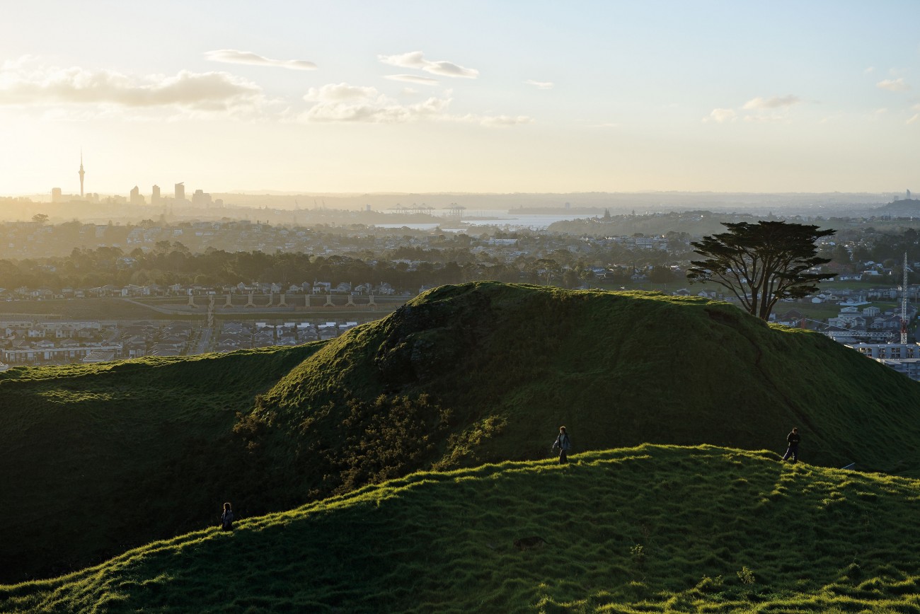
The fire beneath us
New Zealand’s largest city sits atop an active volcanic field that has erupted at least 53 times in the past 250,000 years. The catastrophic blasts felled forests and set the Auckland isthmus alight. The fire-fountaining cones and lava flows rode roughshod over the land. Scientists are not wondering if it will happen again, but what it will cost Auckland in lives and infrastructure when it does.
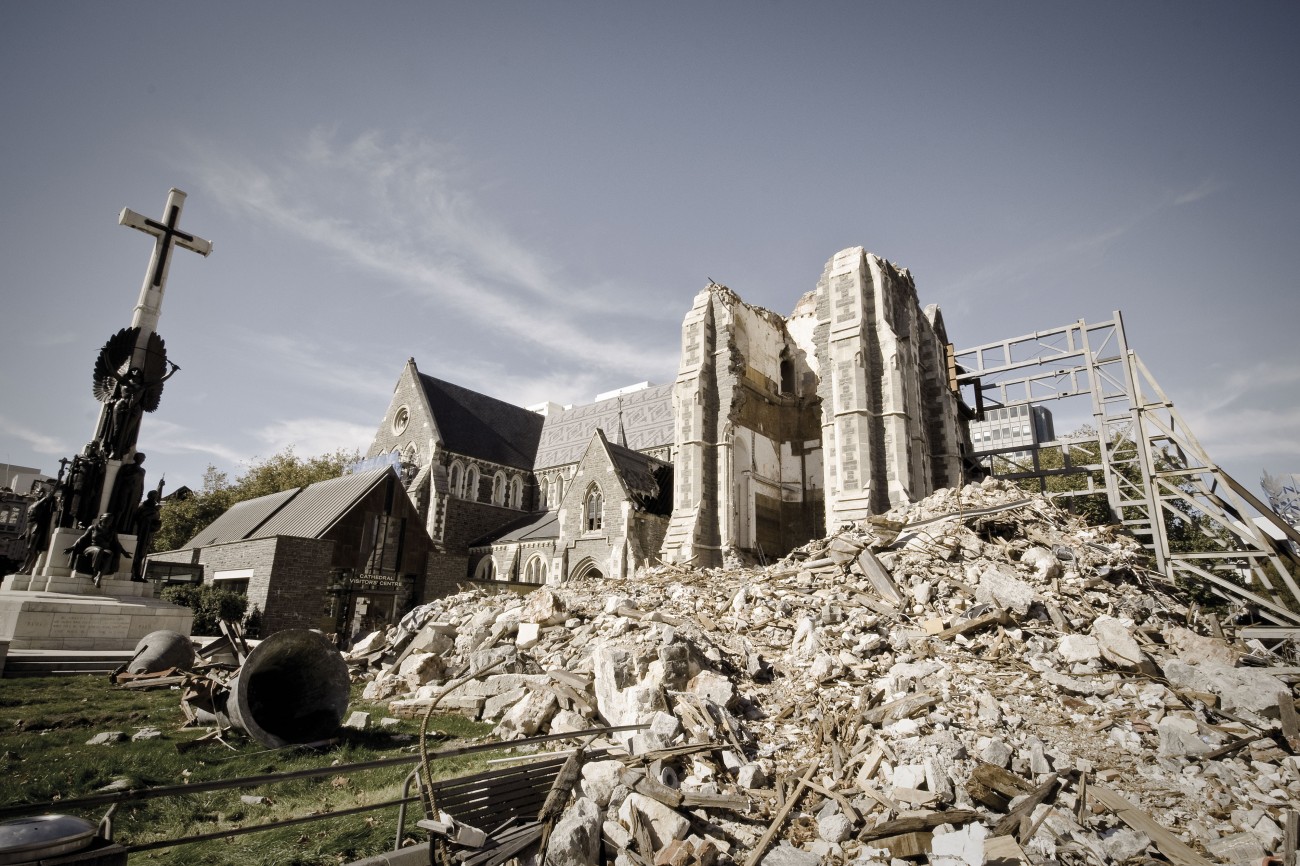
Resurrection: Christchurch moving on
Though ChristChurch Cathedral will almost certainly be restored to former glory, the fate of other heritage buildings, indeed the future of the city itself, is less clear.
Ready or not
Global sea levels are rising, but how high remains unknown.

Softening the seismic blow
Buildings and bodies would not, at first glance, appear to have much in common. But to an engineer there are parallels, if not outright similarities. The history of life is partly about the evolution of hard parts (skeletons) to give support and strength to soft-bodied organisms. A group of New Zealand seismic engineers has been working in the reverse direction: developing ways to make rigid structures, such as buildings and bridges, more flexible and resilient, by supplying them with "soft parts." They would then he less prone to damage during an earthquake. Earthquakes always come in two "doses," the sweet followed by the bitter. First comes the P wave—the primary, or push, wave—which travels at about 20,000 km/h, about five times the speed of a bullet. This wave translates readily into sound energy when it reaches the ground-air interface. Many New Zealanders will have heard the rumble of an earthquake and described it as "sounding like a freight train." That is the P wave. It "softens you up," and is generally kinder than what comes next. The S wave—the secondary, shear, or sideways wave—travels at approximately half the speed of the P wave, but does most of the damage in an earthquake. The reason is that whereas P waves involve movement parallel to the trajectory of the wave, S waves involve movement perpendicular to the wave direction. Rigid structures don't respond well to that sort of movement, as anyone who has seen photographs of the aftereffects of the Napier, Murchison, Edgecumbe or any of the other large earthquakes that have struck New Zealand will attest. Now, however, the buildings that are most important to us—our homes—are about to benefit from a piece of seismic engineering technology which has been developed in earthquake-prone Wellington. Imagine a house built on an array of rubber balls. Each ball is hollow, 12 cm in diameter, and filled with a material (lead marbles perhaps, or a viscous fluid) that will provide a coefficient of friction or inertia that is appropriate to the physical properties of the house. When installed, the balls squash down to as little as 20 mm in height, and create an air gap between the base of the house and the ground surface—say a concrete pad. In an earthquake, the balls roll as the ground moves, and the house stays relatively still—and intact. The balls are strong and flexible and behave both as shock absorbers and springs, and can move in any direction. They function in a similar way to the inter-vertebral discs of cartilage located between vertebrae in the backbones of vertebrates. The balls are the brainchild of Wellington-based scientist and inventor, Bill Robinson, whose company, Robinson Seismic, previously developed the "base isolation" system for high load-bearing structures. Base isolators are bearings that isolate the base of the building from the ground. Measuring about a metre square and half a metre high, they are squat cushions of laminated steel plates (2 mm thick) and rubber (15 mm thick), with four vertical cylinders of pure lead. The steel gives strength, the rubber elasticity, while the lead serves to brake the shaking during a seismic event. Base isolators have been shown to minimise the effect of a major earthquake by as much as 80 per cent, and have been deployed in such buildings as Te Papa and Parliament Buildings. Robinson's new device, patented under the name "Roball," can provide seismic protection at a domestic level, and perhaps offers the prospect of peace of mind to millions of people who live in parts of the world which are prone to seismic hazard.
Just add water
As the world warms, severe weather events increase.

Otherwise fine
Extreme weather takes its toll on rural communities, which feel the wrath of seasonal variances and the deep undercurrent of climate change too.
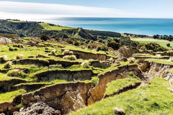
The greening of the red zone
During the two devastating earthquakes of September 2010 and February 2011, land in the suburbs east of Christchurch sank by a metre. What’s a city to do when an apocalyptic landscape appears right on its doorstep?

Under the Weather: A Future Forecast for New Zealand
James Renwick, HarperCollins, $39.99
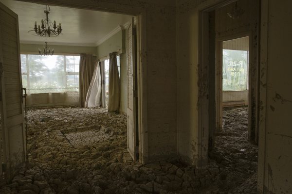
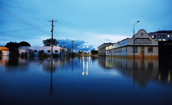
The year of silt
Twelve months on from Cyclone Gabrielle, many people are still fighting to return home. On February 14, 2023, floodwaters filled their houses with mud and destroyed possessions, memories, and livelihoods. Survivors were left virtually on their own to tackle the massive clean-up job—until a network of volunteers began digging out houses and supporting them through the trauma, forging unexpected connections along the way.


