Old man Kaipara
The sea is glassy now as a sand barge is towed down the northern Kaipara, but in another hour, who knows? Shoals, narrow channels, merciless currents and sweeping winds demand constant vigilance from those who ply the waters of New Zealand’s largest harbour. A century ago, the Kaipara was one of the country’s major waterways—a bustling conduit through which the vast kauri forests of the lower north were siphoned from the land. With the passing of the forest, the area became something of a backwater, the domain of farmer and fisherman. Little has changed; the harbour remains mighty in strength, meek in status.
I do not know much about gods; but I think that the river Is a strong brown god—sullen, untamed and intractable, Patient to some degree, at first recognised as a frontier; Useful, untrustworthy, as a conveyor of commerce; Then only a problem confronting the builder of bridges. The problem once solved, the brown god is almost forgotten By the dwellers in cities—ever, however, implacable, Keeping his seasons and rages, destroyer, reminder Of what men choose to forget.
From my vantage point on Kaipara’s South Head the sea was shadowy and restless, reflecting an iron sky that hung low over it with glowering intent. Looking down over the dozens of sand bars at the harbour entrance—including the infamous “Graveyard” of local legend, where the wave-wracked shores are still littered with the skeletons of past shipwrecks—I could feel the water’s elemental force, its shifting power.
Across the entrance, the dark outline of Pouto, the North Head peninsula, stood two-dimensional in the gloom. Rain was falling like a veil in the distance, obscuring the mouth of the Wairoa River, which feeds the northern reaches of the Kaipara, while to the west the broad earth-curve of the Tasman forced into perspective my precarious foothold on it all. All around, the turbulent and wind-tormented water recalled the many shipwrecks and drownings that darken it; sacrifices to Eliot’s implacable brown god, “his seasons and rages.”
Samuel Polack, an English-born trader who travelled through the Kaipara in 1831 seeking commercial opportunities, sounded a clear warning of the dangers of the harbour mouth: “The breakers were dashing on several sand bars in an awful manner, about three miles from the land. The late westerly gale caused the fearful commotion of the rolling waves to bound on these sea sand-spits, dashing the surf to an unusual height. No vessel, of any size or shape, could at this time have entered the Kaipara; instant shipwreck, into a thousand pieces, would have been the result.”
Polack’s warning would prove futile with, between 1840 and 1933, 110 recorded shipwrecks on the harbour. The bar is still an awe-inspiring place, and the significance of the area is deeply embedded in local legend. As the mountain is to the people of Taranaki, so the “fearful commotion” of the Kaipara Heads provides a dramatic backdrop to everyday life on the harbour.
Instead of crossing the seven-kilometre stretch of water that lay between me and Pouto, I planned to follow the intricate meandering of the coastline that, at 3350 km in length, made the Kaipara the largest harbour in the Southern Hemisphere. Skirting the water, I would arrive at the North Head lighthouse—a lonely beacon of white against the bronze sand dunes—in just under a month.
That first evening, having prepared for a cramped night in the back seat of my car at the end of Shelly Beach peninsula, the harbour side of South Head, I wandered down to the wharf, floodlit in an ocean of darkness. A local man, Steve, had four or five lines out. I
Across the entrance, the dark outline of Pouto, the North Head peninsula, stood two-dimensional in the gloom. Rain was falling like a veil in the distance, obscuring the mouth of the Wairoa River, which feeds the northern reaches of the Kaipara, while to the west the broad earth-curve of the Tasman forced into perspective my precarious foothold on it all. All around, the turbulent and wind-tormented water recalled the many shipwrecks and drownings that darken it; sacrifices to Eliot’s implacable brown god, “his seasons and rages.”ROM MY VANTAGE POINT on Kaipara’s South Head the sea was shadowy and restless, reflecting an iron sky that hung low over it with glowering intent. Looking down over the dozens of sand bars at the harbour entrance—including the infamous “Graveyard” of local legend, where the wave-wracked shores are still littered with the skeletons of past shipwrecks—I could feel the water’s elemental force, its shifting power.
Samuel Polack, an English-born trader who travelled through the Kaipara in 1831 seeking commercial opportunities, sounded a clear warning of the dangers of the harbour mouth: “The breakers were dashing on several sand bars in an awful manner, about three miles from the land. The late westerly gale caused the fearful commotion of the rolling waves to bound on these sea sand-spits, dashing the surf to an unusual height. No vessel, of any size or shape, could at this time have entered the Kaipara; instant shipwreck, into a thousand pieces, would have been the result.”
Polack’s warning would prove futile with, between 1840 and 1933, 110 recorded shipwrecks on the harbour. The bar is still an awe-inspiring place, and the significance of the area is deeply embedded in local legend. As the mountain is to the people of Taranaki, so the “fearful commotion” of the Kaipara Heads provides a dramatic backdrop to everyday life on the harbour.
Instead of crossing the seven-kilometre stretch of water that lay between me and Pouto, I planned to follow the intricate meandering of the coastline that, at 3350 km in length, made the Kaipara the largest harbour in the Southern Hemisphere. Skirting the water, I would arrive at the North Head lighthouse—a lonely beacon of white against the bronze sand dunes—in just under a month.
That first evening, having prepared for a cramped night in the back seat of my car at the end of Shelly Beach peninsula, the harbour side of South Head, I wandered down to the wharf, floodlit in an ocean of darkness. A local man, Steve, had four or five lines out. I asked him what he usually caught, and, through an ember-glowing pipe and the long beard of an Old Testament prophet, he told me: “Gurnard mostly. It’s a beautiful fish, rainbow-coloured and silver, wings like a butterfly. When they come out of the water they cry ow ow ow . . . other than that, snapper, mullet, trevally and, you know, the odd stingray.”
As he spoke, a line pulled taut, catching the lamplight. Steve rested the fishing-rod on his hip—drawing the line slowly in, still talking. “Those bloody trawlers, though, out off the Heads. They rape the harbour without even entering it. Don’t let anything in, sweep up entire schools of fish. Out there all night, they are; you can see their lights if you’re fishing on the harbour. They leave us with nothing. Nothing ….” As if in reply, the line fell suddenly slack into the water. Steve relit his pipe, and I left him to it. When I woke later that night, he was still a shadow at the end of the distant pier.
Driving back along the spine of South Head the next morning, I had the strange feeling of being on a sinking ship, water seeping in from either side. As this peninsula had risen out of the ocean, so it seemed that it could sink back at any moment.
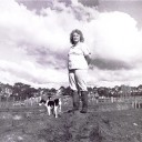
Wild peacocks, startled by my approach, scattered into the surrounding fields; a blur of colour in the still-dark morning. These birds, so Hec Nicholls, a Kaipara resident for all of his 80 years, told me, had been introduced to South Head by Alfred Buckland. In 1878, Buckland, an Auckland auctioneer, purchased most of the peninsula. A few years later, he shipped not only exotic peacocks, but also Spanish Pyrenees fallow deer from Kawau Island, where he had auctioned the estate of Governor Grey. Both now run wild on South Head, the fallows having formed the basis of a local deer capture and farming industry.
But it was kauri that made the Kaipara. These towering pillars of trees, degraded into what Polack called “commodities for exportation,” were toppled from the hills surrounding the harbour and carried away on a flood tide of shipping from the 1860s on. When the supply of trees finally dried up, shipping, in turn, came to a standstill. Hec Nicholls’ father saw the last timber ship leave Helensville: “It was full up and six-foot above deck with squared kauri logs. That would’ve been around 1910, maybe 1911.”
Of his own childhood, Hec recalled: “On the way to school in the morning we would slap the water with tea-tree sticks, and mullet would flop into the boat. It sure isn’t like that any more.”
Up the peninsula from Hec Nicholls’ farm, there is an unlikely amalgam of preservation and destruction in the form of a wildlife sanctuary next to a bombing range. The sanctuary, which takes in Papakanui Spit and the Waionui Inlet, attracts Caspian terns (the largest colony in the country) the rare fairy tern (only six breeding pairs left), white-fronted terns, and up to 10,000 other birds—including arctic migrants. Inland, the Waionui Inlet provides sanctuary for other endangered species including the North Island fernbird, the bittern and the grey-faced petrel.
Bordering this refuge is a Defence Department weapons range where there is regular Air Force, Navy and Special Air Service explosives training, attack squadrons, weapons practice, parachute training, four-wheel-drive practice, night flying and gunnery practice from Iroquois helicopters. Visiting the range early one morning felt like crossing into a picturesque, though war-torn, foreign country. Through pine forest from a lookout tower, pale west coast sand gleamed. Two fluorescent pyramids, primary and secondary targets, shone in the sunlight.
A sudden droning split the sky, and, before this sound, the first A4K Skyhawk appeared. Silently, a bomb detached from the wing pylon, gliding down on a 45-degree angle to hit the primary target at 800 kph. A plume of sand soared into the sky. Only after a five-second stillness came the earth-rocking shudder of the 500-pound bomb. When the smoke cleared, the fluorescent pyramid was gone.
Without a word, the men in the lookout turned to prepare for the next Skyhawk leaving Ohakea, 400 kilometres away.
How do the birds cope with the bombing? According to Jo Ritchie of the Department of Conservation, the presence of the weapons range is a blessing in disguise. The greatest danger to life on the Spit is, apparently, dune buggies and four-wheel-drives, and the use of the land for defence purposes curtails vehicle access to the sanctuary, protecting the nesting birds.
Near Shelly Beach, John Pearce runs what was one of New Zealand’s first biodynamic farms. His 1000-acre property supplies prime pork, lamb and beef to Auckland’s only organic butchery, and his ten-year plan includes the production of organic ice-cream for Japan. A five-acre stretch of tidal water is set aside for mullet farming, the roes destined for the same market. No superphosphate has been used on the farm for 28 years.
When John bought the land 17 years ago, it was a sea of thistle: “You couldn’t ride a horse through … two metres high right through the farm. That’s why it was only $500 an acre, and none of the locals were interested.”
He cleared the farm in two years, thanks to an age-old Maori method: “The tohunga would burn thistle on the windward side of the land, allowing the ash to float across it. With certain cycles of the moon, this technique seemed to work.” John added a kilo of thistle ash to five ton of lime, and, within two years, all evidence of the weed had disappeared. Possums were eliminated using the same approach.
All of the crops used to flavour the ice-cream—persimmon, carob, macadamia and, naturally, sugarcane—are fertilised through the use of stingray pulp, biodynamic herbs and cow dung (the latter, buried for a winter in a cow-horn, provides bacteria for the soil, according to believers). Cockles filter impurities from the water of the mullet breeding ponds. A flap valve controls the tidal flow into the ponds, and enables John to return eggs surplus to his requirements to the harbour.
On the western slopes of the farm, New Zealand’s first environmentally-sound nine-hole golf course is under construction. Using algae and other organic fertilisers, and with two acres of freshwater lakes, the course will provide an alternative to the chemical-drenched urban turf. Here, nature is allowed to spawn, fertilise, breed and control itself, says John. “The farm is a closed-circuit environment.”
[Chapter Break]
The Kaipara River winds a serpentine course through Helensville, turning in on itself continually before breaking through the mangrove-fringed border of the harbour and spilling silt into open water. The harbour itself was once a complex river system which was flooded 10,000 years ago by rising sea levels. Now water can stretch beyond sight, as on South Head, or it can penetrate the land until it falters, and you are able to step over the Kaipara Harbour without realising. Nineteenth century novelist Jane Mander, author of The Story of a New Zealand River, understood the might and the mystery of Kaipara water: “There was something fascinating about seeing a little trickle of water grow until it could carry an ocean-going ship.”
Of Helensville itself, Mander wrote: “The people who passed through Helensville belonged, with but few exceptions, to the desperate, the disappointed, the sanguine, and the disillusioned. The desperate headed for the northern gum-fields as a last resource … and the disillusioned were those who had passed that way before. Nobody ever stayed in Helensville except the people who failed to make connections between the steamers and the trains . .. Nobody ever lived in Helensville except the people who had failed to make a living anywhere else. Everybody who went through it was told the old gag that its name should have ended with the first syllable.”
Helensville was born a milling town, providing a major artery for the flow of kauri. John McLeod set up the first timber mill on the harbour in 1862. And, with typical Victorian self-assertion, later abandoned the local name for the district, Te Awaroa, in favour of that based on the name of his wife Helen. With the demise of the timber industry and the resulting closure of the harbour (“Owing to lack of shipping it has been decided to close Kaipara Harbour as a Port of entry, as from 17 November, 1947, and to remove the Harbour Master”), Helensville came to rely on in-harbour industry, essentially fishing.
If the story of the Kaipara is the story of its people, then Flora Thirkettle, “Queen of the Kaipara,” would have to be the settler spirit incarnate. For her, the harbour gave life—her own, and that of the seven children she “reared up alone.”
I found Flora in an old shed by the river, weaving a fishing net in the traditional way—over-undei; over-undo; in-out, in-out—while a kitten played in the stray twine below. She and her husband had left Awanui for Auckland in 1959, but he died shortly after their arrival, and Flora decided to settle in Helensville. “We drove there in a tractor and trailer, with all our worldly goods in the back—and the kids, of course. All I knew was farming and fishing, so I got a boat and started fishing.” This she did for 35 years (“mainly flounder, though also mullet, kahawai—and every now and then a shark”), until recently: “I don’t go out on the boat much any more, just make nets for the boys that do. Seven days a week.” Flora still has her 26-foot launch, the Olive, and continues to act as the slip-master for the Helensville Boating Club.
Reflecting on her intrusion into the men-only fishing domain, Flora remarked: “The men just sat on the side, to see whether you sank or swam.” Flora, clearly, was still swimming.
As I left, her son Reg, who runs a tour boat on the harbour, told me about sea conditions on the Kaipara. “It can change from flat-calm to a raging ocean—mountains of water—in a flash. When you’re out by the Graveyard, with 80 per cent of the harbour flowing in and out on every tide, it can get pretty rough—you could play guitar on the anchor cord.”
Reg mentioned the nuclear power plant that was proposed for Oyster Point, just north of Helensville, in the early 1970s, and quickly abandoned. This bizarre flight of fancy ranks alongside reclamation of the entire harbour—also considered at one point—for Chernobyl-style environmental sensitivity. The reclamation proposal was born of a time when, as Kit Brown from the Rodney District Council put it, “Dairy was king, and that was all that mattered.”
Cattle may rule on the harbour’s green hills, but on the water, sharks are what the Kaipara is known for.
Ray Scott, a Helensville boatbuilder and after-hours woodcarver, recalled the origins of the shark industry in the late 1940s, when his father and uncle were fishing. “Kaipara shark meat was the best in Australasia. It wasn’t kept on ice for a week, as in other places, but processed immediately. The cold water also meant the flesh was firmer, fresher.”
After the 1970s, when shark meat was found to contain high levels of mercury, Ray’s family turned to mussel dredging. “We used to get, say, 200 sugar-bags per week of wild mussels from out on Papa Rock, growing on rock ballast dumped there last century after ships crossed the bar. It was an extremely dangerous part of the Kaipara. I saw one boat roll over in front of me. It was working the mussels, and dredged into a barren area—came up full of sandstone boulders. Caught by a swell and top-heavy, it had no chance. It was kept afloat by an air-pocket though, so we were able to tow it back to Mosquito Bay. We’re always pulling up parts of old wreckage, timber from last-century square-riggers—that kind of thing.”
Another former shark catcher, Terry Cullen, is now in sand. I joined him on a trip to Pouto, where the sand is gold-tinted and fine. Sand collected here—nearly 1000 tonne, up to twice a day—is destined for the cement footpaths, walls and foundations of Auckland City, as, 100 years earlier, Kaipara kauri provided the city’s timber.
Would the sand run out, just as the trees had, I asked Terry as we wound through a labyrinth of mangroves and rank-odoured mud. “Dredging won’t empty the Kaipara—there’s a hell of a lot of sand and mud out there, you know.” After a moment’s thought: “It’s my harbour, too, and I’d be the first to do something if I thought it was being buggered up.” He admitted, though, “there’s been a bit of trouble with the locals at Pouto; they hate to see their sand turned into cement for Auckland.”
At our anchorage near the Graveyard, the harbour was a cold, ocean-deep colour. It swirled between us and the peninsula at Pouto, a thin, dark channel, while the engine room clattered into action. Then, without warning, sand-laden water started flowing into the barge. From the floor of the harbour through a long vacuum pipe, the Kaipara cascaded into the hold. As the pile of sand slowly built up, the water, in turn, brimmed back into the harbour. It was an unnerving sensation: watching your ship slowly flood until it had its own ebb and flow, its own wave-system—a defiant parody of the all-enveloping ocean.
After two hours of loading—and three metres deeper in the water—we weighed anchor. Terry followed radar through the darkness until we caught sight of the arch of light from Helensville. It was eleven o’clock. We docked just north of Helensville. Stark floodlights illuminated a sudden rain, which pockmarked the sand. A group of men were standing in the shadows, breath steaming, waiting to unload. Ten-v turned to me: “I’ll be back working in four hours, but it’s better than shark fishing. There’ll always be sand in the harbour.”
North of Helensville, Highway 16 traces what was once the western coastline of the North Island, now the eastern flank of the harbour. Driving this stretch of land, you can sense its dramatic past; the wave-lashed coast as it once was. Here, as on South Head, the deep infiltration of water seems to weaken the land, dissolving it into estuary mud and river silt.
Landmarks flick by: Kaukapakapa, Glorit, the Hoteo River. This is the start of the gum lands. Kauri gum—gift of a tree which gave so much to the young country—was, from the 1850s through to 1900, worth more to New Zealand than gold. On the Kaipara, the gum-rush was particularly fierce. Gum fever became so all-consuming that, at one point, notices were posted in Helensville requiring the locals to refrain from digging in the main street.
James Cowan wrote of the Kaipara gumfields in New Zealand, Aotearoa (1908): “Sombre patches of undulating country, sparsely covered with bracken fern … dotted everywhere with upturned heaps of clay—the marks of past diggers: here and there clumps of native forest … black logs and gaunt, half-burned dead trunks, far-stretching level swampland, waving with the long sword-leaves of the native flax … [and the] huts and sod and corrugated iron chimneys of the diggers, these are the gum lands of North Auckland.”
Frank Glavish, a Kaipara man for all of his 83 years, now living by the Hoteo River, conjured up the tough life of the digger: “We lived in mud huts and shacks, and moved around a lot, following the gum; we just about dug the entire North over by hand. Dalmatians would dig for six months, saving the gum in flour sacks, and then go and sell it. They’d send most of the money back home, though always have a blow-out—gambling in Auckland, maybe Helensville—before heading back for another six months’ digging.”
Despite this reliance on the usual anodyne of drink and gambling, Frank recalls the code of honour that existed on the gumfields: “They were honest men; there was no thieving. You could leave your gum, or money, in a sack and nobody’d touch it. If one fella didn’t pay his store bill, the others would pay it for him—then give’m hell. All this so they didn’t get a bad name.”
[chapter Break]
Near Port Albert, the Minniesdale Chapel at Wharehine stands solitary on land sweeping down to the Oruawharo River. Against the muted grey of water and sky and the green of moist, fertile earth, the chapel—with its white colonial picket fence—stands out, defiant, a bulwark against a threatening New World landscape and the terrifying silence that came with it. “We miss the beautiful peals of the chiming bells,” wrote one of the sons of chapel founder Rev. Edwin Stanley Brookes in 1863. Four years later, with pre-cut framing, stained glass and belltower imported from England, the chapel was erected, and settlers’ hearts could at last be soothed by the chimes of home.
There was little else to comfort the people of Albertland. Planned from the safe distance of Birmingham, England, Port Albert was to be the centre for a Methodist Non-Conformist Church Settlement. William Rawson Brame, a young journalist, founded the Albertland Special Settlement Association in 1861. His intention—fortified, no doubt, by the offer of freehold land under the New Zealand 40-acre system—was to settle 1000 people on the Kaipara.
The first batch of 688 settlers left London on May 28, 1862, in two ships, the Hanover and the Matilda Wattenbach. Six more ships would follow, bringing the total of those emigrating under the Non-Conformist banner to nearly 3000.
On arrival in Auckland, many of the newcomers abandoned the proposed journey north to Albertland. As Marian Judson, one of those who persevered, records: “Port Albert, some 67 miles north of Auckland, was at that time altogether isolated, being entirely without roads or other means of communication.” What on paper in Birmingham had seemed a direct route—the so-called Great North Road—was nothing more than a dirt track.
Marian Judson and her family took over two months to reach the port, by way of Riverhead and Helensville. Their long-awaited arrival was anything but inspiring: “There was a cluster of tents pitched on a small piece of comparatively level ground, which ran out into a point in the river. Low hills rising behind, half veiled in mist, and a drizzling rain .. . a spot had been cleared for our tent, but the ground was soaking wet with recent rain, and there was nothing to do but sit on a damp log watching the firelight. Such was our arrival . . . Romance had faded into reality.”
The rain soon passed, and drought set in, compounding the settlers’ problems. And where was Brame, the visionary? He made only two brief trips to Port Albert, clearly alienated by the settlers. (“Brame has gone to Auckland, and says he shall never come back again. Everyone hopes it is true!”) He died in Auckland within two years, dreaming of his unrealised kingdom on earth. “Albertland still lives,” he wrote to his brother in England, “but it has nearly killed me.”
By 1880, largely due to its isolation, Port Albert was, as it is today, a small, one-street township. Murray Bennett, rolling cigarettes on his verandah, told me of the never-used roads that had been planned in England. “See down there, at the foot of my property [pointing towards a water-soaked field], that’s Wattenbach Road—named after the ship. It runs from the water up to the store. Of course, it’s only a paper road, held in reserve.”
The general store I had seen slowly rotting up the road has been in Murray’s family since 1890. It was handed down from father to son, to son, to Murray. “We finally closed the old place in 1990—just not enough business. In fact, we only kept it open the last couple of years to make the centenary.” And this, as much as anything, is the Kaipara for you. A stronger sense of the past than the present, of history than of modern-day life. It wasn’t important that there was no store now; only that there had been, and that it had lasted 100 years.
I thought of the prayer I had seen written on the chapel gate, praising God for the founding settlers: “They lacked all those things which we today regard as being necessary to life, yet in their strength, their faith, their strong resolve they held the essentials of life in calloused, capable hands.”
One pair of calloused Albertlander hands belonged to Charles Levet, who, with his 14-year-old son, became the first winemaker in New Zealand to make a living exclusively from his own vineyard. The Lord Glasgow Vineyard, established in Te Hana in 1863, originally advertised with the phrase, “Purity, Maturity and Soundness.” An old moss-covered winery shed, forlorn in an empty field, is all that remains.
Just beyond Kaiwaka, Pukekaroro, literally “the hill of the black-backed gull,” darkens the skyline. Jane Mander lived at its foot during the late 1880s. Her father ran a kauri milling operation, and it was from this experience that The Story of a New Zealand River was born. A tramline took the logs from the mountain down to the Kaiwaka River, from where they were rafted herring bone-style to Port Albert or Helensville.
The rise and fall of the kauri industry is a story best told through the timber figures themselves. During the first 100 years of European settlement, nearly 1,200,000 hectares of forest were harvested. In 1880, 16,000,000 super-feet of kauri was exported from the Kaipara; by 1900, that figure had climbed to 44,500,000 feet (the equivalent of a single plank of 12-by-l-inch kauri stretching four times the length of New Zealand). By 1920 it had slumped to 10,000,000 feet. From a single mill at Aratapu, on the Wairoa River, 250,000 feet of timber was being shipped per week in 1875. Eventually, the river of kauri slowed to a rivulet by 1920, merely needing the closure of the harbour in 1947 to make the death of the industry official.
Skeletal pillars of the tram-line can still be seen stretching into the bay like aerial mangrove roots. An electricity pylon stands where the Mander house once was, silver wires flung across the river. Norfolk pines fringe a limestone cliff-face, sheltering the fields from rain. I felt, as I walked down to the water, a sense of loss; more than anything, for the countless lengths of kauri drawn from Pukekaroro and sent down the river. No longer “towering up out of the green depths on either side of the open way, row upon row of colossal grey pillars, seemingly .. . eternal,” as Mander had written. Only the dark pillars of the tram-line and the metallic pillars of the pylon.
At Brynderwyn Corner the road following the Kaipara turns off the main route north. Here Pahi-born Gordon Coates, the first New Zealand-born prime minister, is memorialised by a plinth erected in a truck-stop carpark, among cigarette ends and old Coke bottles. The bronze-engraved eulogy appears blind to its sordid surroundings: “Takoto e pa i runga i au mahi nunui mo te Pakeha me te Maori—Rest, father, upon your many works for Pakeha and Maori—Farmer, Soldier, Statesman—He was Indeed a Man.”
Further along the road, I encountered another memorial: a white plaster bust of Queen Victoria encased in dust-laden perspex and resting on a concrete plinth. It stood near the entrance of the marae at Tanoa, where a church service was in full flight; loud, clear hymn-singing floating across the water. Here the “young queen” was preserved as a symbol of Maori loyalty to the Crown, and, across the Otamatea River, evidence of the central player in this close relationship could still be seen. The rust-coloured roof of the old Wesleyan Mission House, occupied by William Gittos for many of his 30 crucial years on the Kaipara (1856-1886), still shone with piety.
“William Gittos . . . gained a great influence over [the Ngati Whatua], ultimately becoming their director in things temporal as well as spiritual.” So his obituary in the Auckland Star, 1916, recorded; and, of “things temporal,” it was Gittos’ land-dealing that proved most significant. After suffering long and greatly at the hands of the northern Ngapuhi, the remnant of the Ngati Whatua were more than willing to sell land and accept Christianity in return for security and hope.
Yet an early official document clearly records Ngati Whatua sorrow: “We have entirely given up and wept over and bidden farewell to this land inherited from our forefathers with its rivers, its lakes, its streams, its spring, its timber, its stones and its grass, with its plains, its forests, its fertile spots and its barren places, and all and everything above the surface of the said Land or beneath the surface of the said Land and all and everything connected with the said Land we have now for ever delivered up to the Queen of England .. . .”
Before long, however, the wealth accumulated from Maori land sales overshadowed such sentimentality. “The local Maori had a hell of a lot of money—more than the white settlers,” Halley Roadley, a Batley farmer and oyster-fisherman told me, “though they’d spend it all on junk: spats, high celluloid collars, rum, that kind of thing.” It was partly this short-lived wealth that led the Ngati Whatua to abandon still further their Maori identity. In 1877, a resolution was passed: “The name that this, the Ngati Whatua tribe shall be for the future known by, as a mark of loyalty and obedience to the laws of God and the Queen, is The Englishmen.”
Roadley, first president of the New Zealand Oyster Growers Association, claims he was responsible for the introduction of the Pacific oyster into the Kaipara. “We figure the Pacific oyster arrived from Japan on the underbelly of the barges carrying the clip-ons for the Auckland Harbour Bridge. We got hold of them in the Mahurangi Harbour. The Marine Department ordered us to ditch them, but I couldn’t bring myself to destroy those beautiful big shellfish. Now the Kaipara is full of Pacific oysters descended from those original nine, maybe dozen, oysters we had.”
Commercial oyster farming started on the Kaipara in the 1960s. “It’s not the best place for fattening them—they never fatten to the degree of those up at Whangaroa, or the Bay of Islands. Though, I’d say, it’s by far the best place for spat-catching [seeding the free-swimming juvenile oysters on to stakes].”
Gittos left the area in 1886, and his mission station was purchased by a Dane, Victor Nissen, who renamed it Aramando Estate. Encouraged by Sir George Grey, he spent £12,000 (millions in today’s dollars) importing 49 ostriches from South Africa to start a farming venture that could not fail and boasted fabulous economics. But a severe drought on the Kaipara left the birds starving, and Nissen resold them to the Nathan family of Whitford.
Ostriches were not the first or last failed venture on this part of the Kaipara. The country’s first tobacco plantation was established at Pahi in 1882 by the Auckland Tobacco Company. Though backed by both local and national dignitaries, it soon failed, not because of adverse climate—local Maori had cultivated tobacco for personal use for years—but because the 1880s saw the start of an economic recession.
Two decades later, a few lumps of metal-containing ore led to a completely unrealistic enthusiasm for Kaipara copper that flared into investment in 1906, before sputtering into ruin and disillusionment by 1910.
Fishing, too, has seen wild fluctuations. As far back as 1886 output from the Neptune fish cannery at Batley halved because over the preceding decade fishermen had failed to observe a voluntary closed season during the breeding months, acting “in a reckless and destructive fashion by netting the mouths of creeks … and destroying hundreds of young fish and thousands of spawn.” The harbour was fished out. Fruit was canned to take up the slack.
A nearby flour mill fared no better. Wheat was brought from the South Island as ballast on timber ships to supplement local production, but the cost of shipping out flour was high. The mill closed after less than a decade of use.
[chapter Break]
Riving Down The Winding gravel road into the reserve at Pahi, you can’t help but notice what a botany book describes as “one of the ten finest exotic trees in New Zealand” suddenly rising up on your right. The Moreton Bay fig, when last measured in 1988, stood at a height of 27.7 m and boasted a spread of 42.2 m, and a girth of 14.17 m. These figures translate into a tree that overhangs the reserve like a roof, providing a translucent canopy for the camping ground. With a vein-like intricacy, its branches are flung skyward, echoing the root system below. When a single tree competes with the sky, or the earth, then dry figures really start to mean something.
At Pahi I caught up with Ken Weber, who has lived for 78 years on the Kaipara. We were talking fishing, and I asked him about the latest development: big game fishing on the West Coast. “My son, Marek, caught the first striped marlin on the Coast a couple of years back,” he said. “It took three-quarters of an hour to land out off Pouto, say 15 km offshore, and weighed in at 106 kilos.” According to Ken, marlin fishing is sweeping the Kaipara like a tidal wave—”there are weighing stations at Ruawai, Pahi, Port Albert, everywhere.” These days on the Kaipara it seems every man is an Ernest Hemingway.
A more lucrative pursuit, though, would be ambergris hunting. Ambergris, a grey wax-like substance, is produced by a sperm whale to protect its stomach lining from the sharp beaks of the squid the whales eat. French perfumers use it as a fixing agent to hold the essence of a scent in expensive perfume—a far cry from the stinking remains of a whale Ken once found washed up on Fitzgerald Spit.
“I was walking near the spit, straight out from Tapora, and found what looked like the hull of a ship washed up on the sand. It was a sperm whale, or part of it. Its remains were scattered across the beach. Well, I remembered ambergris from the ’30s, when my uncle had found a lump the size of a man’s fist. He thought it was kauri gum at first, and was about to use it for lighting the fire when my father recognised it. Turned out to be worth 36 pounds, quite a lot then. So, I knew what it looked like, and could still remember the smell.”
Ken sent a sample to Auckland, went deerstalking in the meantime, and returned to a cheque for $9000. He sent the rest away to France, and for roughly 70 kilos of ambergris received “about $140,000 in the post, which I divided among my family. You’re not allowed to cut up dead whales any longer, though a few years ago they cut one up down there [pointing across the harbour] while it was still alive.”
Just out of Matakohe, down by Te Mateotetawa Creek, Marek Weber runs the family sawmill: earth floor, planks stacked by the roadside, felled logs out the back. Kumara stacked in layers of corrugated-iron, a small mountain of dank sawdust by the ever-present mangrove inlet, two black pigs screaming like, well, like stuck pigs, further up the bank. And inside, Marek working the timber on rust-covered iron rails, a huge circular-saw shining in the gloom.
He remembers rafting logs up the creek as recently as the 1950s and ’60s. “Bloody cold water and mud, that’s what I remember. It’d take us three days for 25 tonne, or 8000 super-feet. A day to fell them, then roll ’em down to the river. A day to load them up, to dog ’em [securing the logs with steel chains], up to yer waist in water trying to chain ’em all together. Then tow them up the creek, on a high tide, of course, but outgoing so they wouldn’t smash into the back of y’launch. We’d leave them tied up by the mangroves, then the next day get ’em up on long pine skids by the bank. That’d be three days. Now you can do it in a single day with a truck.”
So, the nineteenth century finally came to an end on the Kaipara around 1964.
Leaving Matakohe, you sweep down off the undulating hill country of the north-eastern Kaipara and on to the river plains of the Wairoa. The coiling road starts to straighten out and, with the perfect cone of Tokatoka shimmering through the cloud cover, you enter a new Kaipara.
Ruawai—kumara country—where life becomes real! This on a road sign heralding the town founded on the sweet potato. According to Gary Blundell, of Kaipara Produce, “this area has the perfect soil for kumara: river-silt layered over a clay base.” Ruawai produces roughly 12,000 tonne per year, 90 per cent of the kumara consumed annually in New Zealand—everything from the common Owairaka Red to the lesser-known Tokatoka Gold. This latter variety is clearly popular, and beckoned to me from countless roadside stalls between Ruawai and Dargaville. I even spotted a vanity plate on an old BMW which proclaimed “T T GOLD” in thick black letters.
Tokatoka, according to Maori legend, was one of five brothers—so Colleen Urlich, a local teacher of Ngapuhi and Ngati Whatua descent, told me. “They’d heard of the toheroa on the west coast, so they crossed the Wairoa to go and eat some. On their way back, full of shellfish, they found the river too deep and swift. Maungaraho made it across, then Tokatoka. Te Kewi-pahutai only just made it to the eastern bank, where he now sits with feet dangling in the water. Sadly, 0 Kiriahi didn’t—he drowned, and is now a reef. Seeing this, Motuwheteke decided not to cross and risk drowning, so he stayed on the western bank. So the two older brothers, Maungaraho and Tokatoka, elected to stay and wait until the last brother would cross the river. They’ll never leave now, though; Motuwheteke has been quarried for rock.
He’s not going anywhere.”
In Dargaville, the river doesn’t so much flow through the town as form it. At the height of the kauri industry, there were nine mills on the northern Wairoa. Noel Hilliam, curator of the Dargaville Maritime Museum, told me about a photograph taken in 1893 “showing a five-mile stretch of the river, where you can count 53 sailing ships—at the wharf, sailing, and at anchor, waiting for logs rafted down the river.”
A sign near the northern Wairoa bridge warns: Manchurian ricegrass—tbis weed invades waterways—don’t spread. And below, undulating in the wind, you can see this lank grass lining both sides of the river. According to Noel, it came from South Africa in the nineteenth-century as ballast. “There are roughly half a million seeds on each frond,” he told me, “They float upriver with the tidal flow, but only grow in fresh water.” As ever on the Kaipara, echoes of the past can still be heard; plants sown over 100 years ago still grow.
[chapter Break]
Just before easter, walking through the main street of Dargaville, I came upon the Ninth Annual Kauri Coast Kumara Festival. Kumara in every shopfront, kumara fritters, kumara pâté, kumara chips. A cairn of raw kumara on every counter. Kumara wine-tasting—I couldn’t taste the kumara, though an old kumara-wino standing next to me figured it was “an acquired taste . .. and you’re too young to have acquired it.” All through town, and down by the river, Kumara Queens were strolling: Miss Unisex Haircare, Miss Foster’s Decor, Miss Vuletich Construction, Miss Ethnic Shop, and so on. It was an updated harvest festival, with the kumara as centrepiece.
The next morning, I went with Noel Hilliam to the Kumara Festival Rifle Shoot. In between firing at a kumara spray-painted on to a target in the far distance, I talked to Noel about his special interest: the first European ships to visit New Zealand.
Noel believes New Zealand history will soon have to be rewritten. “There was an old legend of a Spanish wreck somewhere on the Wairoa River. Where, we didn’t know. Then, looking at an old map of the Wairoa from 1838, it became clear the river had changed course over the last century. In one particular place, what was once water is now land. We took a radar scan of that field, which indicated timber and metal some 17-32 feet beneath the surface. A magnetometer test later confirmed this. So, next summer, we’re going to send a steel box down into the earth, and excavate from inside that. Otherwise the consolidated river silt would be too unstable to work with.” The wreck, according to Noel, has been buried since the sixteenth-century, so another year or two won’t hurt.
Of the modern-day harbour, though, Noel feels past glory is about to be recaptured. “From kauri to radiata pine, it’s gone full circle. With nearly 100,000 hectares of pine forest, it’s going to have to move somewhere, somehow. The cheapest way, as in the nineteenth-century, will be by water.” Recently, the Navy conducted a hydrographical survey of the harbour, and will shortly publish the first nautical chart of the Kaipara since 1852. And why? “The prospect of shipping timber by water again—better than those North Head roads, anyhow.”
Through the crack of rifle fire, the acrid odour of drifting gunpowder, and barrel-smoke whorling upward in the sunlight, Noel turned to me and, expressing a “what if” feeling common on the Kaipara, said: “As Gordon Coates put it, Dargaville is the Cinderella of New Zealand, just waiting for that glass slipper.”
Matich Menswear, Rakich Sports, Vodanovich Pharmacy. Walking through the main street of Dargaville, you could be forgiven for thinking you’re strolling through old Dubrovnik. Dargaville was literally founded on the gum industry. Joseph Dargaville, a gum and timber merchant, abandoned the local name of Whapu for Dargaville in 1887. And, in the years following, a constant flow of Dalmatian gum-diggers was to give the town life. Some spent their whole lives digging the golden resin, then went back to Yugoslavia in their 80s having never learned English.
Towards North Head, and along a dead-straight road—Notorious West Road—lives Maurice Hansen. A shipbuilder, he has been on the river for all of his 65 years. He looks the part: brawny, bearded and with a mermaid tattooed on his forearm. (“I wanted an anchor on my shoulder, but my wife wouldn’t let me.”)
Maurice lives on Taniwhanui Point, where Rangiriri, a taniwha, was said to manifest itself as a black log floating in the opposite direction to the tide. “Local Maori used to put an offering on the riverbank, anything, to calm the taniwha. Even now, if you’re on a boat, you don’t open a can of beer until you’re past this point. Typical seaman superstition!”
Like Noel Hilliam, Maurice believes the “good old days” are yet to come. “All of Pouto forest should be transported by river. You could just stand back and let the tide do your work.”
Working for a few years raising lost timber from the river mud, Maurice got to know the northern Wairoa literally inside-out. “About a foot under the water, the light goes out. Black, pitch-black; darker than you’ve ever seen—or, I s’pose, not seen. You can’t even use a light down there, it won’t penetrate an inch. Too thick to drink, too thin to plough. That’s the northern Wairoa for you.”
I drove on through Te Kopuru, with the cone of Tokatoka rearing up as a backdrop to the main street. It was hard to believe that this small town—with a takeaway bar, a corner-shop and a church—once revolved around the largest sawmill in the southern hemisphere. This mill, in the years 1901-2 alone, cut 267,000,000 feet of timber.
Turning a corner, I followed the river out of town. Ricegrass slowly merged into mangrove, as freshwater turned to salt. Just before Pouto is Tapu Bush, an 80-hectare coastal dune forest. It fringes the sweeping duneland of the west coast, a pocket of virgin native forest surrounded by 150 hectares of tea tree. Pouto Forest Farm Ltd, bordering the area, has a part share in Tapu Bush, along with local Maori. “It’s an esoteric interest, not financial,” explained trustee Mark Farnsworth. “This is one of the only mixed podocarp dune forests left in the country.”
This area was preserved, while so much perished, by virtue of the tapu placed on it by local Maori. The land contains an urupa, or burial ground. After being washed in a nearby lagoon, the dead were placed in burial caves deep within the protection of this dense growth.
Only the determined would fight through the manuka-throttled dune country to enter the sanctuary of the forest proper: the sudden cathedral of ancient kohekohe, totara, karaka and puriri, that rises up from the dune floor below. Mark was both determined and, with the sun setting, fast. He kept up a running commentary along the way:
“Native olive tree . . . possum-run, look at the damage . good rewarewa growth . . . dropping down a dune crest now . . . nice totara, mature dune forest canopy . pig run, should be ring-fenced and hunted to extinction . puriri on pure sand, possums giving it hell . . . look at the size of that karaka . . . along this dune trough . . . a kohekohe festooned with orchid epiphytes . . . fantails following . . . last-century settler axe-mark in that totara, checking if it was hollow . magnificent rororo . . . kidney fern, facing south for moisture.” And so on. We made it out of Tapu Bush with the sun bleeding into the sand; and darkness seeping through the forest, filling it like water.
Walking along the windswept shoreline of Pouto the following dawn, after a final night of suffering in my car, I thought back to what Des Subritzky had told me about the lighthouse. He had been in charge of its restoration in 1983-4, a century after the light first punctured the gloom of the Kaipara in December 1884. Abandoned from 1952, when the light was finally extinguished, the lighthouse was on the verge of collapse. Working on it gave Des some insight into the life of a nineteenth-century lighthouse keeper: “It was just like being on a ship. You could hear the wind howling through the turret up top. We cut tea-tree scaffolding from the surrounding growth to shore it up—transporting anything else over the dunes would’ve been impossible. It was like driving over a desert.”
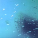
It took me over two hours to walk to the lighthouse across the thinly-veined bronze sand, past the half-sunken, wrecked hull of a ship, past a dried-up shark, over clumps of kelp and driftwood. Clambering over steep dunes, I emerged from the salt mist that swept in off the ocean, stinging the skin, and into clear light. I followed a path through wind-shorn manuka, and on to a level plateau where the lighthouse looked smart in fresh white and red paint.
Yet it was the harbour, once more, that proved most absorbing. The Graveyard—or, as Maori knew it, Tahuri waka whakarere wahine, “So many widows from drowning”—frothed white below me. Light over the breakers beyond the Heads shone on Papakanui Spit only seven kilometres away—though for me the distance of a month and untold kilometres since the start of my journey.
And what was this Kaipara I had found? A place of wild peacocks left over from last century farming ventures, of broken-down piers abandoned for the road, of grassed-over streets, named but never used, of wrecked ships full of mud and mangrove; a place of ricegrass grown from sailing ship ballast, of unlit, isolated lighthouses left to the mercy of weather.
A “strong brown god”? Yes, and a “destroyer, reminder of what men choose to forget.”