New Zealand’s Next Top Model
A small group of Kiwi scientists is attempting to construct the ultimate crystal ball—a mathematical model of the Earth’s natural systems so intricate that it can predict the behaviour of our atmosphere, land and seas, human industry and biological production, far into the future. Behold, the New Zealand Earth System Model—the most nuanced and complex description of our region’s functions ever devised.

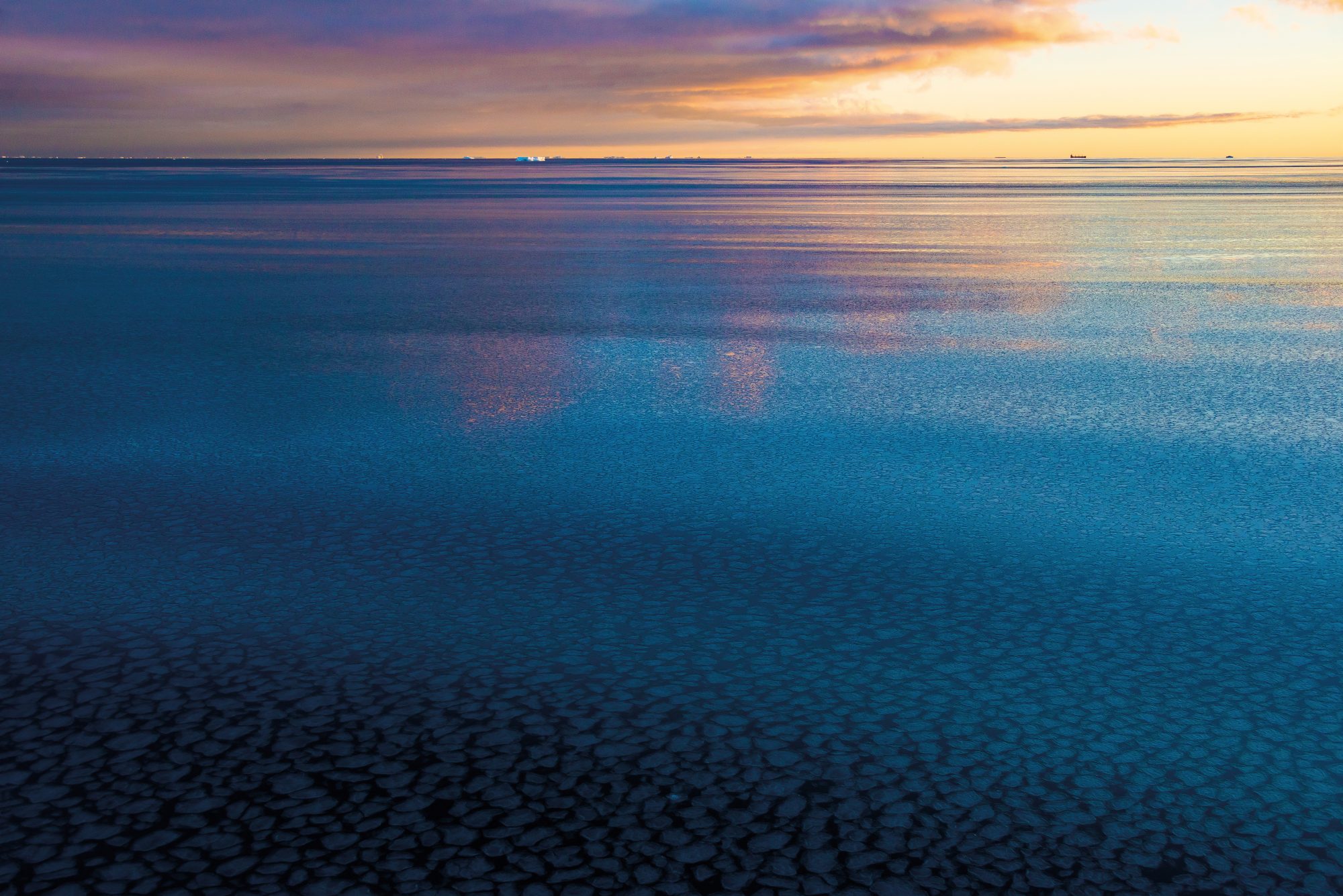
Next summer, University of Canterbury PhD student Sean Hartery is sailing south to spend six weeks aboard the research ship Tangaroa in the roughest ocean in the world. NIWA’s ship will be his home and lab in the Ross Sea, as he and fellow student Peter Kumar stand on deck and send balloons and drones up a kilometre into the air to gather data on how clouds are born. Though some equipment is disposable, it’s also their job to make sure thousands of dollars’ worth of sensitive instruments don’t end up in the drink.
Data collection in the Ross Sea is one of the central facets of the multimillion-dollar Deep South Challenge, one of 11 government-funded National Science Challenges. The goal is to build and exploit a mathematical model that will help fill the gaps in global climate knowledge—a complete codebase of all the rules that govern our climate, and how those rules relate and interact. It’s called an Earth System Model, and it goes far beyond traditional climate models, taking into account many of the disparate land, water, plant and animal systems that make up life on Earth, and how each can affect the carbon cycle.
The behaviour of the Southern Ocean is the problem that scientists are hoping to solve. At the moment, there are variations between the output of the mathematical model and our observations of the real world. The most recent Intergovernmental Panel on Climate Change (IPCC) report has flagged data weaknesses in the Southern Ocean region as one of the most pressing issues, limiting confidence in climate projections based on them.
But where do those weaknesses come from? Is it because of insufficient data? Incorrect assumptions? An unknown process or outcome? Or is there simply a hole in our understanding of that corner of the world? It’s a jigsaw of gargantuan proportions, and solving it—or at least filling in the blanks—will provide a set of high-resolution local climate predictions for those who need them; from Bay of Plenty kiwifruit growers to policy makers in central government.
“We have a major cloud problem,” says NIWA’s Olaf Morgenstern, principal scientist and team leader for the multi-disciplinary, multi-institutional team hosted by NIWA.
“Over the Southern Ocean, we generally underestimate cloud cover; there’s too much clear sky there. If you imagine Wellington Harbour with 30 per cent fewer clouds than observed, it would have a substantial impact on the water temperature.”
Having too few clouds in the computer model distorts the impact of the sun’s rays hitting the surface and allows too much sunlight to reach the ocean. That means too much heat, which has flow-on effects for the rest of the projections. The cloud model should match observations from actual satellites.
The reason climate models aren’t matching observations isn’t very clear, Morgenstern says, but it’s likely that they aren’t correctly taking into account all the complicated ways that clouds work. Specifically, how they form.
Put some water in a clean bottle and shake it up. Let the water settle and peer inside. See anything? Now put a lit match into the bottle and let it expire, then close it up and shake it again. Can you see mist forming? If there aren’t many aerosols (tiny droplets or solids suspended in the air) or particulates around which moisture can cling, it means there won’t be many clouds.
“The Southern Ocean is a significant source of aerosols, such as sea salt, but the composition of them here differs from those in the northern hemisphere, which have more dust and soot,” Morgenstern says. “The cloud schemes in climate models typically are based on northern hemisphere measurements, considering how challenging it is to make measurements in the Southern Ocean. Hence the need for a Kiwi effort in this field.”
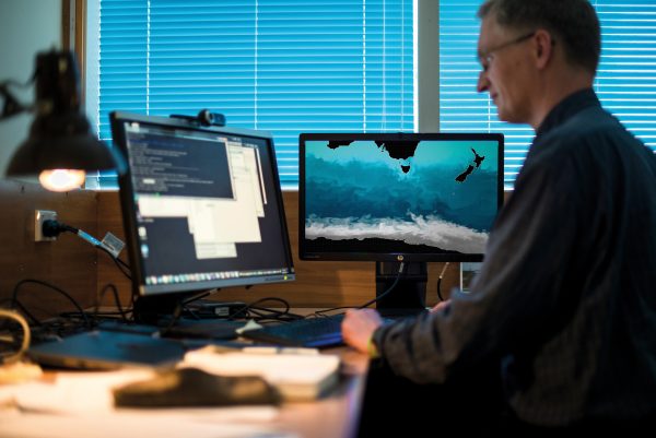
Sean Hartery’s desk at NIWA in Wellington is scattered with instruments he’ll be using to make those measurements. He’ll attach the instruments to drones and balloons and send them skywards from the Tangaroa to measure the aerosols in the atmosphere available for forming clouds, filling in blanks in our understanding of the Southern Ocean and its effect on the planet.
“From a global perspective, this project is important in tuning these models and developing an understanding of how this environment works,” says Morgenstern.
[Chapter Break]
An Earth System Model is one of the most complex and creative endeavours humans have ever produced, says David Carlson, director of the World Climate Research Programme.
“A rover on Mars is easy compared to a climate model,” he says from his home in Geneva, Switzerland. “For people to be able to simulate how the planet works on a set of computers is unbelievable. Intellectually, I don’t think there’s anything equivalent to it.”
When he and the rest of the Deep South Challenge review panel read about the New Zealanders’ plans to build an Earth System Model, he came across a phrase he was unfamiliar with: “Kiwi ingenuity”.
“I remember it as some tangible energy factor that an outsider cannot understand but that gives them the energy to take on a task that others can’t,” he says. Indeed, it’s a big effort.
“Countries don’t routinely run Earth System Models. In New Zealand, there may be fewer people and fewer computing resources, but they’re right at the bleeding edge of what they’re trying to do.”
Almost all of the world’s climate modelling centres are based in the northern hemisphere, which means New Zealand has a significant role to play, as well as colleagues in Australia. And when New Zealand wants to play an active role in climate negotiations, especially in relation to the Southern Ocean, you want your own tools, says Carlson. “Going into this international contest of ideas, facts and politics, you want something your own people worked on and to have some local confidence in it. I’m excited about the fact that they would try it. I think that’s very cool.”
Earth System modelling has become possible in the past couple of decades as computer power has increased, enabling enormous amounts of data to be processed.
New Zealand, however, isn’t building its own model from scratch. We’re harnessing a powerful climate model from the United Kingdom Meteorological Office and supporting the development of the model in areas relevant to us—namely, the Southern Ocean and Antarctica.
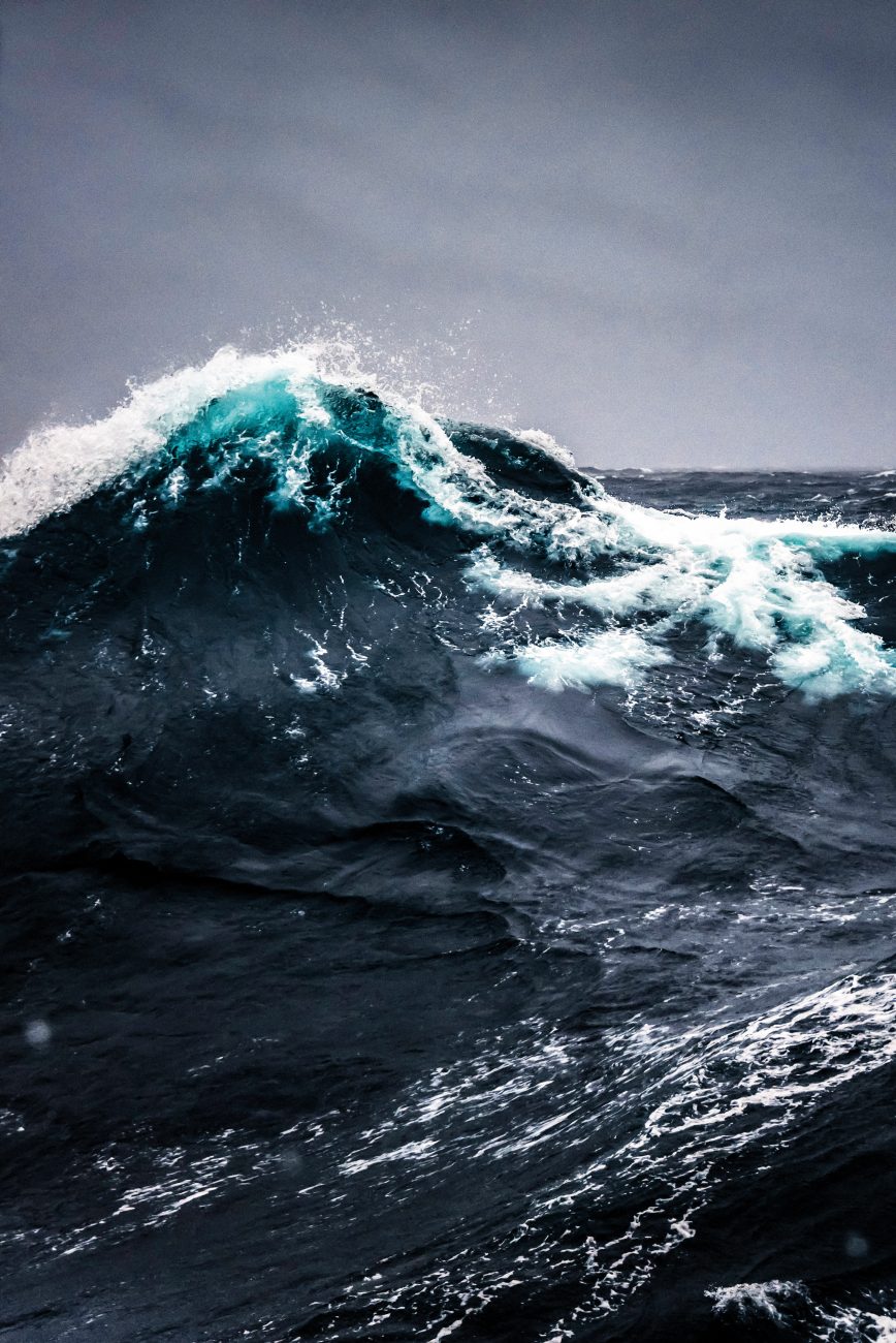
We care deeply about the storms whirling in the Southern Ocean because they generate our weather on a daily basis and radically influence our climate. Yet, because the area drives so much of what happens in the rest of the world, the impact of this effort will be far-reaching.
“If you get it wrong in that model in that particular [latitude] band, it propagates through the rest of the model,” says Carlson. “So, when New Zealand says we’re trying to do a global model but are going to think about the improvements in the Southern Ocean, everyone’s going to pay attention. It has global ramifications.”
The Deep South Science Challenge will be the first organised effort to build this sort of science capability in New Zealand, something that other countries have had for some time.
“This is the first initiative to really get us a seat at that table, in a way,” says Victoria University climate change researcher David Frame.
[Chapter Break]
“Below the 40th latitude there is no law; below the 50th no god,” or so the sci-fi writer Kim Stanley Robinson once wrote. The Southern Ocean has inspired obsessions, adventure and scientific inquiry since Cook first set sail to find a mythical southern continent to balance the north.
As it turns out, the notion wasn’t entirely wrong. The waters around Antarctica play a crucial role in the balance of global climate. If you define the Southern Ocean as starting south of the 30th parallel, you discover it supplies three-quarters of the nutrients that create the food chain feeding our fisheries, and about 75 per cent of the total heat uptake occurs there, too. The Southern Ocean is also a major player in the carbon cycle, absorbing half of the total carbon dioxide taken up by all oceans.
“To have a group that knows the Southern Ocean from observations and experience and who are also taking on the task of trying to improve the models of this ocean-wind-carbon-nutrient system has enormous value for the rest of the planet,” Carlson says. “It has a local effect, but it has an absolutely huge global effect that extends all the way into the northern hemisphere.”
[Chapter Break]
Beyond the Southern Ocean, the problems get more perplexing. Especially under the ice.
When sea ice forms on the Southern Ocean, the salt is expelled, leaving very dense, saline water sinking onto the Antarctic Continental Shelf. It forms a kind of river system, pouring through canyons into the abyss of the deep ocean. As the cold water descends, it also transports heat, and if it isn’t accounted for in the model, the thermal structure of the ocean is misrepresented.
“If we upset the circulation there, there could be large feedbacks,” says Morgenstern. “If the cloud cover over that is incorrectly handled, you have large erroneous heat fluxes coming from the sun hitting the sea surface. That has big consequences.”
[sidebar-1]
A cascade of compounding modelling errors can result, he says, rattling off the names of hidden undersea processes: “It can upset the large conveyor belt circulation, and then the return flow at middle depth; that’s the circulation connecting the two hemispheres. It’s partly driven by what’s going on in the Southern Ocean, but our ability to capture that hasn’t been perfect… As the Southern Ocean is often too warm but the northern oceans tend to be too cold by contrast, that may be an indication that the coupling of the two hemispheres is not well handled in the models.”
The enigma and contradictions of the Southern Ocean now sprawl out before the researchers as they begin their task. Among the most obvious is that, while the reduction of Arctic sea ice is alarming researchers worldwide, sea ice extent has actually been increasing in the Antarctic over the past 37 years.
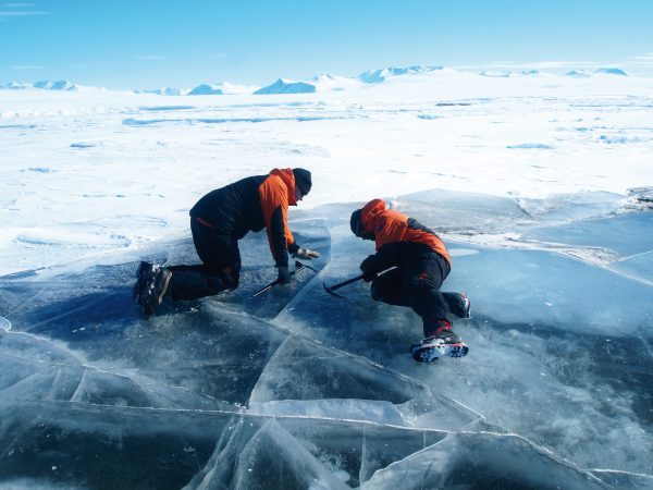
University of Otago physicist Pat Langhorne has been travelling to Antarctica to study ice science for more than 30 years. This past summer, she was the principal investigator on a project with University of Canterbury glaciologist Wolfgang Rack, NIWA colleagues, and the support of Antarctica New Zealand, to measure the depth of Antarctic sea ice… from the air.
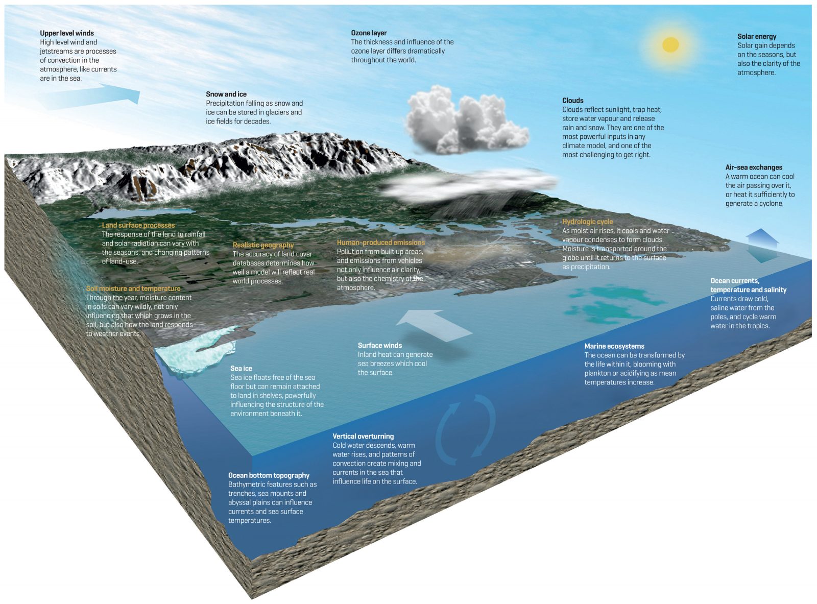
Imagine the surface of the planet divided into tiny cubes, each acted upon by an array of inputs, each input interacting with others, and the resulting outputs—such as the hypothetical cube illustrated above.
Rain and sunshine, cities and plankton blooms, cloud and currents—all can be captured by instruments and rendered in algorithms that allow scientists to define the rules of the model as developers might create a computer game. Thereafter, the accuracy is only a matter of resolution—the smaller the cubes, the more accurate the model.
The researchers used a device called an EM-bird. Suspended beneath a World War II-era DC-3, it was flown just 15 metres above the surface, scanning the ice beneath using electromagnetic induction—the same energy source that heats those flash new cooktops. Previously, researchers used helicopters, which dramatically limited the range of measurements that could be made.
Despite weather delays, a nasty bout of gastroenteritis, a limited time frame, and engineering issues, the project was a success, providing the first airborne measurements of sea-ice thickness—a metric there is little historic data for. (Existing baseline measurements came from ice breakers travelling through the ice, says Langhorne: “You look over the side and see what’s turned over and go, ‘Oh yeah, that’s about a metre.’ Satellite methods are being developed but are really not there yet.”)
The EM-bird also measures how far the ice is floating above the ocean surface, so you get both measurements. “It’s moving up from drilling a hole in the ice to measuring with an aeroplane to comparing with the satellite, so each one informs the next level, and then eventually to inform the Earth System Model.”
[Chapter Break]
Downstairs in the physics lab at the University of Otago, there’s a jointed metal pendulum that reminds everyone of just how mysterious simple systems can be. Set a normal pendulum in motion and it will swing back and forth predictably. But give the double pendulum a tap and its lower arm will dance crazily, making the upper arm swing wildly as well. It’s different every time, and it’s a perfect example of how chaos theory applies to climate change—even the smallest impact can have far-reaching, unforeseen effects on the wider system.
“You know it’s not going to turn into a snake, but you don’t know precisely how it’s going to wiggle,” says Langhorne. “It’s physically impossible to predict what’s going to happen.”
That’s just two jointed metal bars. Now apply that theory to Earth.
“The models are all relatively simple compared to the complexity of the systems,” says Morgenstern. “It is a fact we just have to live with. The biosphere is mightily complex; we have millions of species, perhaps, and that complexity we cannot represent. So we have to find formulations, and those simplified approaches differ in how good they are.”
The development of the new Earth System Model comes at a worrying time globally, as United States President Donald Trump and his Cabinet attack climate science and American environmental protection laws.
“The portrayal of climate science as being still under debate has nothing to do with reality,” Morgenstern says. “The reality is that 99 per cent of the science community is of the view that humans are warming the planet.”
The basic physics of global warming is “utterly uncontroversial”, he says. “The physical evidence of extraordinary warming happening around us and of its linkage to greenhouse gases is overwhelming. If you dispute that, you don’t understand what you’re talking about, and those few voices that speak against this are often in the pockets of certain companies that have vested interests.”

However, climate science is still not an exact science. The models are impressively reliable in some areas, considering the complexity of what they’re doing, but processes that influence the physical world can be difficult to account for in a model—cloud cover, for example, as well as biological feedbacks such as algae growth. Then there are natural events such as volcanic eruptions and social and political changes.
“All sorts of things have happened in the last 150 years which have had an effect on the climate, but climate models on the whole do a pretty good job at reproducing those past observations, at least on a global mean,” Morgenstern says. “So that gives us some confidence.
“But chaos means that if you take the same model and you initialise it with different conditions, you get a slightly different evolution of climate; and over shorter time periods, especially, different conditions matter.”
Anticipating what our climate will be like 10 years from now depends a lot on the heat content of the deep ocean—and Morgenstern says that hasn’t been observed until recently. What is certain is that the more greenhouse gases we release into the atmosphere, the warmer it gets—and the messy lives and habits of seven and a half billion people are difficult for a computer model to take into account.
“Climate projections depend on scenarios of human behaviour—and so far, human
behaviour remains unpredictable,” Morgenstern says.
[Chapter Break]
Global climate simulations are coupled with an atmosphere-only regional climate model that covers New Zealand and the surrounding seas. Scientists apply winds, temperature and humidity at the boundary of that model’s domain, and the regional climate model spits out an impression of how the climate would change locally, including precipitation, wind and other useful variables.
The utility of an Earth System Model also depends on its ‘resolution’. Imagine the globe chunked up into pieces, like our jigsaw puzzle analogy. If the pieces are too large, the model is too simple, and local detail is lost in a tyranny of averages. If the pieces are too small, the complexity of the task becomes immense, or the computing power required impossibly great, or the puzzle utterly indecipherable.

Currently the Earth System Model is run at a resolution of around 200 kilometres, but that’s not good enough, says Morgenstern. “The South Island is around 200 kilometres wide, but the regional model we will couple this to will get down to five kilometres of resolution, and then we can resolve major orographic features—the divide between west coast and east coast—and resolve the catchment areas of rivers. We might even get to higher resolution; it remains to be seen.”
A third step is to take high-resolution precipitation data and couple that to a hydrology model which is used to simulate river flows. “If councils want to know if they have to build a new levee to contain a river, or whether a bridge is adequate for the extreme rain to be expected in the coming decades, that could be based on such information,” he says.
Ultimately, councils, property owners and businesses dependent on good forecasts will be able to access better predictions of climate for New Zealand, right down to the regional level.
“We’re trying to get a coherent picture of what’s likely to happen to New Zealand, improve that picture, and then discuss with people what we might do about it to be better prepared to live in a changing climate,” says David Frame.
New Zealand doesn’t have the dramatic heat waves, wildfires and coral bleaching that occur in places like Australia. “But a drought can knock a full percentage point off our GDP,” he says. “The extreme weather events can also be a big deal for things like infrastructure and congestion in cities.”
The risk of flooding in Northland, for example, has roughly doubled due to climate change.
One of the neat things about the Challenge, he says, is joining together physical science, modelling, social science and political response. “It’s no good scientists saying, ‘Here’s how it’s going to change’, and walking away. It’s understanding aspects such as business, infrastructure and insurance and working closely with them to figure out problems they want to solve. It’s joining up the parts from someone out in the field to someone investing in an airport.
“We want to work with people, find out their priorities and then help them work out ways of dealing with the kinds of changes we expect in the next 50 years or so.”
This feature was produced in association with the Deep South Challenge. Read more stories like this at the climate hub.


