The fire beneath us
New Zealand’s largest city sits atop an active volcanic field that has erupted at least 53 times in the past 250,000 years. The catastrophic blasts felled forests and set the Auckland isthmus alight. The fire-fountaining cones and lava flows rode roughshod over the land. Scientists are not wondering if it will happen again, but what it will cost Auckland in lives and infrastructure when it does.

Jan Lindsay runs a hand over a yellow rock, set with black pellets no bigger than buckshot.
“These are layers of phreatomagmatic tuff—chunks of Waitemata sandstone with black basalt fragments in it. This is the stuff that blows out from the vent,” says the University of Auckland volcanologist.
In its day, it was the kind of buckshot that would kill you. Magma comes up from below and hits water that, as Lindsay explains, flashes to steam and explodes the magma. This is the fearsome phreatomagmatic eruption, the superheated centre that sends a dense ‘base surge’—a massive wave of gas and rock fragments—radiating out at 200 kilometres an hour.
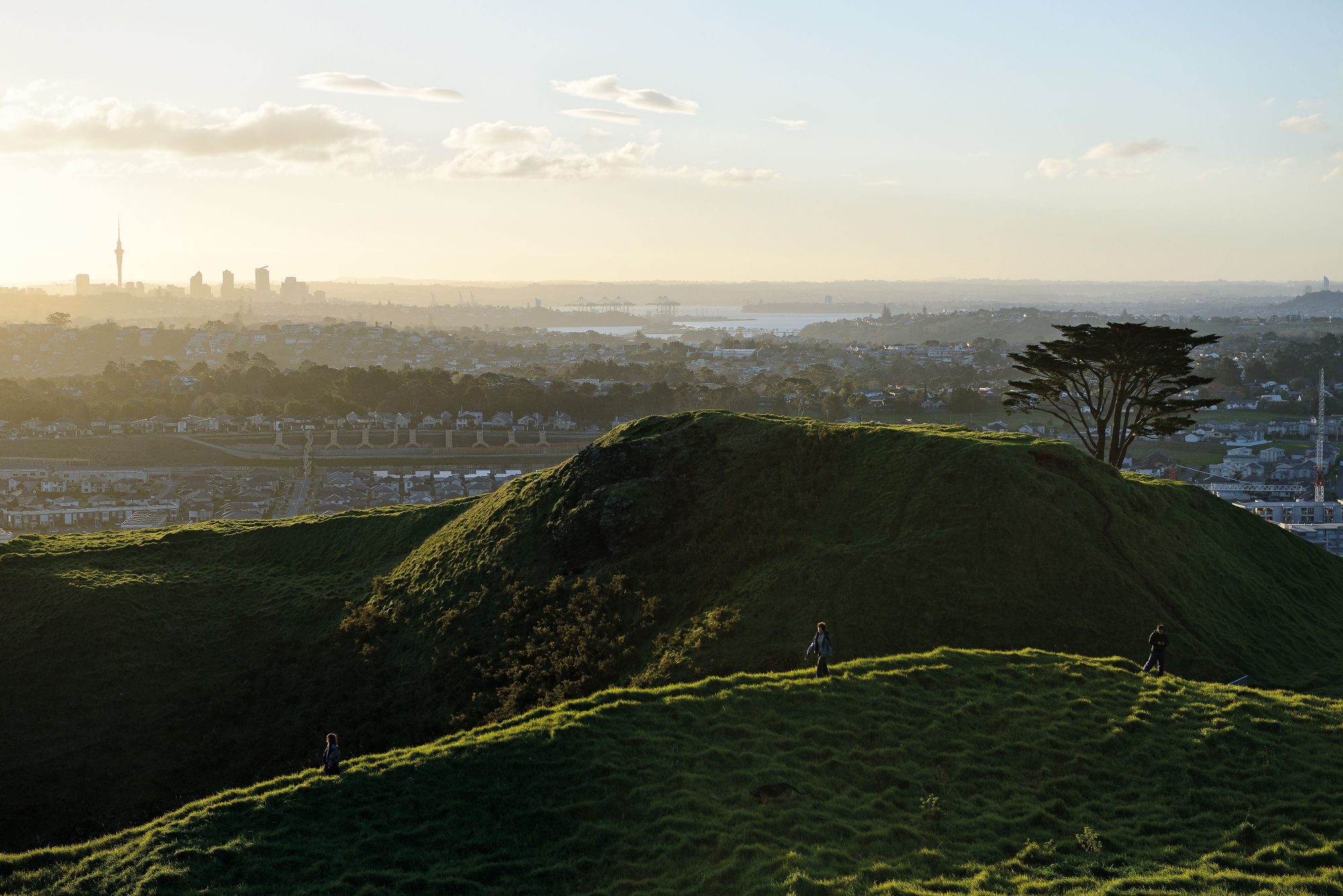
We stand on the beach at Ladies Bay and look up at the layers of tuff in the cliffs above, each one a base-surge relic from the Whakamuhu volcano. As Auckland volcanic eruptions go, this one was small. It put out plenty of base surges, but didn’t get to the scoria cone phase, or to the phase after that—lava flow. It’s hard even to recognise it as a volcanic edifice. The tuff ring—the rim of the explosion crater—is now built over by the type of St Heliers houses that have keypad entries. The crater itself was transformed decades ago into the clifftop Glover Park. Yet to a geologist its power is still apparent, and not just from the base-surge layers in the cliff. Scattered at the foot of the cliff is other evidence of Whakamuhu’s long-ago detonations. Over time, eruptions mined back down the volcano’s own throat until— hundreds of metres below the soft Waitemata sandstones and mudstones—they began to shatter Auckland’s bedrock, and hurl bits of old Gondwana high in the air. Ballistics. Lindsay gifts me a chunk that has fallen from the cliff onto the beach. It’s dark and heavy and laced with epidote veins the colour of jade.

A yacht heels in the wind out on the harbour. If you swing your gaze around from here, you see the sculptural curves of Motukorea (Browns Island)—a volcano. Then Rangitoto—a volcano. Then North Head—a volcano. Then Mt Victoria—a volcano, and so it goes . . . the great scoria cones of the Auckland Volcanic Field (AVF) are mostly softened by time into green pudding-bowl contours. Explosion craters like Whakamuhu are becalmed as small lakes or sportsfields or cow paddocks. As seen from this beach, the AVF is charming. But step away from beach time into Lindsay’s 250,000 years of geological time and you watch the sea level rise and fall hundreds of metres around this isthmus.
Ice ages sap Auckland of its warmth. More than once, a strange white ash sweeps in from rhyolite detonations around Taupō. Local rivers, and even the Waikato, change course with the ease of rainwater down an umbrella. Within that same time span the Auckland isthmus pops and boils like a pot of porridge.
The AVF has popped in 53 different places during its 250,000-year time span and it will pop again. It’s called a monogenetic field, which means simply that the magma pulses are so infrequent, the plumbing below each new volcano closes up. When the next magma eruption begins to rise to the surface, it will likely find a new and unique route, and that poses something of a problem for New Zealand’s largest city. At Auckland Civil Defence Emergency Management (CDEM) headquarters, an AVF eruption is the only one of the city’s hazards to get that most ethereal of hazard ratings—‘Rare’. And it’s one of only three hazards whose consequences are listed as ‘Catastrophic’. Those two categories conjoined elevate its risk rating to ‘High’. Civil Defence legislation of 2002 asks every CDEM area to spell out what it’s doing to mitigate high risks. Fair question: a third of New Zealand’s population resides in Auckland. The city produces 37 per cent of the country’s gross domestic product (GDP). If an eruption occurs, thousands are in harm’s way and the NZX stockmarket will turn tragic. Jan Lindsay, from Auckland University’s School of Environment, has one answer to the question: she’s co-leader of a project that is Determining the Volcanic Risk for Auckland—DEVORA for short.
[Chapter Break]
Devora was Born out of a major civil defence exercise in 2008—Rūaumoko, named for the Maori god of volcanoes. It assumed a moderate eruption somewhere in Auckland, location, for most participants, unknown. GNS Science gave an 11-day warning of a (hypothetical) low-frequency rumble, and triangulated the rumble day by day as it moved closer until—uh huh, there we go—Mangere Inlet. Auckland’s CDEM swung into serious action, and because the situation was classed as an ‘All of Nation’ emergency, so did the national CDEM headquarters in Wellington. The exercise finished on the day of the putative eruption, and was declared a success. The media paid it little heed, however, maybe because the exercise avoided mention of casualties, but there was some interesting modelling produced.
Business was certainly a major casualty. Auckland had suffered a potential business loss of up to $7.2 billion, or 5.6 per cent of New Zealand GDP at the time—close to a 20 per cent dent in the city’s annual productivity.
The most lasting result of the exercise, though, was Devora itself. As the players gathered to talk through the lessons learned, the elephant in the room had no chance to remain invisible. Risk assessment for volcanic hazards in metropolitan areas was primitive. The gold standard for such hazard and risk ratings was New Zealand’s earthquake research. It had identified and classified, nationwide, swathes of territory according to specific risk ratings. Compulsory standards predicated on that risk included not just CDEM responses tuned to a single emergency, but changes in society itself—engineering standards for infrastructure based on earthquake return times, distances from known faults, even soil types. Compared to that, volcanic hazard knowledge and research lagged behind.
[sidebar-1]
Lindsay was at the Rūaumoko wrap, keen to keep research rolling that might sharpen knowledge of the AVF’s past activity and start to define more precisely its hazards. GNS Science volcanic geologist Graham Leonard was also keen, and within a few years, as the research gained a more specific identity, Lindsay would co- ordinate work from four universities and Leonard would lead a focused GNS effort, including the considerable task of upgrading Riskscape, a software program already in use as a multi-hazard mitigation tool, for use as a volcanic eruption module suited to Auckland.
Thus arose the wide-ranging Devora on a $2 million budget put up mainly by the Earthquake Commission and Auckland Council. It aimed to sharpen up possible predictive eruption patterns within AVF geology; to analyse and shape up for inclusion into Riskscape the five main volcanic hazards to life and property; to advise on mitigating those hazards, and to remind Aucklanders that beneath their bumpy city landscape, Rūaumoko was prowling still.
[Chapter Break]
Basalt fragments from the Auckland Volcanic Field have been under nuclear bombardment in a United States Geological Survey reactor, and as Graham Leonard talks on the phone from the USGS West Coast headquarters at Menlo Park in the San Francisco Bay area, the last results are just coming through. The bombardment is part of argon-argon dating, the best-known method of fixing the ages for old rock, and accurate on a good day to within plus or minus 2000 years for every 100,000 years of age.
“We’ve now got ages for 35 volcanoes in total—which is nice,” says Leonard. “That’s two-thirds of them now, which means we’ve got a reasonable picture of the sequence.”
Leonard co-leads Devora with Lindsay. Three years ago, they desk-surveyed the considerable scientific literature already extant on the AVF’s 53 volcanic vents and concluded only three were accurately dated—Rangitoto 550–600 years ago, Mt Wellington 10,000 years ago and Three Kings 28,500 years ago. Age estimates of another eight volcanoes were classed as “reasonably reliable” but couldn’t be put into a proper sequence.
That paper launched a specific AVF dating programme, and if it has not yet shown up any predictive pattern in space or time, it has at least disproved certain of the old ideas, in particular that the field is moving north away from the city.

When the dating is finalised in 2015, the AVF will become the best age-documented volcanic field in the world, for Leonard’s argon-argon work is coupled with a drilling programme into six old lakes and maars, from Pupuke at Takapuna in the north to Pukaki Lagoon at Mangere in the south. Orakei Basin yielded the longest core —an 84-metre virtual barcode of layers, some thick, some fine, that showed ashfall over an 86,000-year period.
Analysis of the core chemistry was put into the hands of Jenni Hopkins, a master of science graduate from Leeds now working at Victoria University. Hopkins, PhD to be completed in 2015, sought to tie each basaltic ash layer in the cores back to its parent volcano. The layers, in their ascending order within the cores, can then be decisive in sorting the various ambiguous overlaps implicit in Leonard’s argon-argon dating, and its error margin. Further refinement may yet show a pattern of volcanic activity within the field.
The correlation of each basaltic ash to its parent volcano sounds simple, but it’s not. Hopkins explains she must match the chemical fingerprint of each ashfall with the fingerprint of rock from a parent volcano, which is often many kilometres distant.
“It’s never been done before, anywhere, to correlate basaltic tephra to a whole rock,” says Hopkins. “It’s working, to a point. The field does have a useful range in geochemistry but it isn’t 53 individual fingerprints; rather, the geochemistry is a factor within a lot of other criteria that narrow each ash layer down to thecentre of interest.”
The wide geographic range of the cores and the specific connection of the ash layers back to their parent vents will also show, with reasonable accuracy, how far each of the major volcanoes cast its ash blanket.
“The argon-argon results reinforce what we see from the ash in the cores,” says Leonard. “There are no major surprises, but some interesting temporal results. We think that around half the eruptions occurred in the last 50,000 years. That’s only a quarter of the AVF’s overall life span and means the field started slowly and then eruptions became more frequent.”
[sidebar-1]
Separating out a faster eruption rate for the last quarter may advance the probability of a volcanic eruption from one per 5000 years to one per 2000 years, but Leonard is wary of any simple calculation.
“It’s certainly important to think about averages, but it’s equally important to be thinking about variability in dates, and clustering. We have a cluster back about 30,000 years ago, and then you’ll notice the large gap in the last two eruptions: Mt Wellington erupted 10,000 years ago and Rangitoto only 550-600 years ago. That’s a big gap compared to the gaps in the last 50,000 years. Also, Rangitoto is really big, and at least one phase of it has a slightly unusual chemistry.
“It’s an important part of the finding to say more categorically that the spacing in time is highly variable and the location is also highly variable.”
In short, Rūaumoko is a random fellow, who may pop up anywhere within the 360 square kilometres of the volcanic field, and at any time. Leonard agrees, but adds—“The data helps us understand the realities of the field and to plan for it, and monitor it, and we are doing that.”

Another critical variable is advance warning of a volcanic eruption. Studies of the fieldwork on a monogenetic field in Chile make uncomfortable reading. Magma replete with volatiles—best understood as dissolved gases—can ascend at 20 kilometres per hour. If Rūaumoko released another pulse of magma tomorrow, none of Auckland’s 11 listening devices would detect its movement until it left the ductile rock of the upper mantle and began moving up through the 30 kilometres of brittle crust.
At Chilean speeds, that journey would take just 90 minutes. That figure strains credibility, but when summing up the research to date, Leonard does hint at speed. “From geochemical work that’s been done so far, we don’t see any evidence for magma stalling on the way up. It’s coming up in small batches and it’s not stopping for a holiday on the way.”
(A new study by graduate student Josiah Ensing is listening for changes in the magma under Auckland using a dozen seismic stations positioned across the field, including a new one on the flank of Rangitoto’s crater.)
[sidebar-2]
A 2006 report estimated magma ascent rates within the AVF at between five hours and 40 days. You would hope for more than five hours’ notice. A Devora study just completed at Auckland University’s faculty of engineering used traffic simulation software to test evacuation times away from a pending eruption just south of Mt Eden. The five-kilometre evacuation radius encompassed 450,000 people (daytime) or 230,000 people (night-time). The study assumed an orderly dispersal, without panic. It brought traffic simulation software to bear on the dispersal, and showed congestion building backwards from motorway slip roads. At its height, the diaspora slowed main roads in the area to five kilometres an hour. The large daytime populations cleared the area in 13 hours. The night-time populations cleared in seven hours.
Meantime, a new study by Auckland University researcher Elaine Smid attempts to refine the magma ascent figures further. The ascent speed is controlled by gases dissolved within the magma, but those gases usually disperse violently as the magma decompresses near the surface, and are lost. Smid has already found samples of melt trapped within the impervious capsules of mineral crystals. The crystals form at depth, so the melt itself has been trapped at depth with the gas volatiles still intact. Smid’s job now is to persuade the melts to release that data.
[Chapter Break]
Once at the surface, the horror begins. There are five phases to an eruption: the base surges, the ballistic bombs, the lava flows, the ashfall and, lastly and more permanently, like the arrival of a visitor from outer space, the ‘edifice’—a large or small volcanic cone that may clamp itself permanently onto the Auckland landscape.
We journey out to the shores of the Manukau Harbour, to the Maungataketake volcano (Ellett’s Mount), and as we pull up beside the volcano’s tuff ring, Lindsay points north to a barn built on that same tuff ring. The barn is a kilometre away, yet this volcano is rated as ‘small’.
“A bit like a nuclear explosion,” says Lindsay of the forces that created this wide, flat crater. “A big boom that goes up, a shock wave that radiates out and the base surge rolls along the ground. And not just one surge—maybe dozens a day.”
We step down to shoreline cliffs. Maungataketake’s attraction for geologists is this seaside exposure of its tuff layers, and the many petrified remains of a forest knocked down by the blast and still trapped within the tuff. Also, there are no houses, and geology teams can wander the paddocks above. A joint American and Canterbury University team did exactly that, dragging their ground-penetrating radar across the paddocks, to trace the run-out of the base surges, and as the run-out diminished, tracing the changing effects on the long-buried forest.


Those surges, the team reported, stood 60 metres high as they came away from the crater. They rolled at 230 kilometres an hour, and their every cubic metre packed 38 kilograms of Waitemata clag and basalt buckshot. Close in, those densities, and their underlying scythe of heavier fragments, chopped the forest off at ground level, and even a kilometre away, the surge was still felling trees half a metre thick. Beyond that kilometre range, the forest was charred by the 500˚C blast, pushed, and buried. The surges from Maungataketake finally petered out around two kilometres from the source.
Maungataketake is a small volcano, and to advance Devora’s hazard assessments, the team offered a cautious extrapolation of its results.
For an average-sized Auckland eruption, it estimated complete destruction within half a kilometre from the vent, moderate destruction up to two kilometres out, and light damage on the final run-out to four kilometres.
It noted possible fires from red-hot ballistics and ashfall in the run-out zone. For any repeat of the big volcanoes that already stand sentinel within the AVF, they proposed a ‘worst-case scenario’ of complete destruction within a 2.5-kilometre radius, severe damage 1.5 kilometres on from that, and moderate damage across the final run-out, a total of six kilometres from the vent. Within that moderate-damage zone, most structures would stand against the blast, but the temperatures might still be hot enough to kill, and failing that, easily sufficient to knock a person down.
Not all of Auckland’s volcanoes were phreatomagmatic. Some were dry at their beginning, and remained dry. They firefountained and built scoria cones, or they built scoria cones, then produced lava, but a Devora paper from a Massey University team led by Gabor Kereszturi emphasised that many of the apparently dry volcanoes had nonetheless begun with phreatomagmatic blasts. It estimated that 83 per cent of the eruptions in the AVF started that way. The Massey team produced a map showing the city’s geology and hydrology, and highlighting the areas most likely to trigger the hazardous phreatomagmatic eruptions. Much of the low-lying land around South Auckland was, in the event of a magma intrusion, marked out as a hazardous zone, but those zones also extended in wide ribbons across the isthmus.
[Chapter Break]
Natalia Deligne describes putting Auckland City’s infrastructure details into the Riskscape program as “at times, quite challenging”. She’s GNS Science’s volcanic hazard modeller, and has divided the city into points 500 metres apart. Throw a digital lasso around any one point and up comes a summary of Auckland’s building assets in the lassooed area as well as a summary of population taken from census data and adjustable by night-time or daytime settings.
To achieve these asset layers, Deligne and her team have had to reconcile the vast files of a big city, many without common identifiers: a building-footprint dataset, a rates dataset, an earthquake-prone-buildings dataset, a Q-valuation dataset.
It’s been challenging work, but Deligne is still not satisfied.
“We can do building damage, but content damage for ash could be much more important. Ash might not cause much roof damage, but if it gets into a warehouse it could damage or destroy all its contents. That’s the next step we’re going towards as regards the buildings.”
Another asset layer, the so-called ‘Lifelines’ layer, is scheduled for input in 2015. It includes roads, telecommunications, electricity, water reticulation and sewerage. Much of that infrastructure is now privatised, owned by companies that defend their commercial secrets, but Deligne says Riskscape has developed layers where information flows one way. It feeds data in, but can’t be tracked back and opened up for exploration by commercial spies.

Such are the asset layers that Riskscape is developing. Rising through those layers are the intrusions of the volcanic-hazard layer. A volcano can pop up through the asset layers on or near any of those 500-metre points. Riskscape will allow choice of the volcano’s size—small, medium or large— with base-surge radii and ballistics tailored to suit. Ashfall is also calibrated against volcano size, and wind speeds. Lava routes have been mapped out for any emerging edifice, anywhere in the city. Throw the digital lasso of whatever size around any of these events—either static, like the edifice itself, or dynamic, like the advancing lava— and Riskscape will bring up the people in harm’s way, the assets under threat and hence the corresponding scale of the risk.
At the least it’s a great teaching tool, and specific Riskscape exercises have been set up for both university postgraduate courses and Auckland CDEM training runs.
“We’ll be able to put a scenario on Mt Eden and see what happens,” says Lindsay. “Devora is working very hard to get all the hazard information in there, and once that’s in, you’ll be able to push a button. You’ll be able to say, ‘The eruption is one cubic kilometre of magma and phreatomagmatic in its first phase and the wind is, say, westerly.’ The model will show where the pyroclastic surges go, where the ash is going and where the lava might go in the later stages. Then you say, ‘Okay, I want to see how many buildings were destroyed’, and you click a button and it will go chukka-chuk and show you a map of all the suburbs that are destroyed. And you might want to say, ‘Okay, if there was no evacuation, how many people died?’”
Riskscape will be useful, too, in persuading businesses that good contingency plans could, if comprehensively adopted throughout the city, cut by half that early estimate of a $7.2 billion productivity loss. But its greater purpose, and the one everyone hopes will never be needed, is to assist the CDEM team in the end-time of that ‘Rare’ volcanic strike.
The program is scheduled to turn on in 2015, but Deligne wants more work done on the so-called ‘fragility functions’—mathematically modelled curves that map the vulnerability of a city’s most vital infrastructure. Electricity supply—how much ash before the short circuits start? Water supply—how much ash before the filters clog? Roads—how much ash before they’re dangerously slippery? Houses—how much ash before a standard roof collapses?

The information is being generated in New Zealand labs as part of Devora, but fragility curves depend for accuracy on very large datasets, and GNS is actively seeking whatever can be culled directly from hot spots in the wider world. The problem, says Deligne, is that there are far fewer volcanic eruptions that affect major cities than there are earthquakes. So when Indonesia’s Kelut volcano erupted in 2014— closing seven airports and forcing the evacuation of 200,000 people—a GNS and University of Canterbury team flew in to survey the damage as a real-world calibration for the fragility functions. As a result of such work, Deligne claims New Zealand is now a world leader in “the volcanic-effects space”.
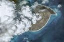
Yet it’s difficult to prepare for every eventuality. Any predictions for the AVF made a millennium ago would have been literally blown out of the water with the eruption of Rangitoto. The eruption was bigger than any previous eruption in the field, disgorging two cubic kilometres of lava and spreading over some 30 square kilometres. It drew magma not just from the mantle, but also from a shallow crustal melt. Unlike the rest of the AVF, it erupted twice, with a decades-long gap in the 550– 600-year period, and there’s some suggestion, not yet proven, that it also erupted for the first time 1000 years before that and continued intermittently.
“Rangitoto, yes,” says Deligne. “We have this big thing that is completely abnormal. That’s weird, put it that way.”
A Rangitoto-style eruption breaks the rules of the AVF, and if it were to happen again, would push the Riskscape program, Civil Defence and the city itself to the limits of their capability.
“Even then,” says Leonard, “the key point is that the whole city does not need to evacuate in any scenario. The challenge is keeping the city running through a crisis; working on planning that will allow for an effective and safe response, and for Auckland to thrive in spite of the next eruption.”
Flashover
Though not an immediate danger to life, ashfall can disrupt electricity supply, close airports, turn roads to skating rinks, clog the filters of municipal water and sewage systems and—if citizens clean down their houses and cars with water—deplete city water reservoirs and block stormwater pipes.
It’s a potential problem for Auckland even without an eruption in the Volcanic Field. Taranaki once dusted the isthmus with eight millimetres of ash, and the white pumiceous layers in Auckland’s lake cores record thick ash dumps from past rhyolite explosions of the Taupō Volcanic Zone. Even ash falling far short of the city limits is capable of disrupting Auckland. Ash from Ruapehu, Tongariro or Ngauruhoe can coat the big ribbed insulators of pylons proximate to the Central Plateau, short-circuit the lines and interrupt Auckland’s electricity feed from the south.
Canterbury University’s Volcanic Ash Testing Lab (VATLAB) is set up to test ashfall effects on metropolitan lifelines. Tom Wilson, senior lecturer in hazard and disaster management, heads a post-graduate team at VATLAB that’s helping to determine the infrastructural ‘fragility’ functions for Riskscape—a predictive computer model for volcanic risk management. One of their projects, funded by Transpower, tests the triggers for short circuits in the company’s insulator strings, known as a ‘flashover’.
The results are often spectacular.
“Ashfall of around three millimetres is where the probabilities start to kick in,” says Wilson. “At 10 millimetres, there’s a 50 per cent chance, at 20 millimetres it becomes very likely. The crucial thing is whether the ashfall gets wet. If it’s dry, it’s resistant. If it’s wet, it becomes very conductive, but too much rain and it’ll wash off, which is good. The worst conditions are a light misty rain.”
VATLAB’s traction engine simulates rubber hitting the road on the highways and byways of this volcanic archipelago. Experiments with the same hard ash likely from an eruption in Auckland or Taranaki show roads turning slippery at less than a millimetre, and more slippery yet as the city’s rains lubricate the surface and release soluble salts.
Auckland’s lifelines are, in general, well set up, says Wilson.“Watercare’s plans, as an example, are possibly the best I’ve seen in the world, and I’ve been to 30 or 40 sites. It has very good protocols in place, they understand the issues, and we’d expect them to perform very well in a volcanic emergency.
“The big issue with volcanoes is there haven’t been many big eruptions that have affected cities in developed nations, so, unlike earthquakes, there’s been no impetus for the research. What’s so exciting about Auckland is we have a very large risk there, and with Devora we’re pro-actively investing in it. It’s been a huge catalyst for a big expansion in the New Zealand volcano impact programme.”