Puysegur weather
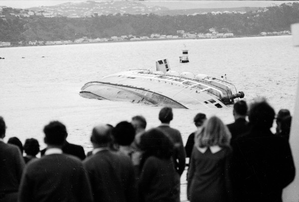
Years ago, I heard the wife of a lighthouse keeper talking on the radio about the weather at Puysegur Point, in Fiordland, where she and her husband had been stationed for a time. Six months or so before they arrived there, a fishing boat had gone down in a storm with all hands. One day, as she walked along the black stony beach, something white caught her eye. Bending over, she picked up a single human tooth. She could not be certain it came from one of the lost fishermen but it symbolised for her the little that the sea gives back after it unleashes its fury on a small boat.
When I told this story to a retired lighthouse keeper I met a couple of years later, he countered with another about strong winds. Because Puysegur Point is so isolated, successive keepers farmed sheep in paddocks near the lighthouse in order to provide themselves and their families with fresh meat. As extreme winds were common, sheep were often blown over the cliffs and onto the rocks below. Eventually the keepers switched to cattle, as they were harder for the wind to dislodge.
When people talk about the weather conditions where they live, they don’t usually brag about how bad they are. They generally like to imagine that somewhere else is worse off than their home town. I have an Auckland friend who survived a couple of years of Wellington weather in the 1980s. Now he is back in the damp north he never fails to remind me how much warmer Auckland is. In return, I usually point out how often it rains in Auckland when we are having a fine day in Wellington, or how persistent Auckland’s south-westerlies are while Wellington is enjoying its winter calms.
Considering the whole country—not just the populated areas—it is probable that southern Fiordland and the adjacent sea are the stormiest places in New Zealand. Rainfall measurements certainly show that Fiordland is the wettest part of the country, with some areas experiencing over ten metres of rain a year.
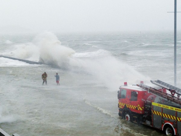
Reports from a weather station at Puysegur Point confirm the frequency of gale-and storm-force winds, for which the area is renowned. Further confirmation comes from a weather station downwind of Puysegur Point, on the south-western tip of Stewart Island.
The winds off the coast of Fiordland are gauged twice a day by a satellite-borne instrument known as a scatterometer. This emits pulses of microwave energy and measures the returning signal, or echo, which provides an indication of wind strength. In this way the frequent gales in the area are recorded, including some that do not show up at either Puysegur or South West Cape because the wind direction is too northerly.
The reason for the frequent gales in the Puysegur region is that it is located near the southern end of the Southern Alps. When westerly winds slam into the mountains, not all of the air manages to rise over the ridgeline. Some pours around the ends of the mountain chain.
Winds from both the north-west and south-west blow fiercely on this coast, but a north-west wind ahead of a front is the worst, for two reasons. First, the wind blows perpendicular to the lie of the Southern Alps. Second, as the air approaches New Zealand, the progressively colder sea surface cools it from below. This makes it more stable, and so more resistant to moving up and over the mountains, causing a greater proportion to flow around the Fiordland end of the Southern Alps.
The best weather story I know concerning the Puysegur area, originally written up in a Sydney newspaper, is of a storm that struck in 1810. Described as a hurricane, the tempest, which lasted 48 hours, flattened swathes of forest and caused numerous landslides. The slides blocked several streams, resulting in dangerous floods. The mouth of the Waiau River, which empties into Te Waewae Bay near Tuatapere, was almost completely blocked with shingle, preventing it from flowing into the sea. A lake formed near the river mouth, threatening to flood the country for miles around, before the rising water eventually broke through the blockage.
On Stewart Island, a gang of eight sealers working in a cove near South Cape was caught by the storm. With difficulty, the men reached the shelter of a cave, where they camped. During the night, while they were asleep, a landslide blocked the mouth of the cave. With no hope of rescue from the outside, the men set about digging their way out. Luckily, they had all their camping gear and provisions with them, and a stream broke through the roof of the previously dry cave, providing them with water. Initially the stream was heavy enough to threaten them with inundation, but it eased off to a trickle once the storm had passed.
The men had only two shovels, one axe and four iron pikes to work with. At first, the more debris they cleared away, the more slid down from above. It took them almost a week to burrow their way out. They were then able to observe that the cave was to one side of the slip. Had it been closer to the main body of the slip, they would never have dug themselves free.
Having no timepiece with them, and unable to tell the difference between night and day while they were entombed, the men had lost track of time. When a ship picked them up, they found that they were two days ahead in their reckoning of the date. The storm had blown them into the future.