


Central Otago
Central Otago has long been a magnet for painters and photographers as its landscapes offer vibrant colours and plenty of vistas to challenge one’s visual perception.

It came in one big crate, over six metres long and weighing half a tonne. As Dave Witherow hoisted it into his double garage in Mosgiel, near Dunedin, it was hard not to think of the package as an oversized cocoon from which something beautiful, light and free was about to hatch. As with most modern kitset aeroplanes, the RANS S7 Courier came with its skeletal fuselage already assembled, but the rest of it was in some 800 parts, with only an inventory and manual to make sense of it.
Over long evenings and weekends, Witherow pieced the machine together, assembling the wings and fitting the fuel tanks into them, installing the 100 HP Rotax engine, running steerage cables over their pulley systems. Finally, 700 hours later, he moved the machine by trailer to the Taieri aerodrome for the first test flight.
Witherow built the plane specifically for “bush flying”. His idea of a good weekend is to pack light and fly into one of the old deer cullers’ airstrips in the remote backcountry—camping under the wing, hunting or fishing, returning home with a good look at the land below.
“People don’t realise the beauty and freedom that comes with this sort of flying,” Witherow told me as we walked across the paddock to where his Courier was staked against the wind. “Once you are outside controlled airspace, you are free like a bird. There is a lot of sky over Otago and all of it is yours, a 3D playground which you can explore in any direction you wish. This is definitely the way to see this country.”
I had come to Witherow for just that, a new way to see Otago. Responding to some sort of inner compulsion, we all gravitate towards certain places and landscapes. I never really questioned why I was so irrevocably drawn to settle in Central Otago 20 years ago. I wasn’t even sure if this attraction was still at work. Was my centre of gravity still aligned with Otago?

Hoping to find answers, I had taken up a new hobby, and was working my way through Drawing on the Right Side of the Brain, a best-selling manual for the artistically challenged by Betty Edwards, professor emeritus of art at California State University, Long Beach. Everyone can draw, Edwards maintains; it’s seeing that is the problem.
In our ever-accelerating, image-saturated culture, we often no longer look at things closely and see them for what they are. Instead, our brains briskly label and categorise them, then give them no more attention. This was especially true when looking at the familiar, like the landscapes in which we lived. An aerial perspective, I figured, was a good way to start seeing the land anew.
Technically speaking, Witherow’s plane was a cabined microlight, a rug-and-tube design, which in the parlance of backyard airmen means a steel frame covered with heat-shrinked Ceconite fabric—the same material now used in restoration of vintage biplanes such as Tiger Moths. And, like the Moths, the kitset microlights have breathed new life into the circles of recreational aviators.
“It’s like being back in the days of Jean Batten and Bert Mercer,” Witherow said. “They put adventure back into flying.” He ran an affectionate hand along the Courier’s propeller, then began his pre-flight checks.

Poet Brian Turner, acclaimed as the literary voice of Otago, has dedicated his book Into the Wider World to Dave Witherow, a tribute to some 40 years of companionship and wilderness adventures the two men have shared. But over those years, Witherow himself has developed a distinct writer’s voice, and as an environmentalist, Fish & Game New Zealand councillor and self-declared armchair philosopher, he uses it mainly to address the issues of our troubled relationship with the natural world, especially in Otago, which he has made his home.
“You cannot stop so-called progress, but you can slow it down,” he told me. “Some of us have to play the role of brakes or our happy-go-lucky economic model careers out of control and crashes sooner rather than later.”
Seeing this land from the air, from an uncommonly broad perspective, has made him all the more passionate about wanting to protect it.
We took off into the clear Otago sky but stayed at low altitude, as is customary among the bush pilots. The plane—which felt buoyant but insubstantial—motored valiantly through the still autumn air, defiant of gravity and the world below.
It was an Icarus-style experience.
An edge of vulnerability heightened the senses, the oblique autumn sunlight set the colours ablaze and bathed the landscape in intricate detail, casting crisp chiaroscuro shadows.
In the cockpit of Witherow’s plane there was no way to draw anything because the vistas were passing by too fast. But, following Edwards’ advice, I disciplined myself to look at the land below as if I was drawing it. My eyes travelled over every rock and clump of tussock, their shadows elongated by the falling sun.
In Edwards’ drawing course, the first lessons were about lines and contours and how they are in fact edges of forms and their shared boundaries. Our low-altitude aerial perspective made the forms of Otago appear like an intricate bas-relief—a covering of brown suede rumpled into creases and folds—but the contours of the land were clean and distinct, and none more so than the contorted course of the Taieri River.
As it enters the Styx Basin near Paerau, at the foothills of the Rock and Pillar Range, the river seems to lose its purpose. It meanders in every direction, repeatedly folding back on itself in a maze of oxbows, channels and backwaters, as if reluctant to continue on its journey towards the ocean. Hydrologists refer to this phenomenon as a “scroll plain”, and although it is common in Australia—where billabongs are formed by a change in the course of the river, or seasonally during the Dry—the Upper Taieri is the only New Zealand river which succumbs to such a melancholic mood. The river’s intricate scrollwork is a feast for the eyes, but it can only be seen from the air, and the idea of building a kitset plane so that you can see such sights suddenly did not seem at all extravagant.

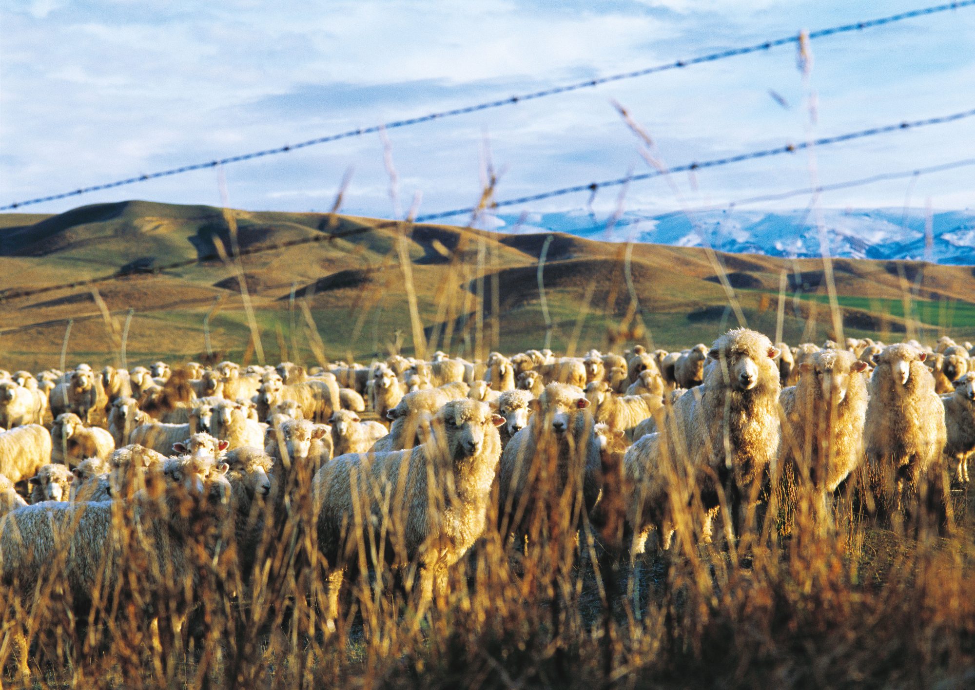
The tussock beneath our wings was burnished by the evening sun, a subtle reminder that this was a region shaped by gold—the rush for the yellow metal altered the landscape forever and struck a seam through the nation’s history.
Dunedin, which became the capital of the Otago province in 1852, was largely built on the wealth generated following the discovery of gold in Gabriel’s Gully, to the southwest, in 1861. The town’s medical practitioner, Robert Fulton, wrote: “Every able-bodied man in town or village threw down his tools and went off to the diggings. A tremendous rush from Australia took place; ship after ship sailed in, 69 in 1860, increased within 12 months to 256; the population of the province leaped from 12 to 30 thousands odd.”
The gold rush in Otago was one of the largest in the world. For diggers, however, Otago was largely a barren waste studded with nuggets—harsh, inhospitable, even frightening. During winter, rivers were at their lowest and most conducive to quick and profitable gold prospecting. But Otago winters are the harshest in all of New Zealand and many lives were lost to snow and cold.
“Another wretched week over, what with the cold, mud and snow; existence is nearly unbearable,” digger John Henry Watmuff wrote in June 1862. “I don’t think there’s such a miserable country on the face of the earth; if so, God help its inhabitants.”
However, Vincent Pyke, the commissioner of the goldfields, was comfortably detached from the necessities of immediate survival, and maintained a much more lyrical view of the Wasteland. “Huge unshapely masses of rock—weather-beaten, geological veterans—blackened and seamed and scarred by I know not how many centuries of conflict with the elements,” he wrote in History of the Early Gold Discoveries in Otago, “a picture of sublime desolation…unrelieved by any kindly touch from the hand of Nature.”
But it did appeal to some. In 1857, prospective sheep farmer Watson Shennan eyed the valley of the Manuherikia River and rejoiced. “Here is the country we are looking for…a very land of promise,” he wrote. “Here we shall pitch our tent, and here we shall stay and make our home for good.”
The legacy of Shennan’s pastoralism remains today, as do the artefacts of the diggers—a scattering of heavy machinery now rusting in the tussock hills, dams and water races, and a few examples of flora that have long since become an inseparable part of the Otago landscape. Once considered common and noxious weeds, viper’s bugloss (Echium vulgare) and common thyme (Thymus vulgaris) turned out not so vulgaris after all, and they are now the mainstay of Otago honey production. A rosehip industry was also planned, but never eventuated, and the briar rose was allowed to run wild in the hills, lacing them with its barbed-wire tendrils. With characteristic foresight, the pioneers also planted the now-ubiquitous woolly mullein, a Christmas-tree-shaped shrub which grows up to 1.5 m tall and which they treasured for its large, soft, velvety leaves, said to be ideal as backcountry toilet paper.

As the wealth of the interior increased, the Otago Central Railway was struck through from Dunedin, connecting the goldfields with the port. In 1921, it finally reached the railhead at Cromwell, though well after the gold rush had ended. It was chiselled into the land in easy curves, avoiding the mountains except for a gentle climb over the Raggedy Range, then inscribed a rough half-circle between Middle-march and Alexandra and dog-legged sharply to end at Clyde. It was an impressive feat of engineering and pioneering spirit, but by the end of construction of the Clyde Dam in the late 1980s, it had outlived its usefulness. Were it not for one woman’s vision, the track once hewn with so much labour and sweat may have reverted back to that land, blending into the sunburnt landscape as if it was never there.
Two days after the flight with Witherow, I walked a fragment of this line between Galloway and Chatto Creek with Daphne Hull, the Alexandra businesswoman credited with reviving the old railway and turning it into the country’s first cycleway, the Otago Central Rail Trail.
“The last time the Otago railway saw heavy use was during the construction of the Clyde Dam, right up to 1987,” Daphne said as we set out along the trail, as smooth and narrow as a country lane.
“Then a machine they called Pink Panther rolled into Clyde and as it retreated to Middlemarch, it pulled out all the rails and sleepers as it went.” (The Dunedin-to-Middlemarch section has been left intact and rebranded as the Taieri Gorge Scenic Railway.)
“It wasn’t long before farmers were extending their fences over the track,” she went on. “Given a few years, most traces of it would have been gone.”
But Daphne had another idea. She read somewhere about a railway track converted into a cycleway and wondered if the same could be done in Otago. The locals were incredulous. “Who, in their right mind,” one farmer asked, “would want to ride a push bike through 150 km of nothing?”
The great nothing, as Daphne saw it, was rich with commodities as rare as gold in urban centres—space and solitude. What’s more, it was never far from a road and a good espresso. The beauty of this region was not of the obvious variety—just like drawing it, to really see Central Otago you have to slow down. And for this, a bicycle is the perfect vehicle.
Opposition to the idea was strong, more from the inertia of attitudes than for any other reason, but Daphne waited the opponents out, persuading those receptive enough to see her vision. “In the end, it was the wives of the farmers who first started seeing the potential benefits of the trail,” she said. “They could rent out a room or a cottage, open a small B&B or a cafe, help the farm with some extra cash flow. That’s how we got the wheels rolling. Now, this quiet influx of visitors brings as much business to the runholders along the Trail as do their farms.”

Last year, 11,000 people cycled the entire Rail Trail, and there were at least as many who rode only sections of it. While we walked, cyclists in twos, threes or larger groups passed by. Then locals, cycling or jogging with off-road pram buggies. A leisurely peloton of a dozen Aucklanders stopped for a chat, and it transpired that for some of them this was the second, even third time on the Trail.
“And we’ll come again,” a middle-aged woman told me, her face glowing with pleasure, exertion and the morning chill. “After the congestion and hassles of city living, this,” she nodded towards the trail vanishing into the great nothing of tussock and tors, “this feels like the deepest breath of fresh air.”
We watched them disappear around a bend. “You know, this place used to be completely dead,” Daphne told me. “One farmer remarked they never had tourists here before. I was in Lauder the other day, and I counted over 70 bicycles propped around the place. The cafe owner was in panic. ‘Don’t just stand there’, she called out to me, ‘give us a hand!’”
In an ironic twist of fate, the railway that was struck through Central Otago to extract the gold did just that, albeit a century later. But unlike its short-lived predecessor, this new gold rush can never run out.
[Chapter Break]
In the evenings, in my camper by the light of a hurricane lamp, I went through the Edwards drawing homework. She suggested fairly unorthodox exercises. One involved copying sketches by well-known artists, but from originals turned upside down. Another called for exact copying of the lines in the palm of one’s hand, not a test in palmistry but merely drawing of the lines seen, precisely and without mental analysis. She also encouraged the students to look for complimentary subjects, and for this latter study in intricacy I found one in the barren hills above the Butchers Dam, near Alexandra.
I have driven past it so many times, never giving it more than a cursory glance, but now, looking at Otago more closely, I realised what an error of omission this had been. The area known as the Flat Top Hill is as close to a desert landscape as you can find in this country, a barren schist plateau exposed to all winds and receiving a mere 300 mm of annual rainfall. Yet some 182 species of native plants have been counted here, more than in an average forest. Most are not immediately obvious, but then in Otago this is a recurring theme. For all its size and spaciousness, its big-sky country image, I was coming to understand that really seeing Otago required not just slowing down but also using different lenses to perceive it. The beauty of the desert on Flat Top Hill is found in the minutiae: the bristle of Dracophyllum cushion plant, the antler-like antennae of a manuka beetle, the rock-pattern camouflage of the common Otago gecko, and above all in the untold variety of lichens.


What Otago lacks in forests it makes up for with a profusion of lichens which, as one of the planet’s most successful colonisers, have taken up this extremely harsh ecological niche where few plants can survive.
Hiking about the plateau, on the rim of the canyon cut into a deep V by the Clutha River, I suddenly realised how omnipresent the lichens were, how much texture and depth they added to this land, and how little I had noticed them before. Some were like blistering paint peeling off rocks in hues and layers of green, others formed vivid map-like patches that resembled satellite images of the Earth. Others still grew in colourful patterns which brought to mind Aboriginal dot paintings.
Sitting down on a slab of schist, I trained a magnifying glass on a rock encrusted with lichens. The circle of the glass revealed a world of stunning complexity, like an aerial view of a forest canopy, and not just a sea of green but a myriad of individual plants. I let my eyes travel over their edges and contours while my pencil, like the needle of a seismograph, recorded this journey.
But the most difficult concept in Edwards’ drawing course was still to come—drawing negative space. The task was to mentally flip a scene from a positive into a negative—to draw the space around objects rather than the objects themselves. The implication is that empty space is as important an element as the objects within it.
This mode of representation has its corollary in real life in Otago, a region where space is the most dominant feature.
And this is nowhere more true than in the heart of the great nothing—the Oteake Conservation Park.
Following the tenure review process, large tracts of the inland high country were made accessible to the public. The Oteake, which encompasses parts of the St Bathans, Hawkdun, Ida and St Marys Ranges in the block of land between the Clutha and Waitaki Rivers, was officially opened in May this year and has been heralded as one of the most significant additions to our conservation estate.
Yet Oteake has no grand crowd-pleasing features, no obvious attractions which could easily be publicised, rated and recommended or added to one’s collection of trophy experiences. Because the area’s greatest attraction is simply the absence of everything else, its uncluttered spaciousness. During the days I spent in Oteake—which is only slightly smaller than Mt Cook National Park—it seemed I had all 64,000 hectares entirely to myself.

Early snow had fallen in such abundance that to get around the hills I had to use touring skis, which allow a skier to skin up hills as well as ski down. I quickly settled into the meditative swoosh-and-crunch rhythm of the synthetic-fur skins biting into snow. Most ski enthusiasts would be disappointed here. No “steep and deep” in sight, not even a decent fall-line. Nothing but rolling flatland. High plateaus stretched in all directions, my perspective hiding the valleys that separated them.
Depending on local hydrology, these mesa-like summits could be either deserts like Flat Top Hill or more commonly a tundra of cushion plants, peat bogs and seeps, sometimes forming miniature wetlands. But all were now uniformly silenced with snow, their features covered and hidden so that, when I managed a quick sketch before my fingers turned clumsy from the cold, the result was but a horizon line under an immense and empty sky. But as Edwards had promised, this was never an exercise in drawing, but in learning to see properly.
“I have learned that what I have not drawn, I have not really seen,” said artist Frederick Franck, “and that when I start drawing an ordinary thing, I realise how extraordinary it is.”
In Oteake, I had glimpses of that. Every time I stopped moving, a silence of almost symphonic quality returned instantly. Inexplicably, both space and silence were oddly comforting—infinite elbow-room to think and to be. Was this why this land exerted such gravitational pull on the souls of artists?

Brian Turner once said he loved to recline on the ground in among the tussocks and just gaze up into the sky. The dome of blue, with the clouds sailing across it like tall ships, was as vast as an ocean. At this time of year, I wasn’t afforded the luxury of lingering—you had to keep moving in order not to become a frozen companion to the tors. But there was no better place to come to grips with the importance of space. Here, space seemed to be all that there was.
Like the railway that arrived too late for the gold, but struck it rich a century later, this is a landscape of unexpected wealth where the greatest find may be nothing at all.
A few days later, I was back on the shores of Lake Wanaka, sketching the skyline of my home town. My drawings had a semblance of accuracy, the lines within them no longer hurriedly symbolic but now purposeful and examined. Learning to draw helped me to see beneath the veneer of the familiar, to catch glimpses of Otago as it really was, perhaps for the first time. The journey and the act of drawing what I saw had also satisfied my yearning to understand this land and my place in it, though it did so in a most unexpected way.
But whatever Otago had offered me as a subject, it returned a great deal more as an environment in which to live. With its austere grandeur, vastness and prolonged silences, the Central Otago landscape seems to be like some venerable Zen teacher. It doesn’t offer answers to anything, but simply stops one asking so many questions.


