Anatomy of a southeast gale
Millions of blossoms blew like snow through the orchards of Taranaki when the southeast gales struck on the morning of 23 November last year. The resulting loss to the fruit crop was estimated to be hundreds of thousands of dollars. The force of the wind was comparable to the southeast gales experienced in Taranaki during Cyclone Bola, but the effect on the orchards was far worse due to the vulnerability of the blossoms.
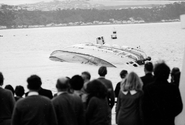
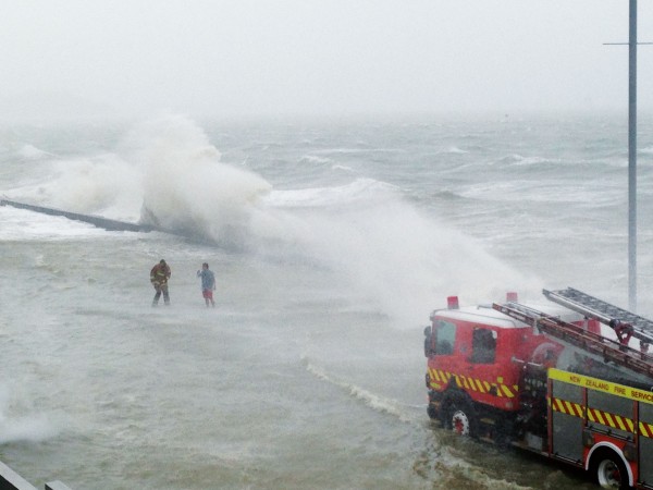
Off the Taranaki coast wind reaching 135kph blasted the Maui platform, and in Cook Strait winds of over 90kph blew for 14 hours, making it impossible to search for two men lost earlier when their catamaran overturned near Kapiti Island.
What caused this storm? A cold front crossed the North Island on Monday and became slow moving northeast of New Zealand. On Tuesday a low developed on the front, deepening rapidly during Wednesday as it moved southwest towards Auckland. For a time the map resembled the pattern of isobars of Cyclone Bola but by Thursday night the low had weakened considerably and the gales were easing.
What caused the low to deepen so quickly? Part of the answer lies in the nature of the wind flow at 10,000 metres. The weather maps at this altitude show that the ribbon of strong wind known as the jet stream changed direction sharply from southwest to northwest north of New Zealand as it blew around the trough of low pressure.
As air alters course sharply like this it gains clockwise spin, losing it again as it travels away from the bend into the straight northwest flow. This loss of spin causes the air to spread out horizontally, drawing up air from below and thus helping to create a depression at sea level. The rate at which the depression deepens depends on wind speed around the trough and on the sharpness of the change of direction at the trough.
Also important in this case, the air moving into the depression from the east was very warm and humid. As it rose within the low it cooled and much of its water vapour condensed to liquid. When water changes from gas to liquid it releases considerable heat, and this would have contributed to the upward motion of the air and so further deepened the depression.
As the depression became larger and more intense it changed the wind pattern at high altitudes that had contributed to its development. As the low centre moved across Auckland the warm, moist tropical air moving into it from the east now had to cross the ranges behind Gisborne. The uplift over these ranges caused most of the low level moisture to condense and fall out as rain. Consequently, the release of heat by condensation was confined to the area above the ranges and could no longer contribute to maintaining the intensity of the depression, which rapidly decayed.
The great difficulty in forecasting these rapid changes is in obtaining accurate measurements of the winds at 10,000 metres, particularly in the jet streams. No observations are made south of Australia, and over the Tasman Sea only occasional reports from aircraft are received.
Just how critically the development of depressions depends on the nature of the high level winds was shown by the destructive English storm of October 1987, which was not well forecast. When the computer model was rerun after the event using an additional late aircraft observation of unexpected strong winds at high levels, its prediction was much more accurate.
This storm, which destroyed 15 million trees and killed 19 people, was so severe that it invited comparison with famous storms of the past, particularly one in 1703 which was documented by Daniel Defoe. During that destructive windstorm, 8000 people died, chiefly at sea, and hundreds of windmills burned down because their sails turned so fast they set their wooden gears on fire.